Situation Summary
Tonga faces a composite threat score of 5 globally, with 3 tracked events in the GeoBit system. Web research over the last 24–48 hours has not yielded verified, independently corroborated security incidents, civil unrest, crime spikes, or infrastructure failures within that timeframe. The most recent confirmed signals consist of seismic activity (three earthquakes, M 4.4–4.7, in the past week, 238–298 km from populated centers) and older political statements from early-to-mid June. No imminent or acute threat to personnel or assets is indicated by current available intelligence.
Key Developments
- Seismic Activity (Recent): Three moderate earthquakes (M 4.4–4.7) recorded 238–298 km southeast and southwest of Hihifo and Houma. While distant from main population centers, they reflect ongoing tectonic stress typical of Tonga's volcanic arc setting and warrant continued monitoring for secondary hazards (aftershocks, submarine landslides).
- Political Statements (2026-06-18 to 2026-06-19): Public statements issued by the Tongan government and involving UN commentary. No verified operational security incident or civil disorder has been confirmed in web research to support these signals as current-day disruptions; older context (volcanic eruption and tsunami aftermath from prior weeks) may underpin some messaging.
- No Verified Recent Crime, Unrest, or Arrest Events in Tonga: Event signals referencing arrest/detention and criminal-political dissent are associated with Togo and the African Union, not Tonga. Cross-source validation of a domestic Tongan security incident within the last 48 hours was not possible.
Highest-Risk Areas
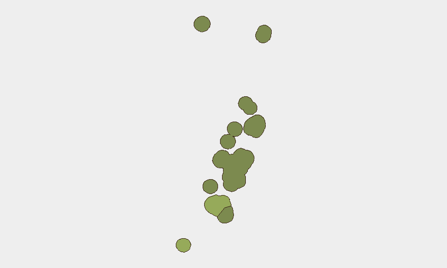
Tongatapu (risk 45) dominates the sub-national ranking and remains the primary focus for security planning, as it is Tonga's administrative and population center, home to Nuku'alofa and most critical infrastructure. Vavaʻu (risk 28) and Haʻapai (risk 22) are secondary concern zones; ʻEua and Ongo Niua carry lower composite scores. Risk drivers in Tongatapu include historical patterns of political dissent, maritime vulnerabilities, and seismic/volcanic exposure, rather than acute current incidents. Duty-of-care teams with personnel in the capital or outlying island groups should maintain awareness of both protest activity and natural-hazard early-warning systems.
How GeoBit Would Assist
Security teams operating in Tonga should employ Intel Sweep and multi-language OSINT to establish a persistent baseline of political statements, arrest reports, and labor actions; AOI Monitoring & Early Warning on Tongatapu and key ports to catch emerging unrest or infrastructure disruption in near-real-time; and Environmental & Health monitoring tied to seismic and volcanic risk to anticipate secondary hazards. Satellite & Imagery analysis can supplement visual confirmation of port activity, road conditions, or crowd assembly in advance of planned operations. Routing & Network Analysis should be used to pre-plan alternative transport and evacuation corridors if domestic unrest escalates.
7-Day Outlook
No acute threat escalation is forecast for the coming week based on current signals. Seismic activity may continue at low-to-moderate magnitude; political statements suggest simmering friction with governance and international bodies, but no validated protest or strike activity was detected in the last 48 hours. Security postures should remain at baseline vigilance with focus on natural-hazard preparedness and real-time monitoring for any political or civil order deterioration.
Highest-Risk Areas — Ranked
| # | State / Region | Risk |
|---|---|---|
| 1 | Tongatapu | 45 |
| 2 | Vavaʻu | 28 |
| 3 | Haʻapai | 22 |
| 4 | ʻEua | 18 |
| 5 | Ongo Niua | 12 |
Previous Daily Briefs
A new Tonga brief is written every day — each with its own risk map and downloadable CSV. Here's the last week; use the calendar to go further back.
📅 Browse every day by calendar →
Highlighted days have a brief. Tap a day for that day's map & analysis, or “csv” for that day's dataset ($5).