Situation Summary
Tunisia remains a moderate-risk environment (global rank #130) with persistent internal instability concentrated in two high-threat zones: the southern border region (Kébili) and the capital (Tunis). Recent activity signals include public statements, anti-immigrant rallies, and a recorded flood event, though specific incident details from the past 48 hours remain limited in open-source corroboration. The country's security posture reflects chronic terrorism exposure in remote areas, periodic social unrest in urban centers, and climate-related hazards rather than acute crisis indicators at this time.
Key Developments
- 2026-06-21 · Anti-Immigrant Rally · Tunis and Nationwide: Demonstrations opposing immigration were recorded; specific locations, organizers, and turnout figures are not yet detailed in available reporting. Monitor for downstream enforcement action and counter-protest activity.
- 2026-06-20 · Chinese National Protest Activity · Tunis: A demonstration involving Chinese nationals was reported; nature of grievance (labor, diplomatic, consular) and scale remain unclear. Verify whether this reflects broader diaspora tension or isolated incident.
- 2026-06-20 · Public Statement · Tunisia (Unspecified Actor): An official or organizational statement was issued; content and issuer require clarification from primary sources to assess policy or security implications.
- Flood Event · Tunisia (Region Unspecified, Recent): A flood was recorded in the country; location, displacement, and infrastructure impact remain to be quantified. Verify which governorate(s) were affected and whether road/supply chain disruption has occurred.
- Regional Context (Background): Since mid-June, Tunisia has experienced a recurring pattern of civil demonstration activity and security statements, consistent with pre-summer seasonal mobility and labor-related grievance cycles.
Highest-Risk Areas
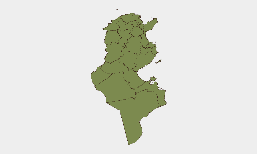
Kébili and Tunis dominate the national threat profile. Kébili (risk 27.1) in the southern Saharan region remains Tunisia's highest-risk governorate, driven by proximity to ungoverned/under-governed border areas, historical militant sanctuary, and smuggling networks. Tunis (risk 27.1), the capital and economic hub, concentrates security events—rallies, statements, diplomatic incidents—reflecting population density, political contestation, and migrant populations. Sfax (risk 10), a major port city, ranks third and warrants monitoring for economic disruption and inter-communal friction. The remaining nine governorates show minimal tracked event activity (1.4 each), indicating risk is sharply concentrated rather than dispersed.
How GeoBit Would Assist
Security teams managing personnel or assets in Tunisia should deploy AOI Monitoring & Early Warning on Kébili and central Tunis to flag emerging protests, security incidents, or border activity in near-real time. Intel Sweep combined with Entity Extraction and Network Analysis will disambiguate the anti-immigrant rally participants and Chinese national protest actors to assess whether these reflect isolated events or coordinated campaigns. Satellite & Imagery analysis can assess flood extent and infrastructure damage in the affected governorate, enabling faster duty-of-care notifications and routing adjustments via Routing & Network Analysis if supply lines or staff transit are compromised.
7-Day Outlook
No acute escalation indicators are visible; however, the convergence of anti-immigrant sentiment, diplomatic incidents, and climate hazards suggests elevated ambient friction in urban and border zones through late June. Recommend maintaining heightened situational awareness in Tunis and Kébili and confirming staff and supply-chain resilience against short-notice disruption from flooding or public order events.
Highest-Risk Areas — Ranked
| # | State / Region | Risk |
|---|---|---|
| 1 | Kébili | 31.4 |
| 2 | Tunis | 27.1 |
| 3 | Sfax | 10 |
| 4 | Tataouine | 1.4 |
| 5 | Nabeul | 1.4 |
| 6 | Monastir | 1.4 |
| 7 | Mahdia | 1.4 |
| 8 | Médenine | 1.4 |
| 9 | Jendouba | 1.4 |
| 10 | Béja | 1.4 |
| 11 | Bizerte | 1.4 |
| 12 | Ariana | 1.4 |
Previous Daily Briefs
A new Tunisia brief is written every day — each with its own risk map and downloadable CSV. Here's the last week; use the calendar to go further back.
📅 Browse every day by calendar →
Highlighted days have a brief. Tap a day for that day's map & analysis, or “csv” for that day's dataset ($5).