Situation Summary
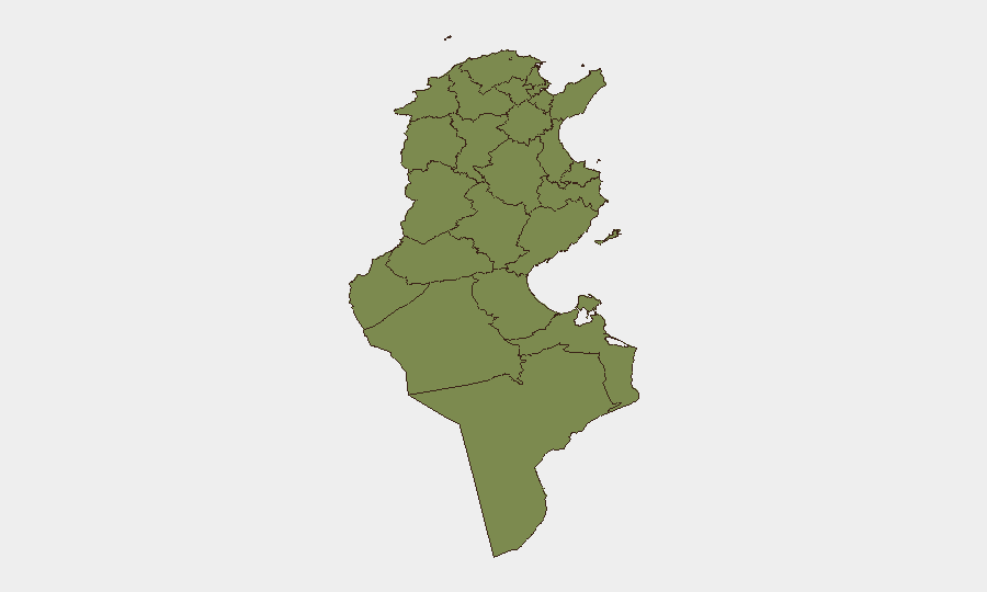
Tunisia remains a moderate-risk environment (rank #76 globally, composite score 28) with no tracked security incidents during the review period, yet underlying fragility persists in security, governance, and socioeconomic conditions. Northwestern and southern border regions—particularly Kasserine, Jendouba, and Tataouine—carry substantially elevated risk (scores 85–92) driven by residual militant presence, smuggling networks, and chronic unemployment. Political tensions have sharpened this week, with planned nationwide mobilization on 17 October and recent mass arrests signaling tightened state control amid civil unrest.
Key Developments
- Djerba — 7 October: The U.S. Embassy issued heightened-threat advisory for Djerba on or around 7 October, directing U.S. nationals to avoid the area and crowds, and maintain low profile. No specific threat detail disclosed.
- Tripoli (Libya–Tunisia border) — 11 October: Tunisia's interior minister held bilateral security talks with Libya's counterpart to strengthen cross-border coordination and facilitate authorized border crossings, reflecting shared concerns over smuggling and irregular movement.
- Tunisia (nationwide scope) — 8 October: Eight political parties announced coordinated mobilization scheduled for 17 October, citing political repression, deteriorating socioeconomic conditions, and declining public services. Civil-society participation indicators suggest potential for significant turnout.
- Tunisia (location unspecified) — 8 October: Authorities arrested approximately 330 individuals on sabotage and robbery charges amid reported violent unrest; specific geographic locations and incident timeline not disclosed in available reporting.
- Tunis — 8 October: Rights organizations renewed advocacy for release of blogger Hajer Awadi following her 26-month sentence (conviction issued 30 September) related to a social-media post on security operations, underscoring press-freedom concerns.
Highest-Risk Areas
Kasserine (risk 92), Jendouba (88), and Tataouine (85) dominate the risk profile, concentrated in Tunisia's northwest and far south—regions historically associated with residual militant networks, porous borders with Libya and Algeria, and endemic smuggling. These zones face compounded vulnerability from chronic unemployment, limited state capacity, and cross-border trafficking in weapons and contraband. The top five governorates (Kasserine, Jendouba, Tataouine, Médenine, Gafsa) collectively account for sustained militant recruitment potential and unpredictable security incidents; the capital and coastal regions carry substantially lower risk.
How GeoBit Would Assist
Corporate security and duty-of-care teams should deploy AOI Monitoring & Early Warning on Kasserine, Jendouba, Djerba, and border corridors to detect emerging incidents and U.S. Embassy alerts in near-real time. Multi-language OSINT fusion and Telegram/X monitoring would track planned 17 October mobilization rhetoric and state-response signals, enabling scenario planning. Routing & Network Analysis capabilities should be applied to alternative travel routes avoiding high-risk governorates and dynamically updated as political and security conditions shift.
7-Day Outlook
The 17 October nationwide mobilization poses near-term risk of civil disorder and security-force response, particularly in urban centers; state mass arrests on 8 October suggest preparedness for confrontation. U.S. Embassy advisory on Djerba indicates credible but unspecified threat intelligence; monitoring for secondary alerts or incident reporting is warranted. Border security talks with Libya may temporarily improve cross-border control but do not address underlying smuggling or militant logistics; risk trajectory remains elevated but not acute over the coming week.
Highest-Risk Areas — Ranked
| # | State / Region | Risk |
|---|---|---|
| 1 | Kasserine | 92 |
| 2 | Jendouba | 88 |
| 3 | Tataouine | 85 |
| 4 | Médenine | 83 |
| 5 | Gafsa | 78 |
| 6 | Béja | 75 |
| 7 | Sidi Bouzid | 72 |
| 8 | Al Kaf | 70 |
| 9 | Kébili | 68 |
| 10 | Kairouan | 65 |
| 11 | Siliana | 62 |
| 12 | Tozeur | 58 |
Sources
Previous Weekly Briefs
A new Tunisia brief is written every Monday, covering the week — each with its own risk map and downloadable CSV. Use the calendar to go further back.
- October 6, 2026
- September 29, 2026
- September 22, 2026
- September 15, 2026
- September 8, 2026
- September 2, 2026
- August 31, 2026
📅 Browse past briefs by calendar →
Highlighted days have a brief. Tap a day for that day's map & analysis, or “csv” for that day's dataset ($5).
Atlas — our AI intelligence desk — emails them this snapshot personally. Nothing else, no list.