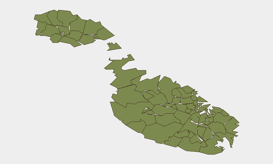
Situation Summary
Malta remains a low-threat jurisdiction globally (rank #149, composite score 10), but concentrated risk in Valletta, Sliema, and St Julian's reflects localized crime and maritime exposure. The past week saw a fatal maritime incident, a World War II ordnance discovery beneath the ferry route, and a violent-crime arrest tied to St Julian's. Drug trafficking and wildlife smuggling continue as secondary threats; infrastructure resilience (following late-September power outages) and maritime safety are emerging operational concerns.
Key Developments
- St Julian's / Malta International Airport – 6 October: Police arrested a 25-year-old French national at the airport on suspicion of involvement in a stabbing attack in St Julian's (1 October); searches recovered items linked to the incident. The victim, a 22-year-old UK national, sustained minor injuries.
- Żurrieq, Wied Diegu – 11 October: Two foreign nationals reported missing during a search-and-rescue operation near Wied Diegu were recovered by sea. One male was unresponsive and subsequently certified dead; one female sustained minor injuries. Police investigation ongoing.
- Ċirkewwa / Gozo Channel – 7 October: Divers working on ghost-net removal discovered a suspected unexploded World War II aerial bomb approximately 200 metres offshore at 37 metres depth, directly beneath the Gozo ferry crossing. The Armed Forces of Malta was notified for assessment and clearance.
- St Paul's Bay & Marsa – 4 October: Police conducted linked narcotics operations at both locations, detaining multiple individuals and recovering suspected drugs. Seizures part of broader enforcement activity ongoing since late September.
- Żurrieq – 29 September (relevant to week's context): Police seized 28+ kilograms of heroin and cocaine valued at €3.5 million in a linked multi-location operation, with parallel seizures in Gozo, signalling sustained drug-trafficking pressure in southern and offshore areas.
Highest-Risk Areas
Valletta, Sliema, and St Julian's form a high-risk corridor (scores 95, 92, 90 respectively), driven primarily by violent crime, transient populations, and maritime/tourism infrastructure density. The arrest at the airport and the St Julian's stabbing reflect concentrated interpersonal violence in the capital and northern resort zones. Southern and harbour towns (Żurrieq, Paola, Birgu, Senglea, Cospicua) show elevated scores linked to drug-trafficking operations and maritime-access vulnerabilities. Valletta's rank reflects its role as administrative, commercial, and transport hub.
How GeoBit Would Assist
OSINT Fusion & Corroboration and Intel Sweep capabilities would integrate local police, port authority, and Armed Forces Malta statements to establish baseline threat signatures and early-warning triggers for violent crime and drug-trafficking clusters. AOI Monitoring & Early Warning with persistent watch on Valletta, Sliema, and southern harbour zones would alert security teams to emerging activity patterns, arrests, and maritime anomalies in near-real time. Routing & Network Analysis would support duty-of-care teams in identifying safer transit corridors in high-risk towns and planning secure movement for personnel and assets around documented crime hotspots and maritime hazards (e.g., unexploded ordnance near ferry routes).
7-Day Outlook
No significant escalation is anticipated. Drug enforcement operations appear to be yielding major seizures, suggesting active state interdiction capacity. The World War II ordnance discovery and recent maritime fatality underscore need for enhanced hazard awareness in offshore and coastal transit zones. Continued low-level violent crime and trafficking activity is likely, concentrated in Valletta, Sliema, and southern towns; routine security protocols remain appropriate for corporate operations.
Highest-Risk Areas — Ranked
| # | State / Region | Risk |
|---|---|---|
| 1 | Valletta | 95 |
| 2 | Sliema | 92 |
| 3 | Saint Julian's | 90 |
| 4 | Gżira | 88 |
| 5 | Hamrun | 87 |
| 6 | Paola | 86 |
| 7 | Msida | 85 |
| 8 | Birkirkara | 84 |
| 9 | Birgu | 83 |
| 10 | Senglea | 82 |
| 11 | Cospicua | 81 |
| 12 | Żabbar | 80 |
Sources
Previous Weekly Briefs
A new Malta brief is written every Monday, covering the week — each with its own risk map and downloadable CSV. Use the calendar to go further back.
- October 6, 2026
- September 29, 2026
- September 22, 2026
- September 15, 2026
- September 8, 2026
- September 1, 2026
- August 29, 2026
📅 Browse past briefs by calendar →
Highlighted days have a brief. Tap a day for that day's map & analysis, or “csv” for that day's dataset ($5).
Atlas — our AI intelligence desk — emails them this snapshot personally. Nothing else, no list.