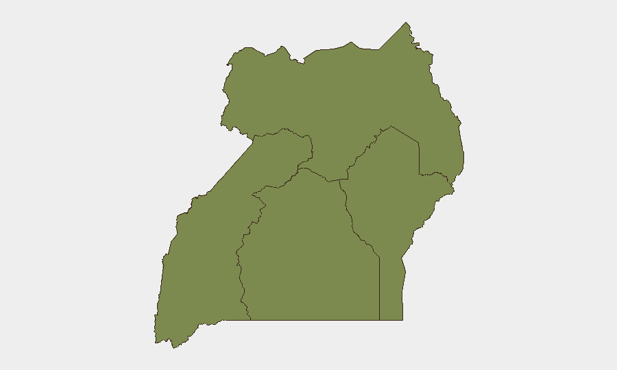
Situation Summary
Uganda faces a complex security environment characterized by concurrent political instability, civil-liberties concerns, organized crime, and residual public-health risk. High-level political friction—evidenced by parliamentary disagreements, opposition criticism, and multiple ministerial statements on 15 July—coincides with documented patterns of security-force detention of political figures and media pressure since mid-June. The Central Region (composite risk 32.6) dominates the national threat picture, driven primarily by political violence and governance instability in and around Kampala, while the Northern and Eastern regions present secondary but material risks.
Key Developments
- Kampala – 16 July – HRW reports ongoing military detention of political critics and media siege. Human Rights Watch documented that the Uganda People's Defence Force has seized at least five government critics in recent weeks, held them incommunicado, and maintained a military enclosure around Nation Media Group premises (ordered shut 28 June). Pattern indicates systematic political pressure with implications for civil unrest and journalist/activist safety.
- Butambala–Kampala corridor – 11–14 July, unresolved as of 16 July – Opposition MP Muwanga Kivumbi remains missing after armed interception. Hon. Muhammad Muwanga Kivumbi (National Unity Platform deputy president, former Butambala MP) was forcibly taken into an unmarked vehicle by armed operatives on 11 July, one day after bail was granted. Whereabouts unknown; parliamentary inquiries on 14 July and public discussion on 16 July confirm the case remains active and high-profile, raising enforced-disappearance and political-stability concerns.
- Katwe Division, Kampala Metropolitan Area – 16 July – Police arrest five suspects in "panga squad" robbery ring. Law enforcement arrested five individuals allegedly linked to a recent wave of aggravated robberies in the southern Kampala division, recovering machetes and two vehicles. Reflects heightened urban crime and police activity in Kampala's high-density areas.
- Nationwide – mid-July – Last Ebola patient discharged; 42-day countdown to Ebola-free status begins. Uganda discharged its final confirmed Ebola case, triggering the WHO-mandated 42-day observation period before official declaration of Ebola-free status, provided no new cases emerge. Travel advisories remain in effect pending completion of countdown.
- Nationwide – 15–16 July – Updated travel advisories reinforce terrorism, civil-unrest, and violent-crime warnings. Foreign governments issued or reaffirmed travel advisories citing terrorism threat, armed robbery, carjacking, kidnapping, and risk of spontaneous political gatherings met by heavy security response.
Highest-Risk Areas
The Central Region (32.6 composite risk) is by far the primary driver of Uganda's national threat profile, encompassing Kampala and surrounding areas where political detention, media pressure, and urban organized crime converge. The Northern Region (22.6) and Eastern Region (17.6) present secondary but material risks stemming from residual insurgent activity and cross-border vulnerability. The Western Region (2.6) remains significantly lower-risk and is suitable for routine corporate operations where feasible.
How GeoBit Would Assist
Security teams should deploy Intel Sweep and OSINT fusion (Twitter, YouTube, local media) to monitor parliamentary statements, opposition activity, and opposition-aligned civil-society networks for early warning of mass gatherings or heightened security crackdowns. AOI Monitoring with alerting on Central Region (especially Kampala divisions and Butambala–Kampala corridor) would provide near-real-time signals of security incidents, arrests, or transport disruption. Routing & Network Analysis would enable duty-of-care teams to preplan safe alternative routes for employees in Kampala and flag high-risk checkpoints or areas under active police/military operation.
7-Day Outlook
Political temperature is likely to remain elevated through mid-to-late July, with parliamentary tensions and opposition statements continuing. The missing-MP case and media siege represent focal points for domestic and international civil-rights scrutiny, increasing the risk of unscheduled demonstrations or security-force responses in Kampala. Routine vigilance and contingency planning remain essential for personnel and assets in the Central Region.
Highest-Risk Areas — Ranked
| # | State / Region | Risk |
|---|---|---|
| 1 | Central Region | 32.6 |
| 2 | Northern Region | 22.6 |
| 3 | Eastern Region | 17.6 |
| 4 | Western Region | 2.6 |
Sources
Previous Daily Briefs
A new Uganda brief is written every day — each with its own risk map and downloadable CSV. Here's the last week; use the calendar to go further back.
📅 Browse every day by calendar →
Highlighted days have a brief. Tap a day for that day's map & analysis, or “csv” for that day's dataset ($5).
Atlas — our AI intelligence desk — emails them this snapshot personally. Nothing else, no list.