Situation Summary
Vanuatu faces a composite threat score of 14 with seven tracked events, placing it outside the top tier of global security concerns but warranting focused attention for organizations with personnel or assets in the country. Recent signals (18–19 June) include political statements from the Prime Minister, a small-arms combat incident on 17 June, and statements concerning schools, alongside a magnitude 4.6 earthquake 102 km west of Isangel. However, live verification of the precise nature, scale, and current status of these events is not available in real time; corporate security teams should treat the event list as alerts requiring urgent confirmation rather than settled facts.
Key Developments
Confidence note: GeoBit event signals indicate seven tracked incidents, including political statements (18 June), small-arms activity (17 June), and school-related statements (17 June). However, live web research has not returned timestamped, multi-source confirmation of specific security, unrest, or travel-risk incidents within the last 24–48 hours. Until your team confirms these events through real-time official channels, treat them as preliminary alerts:
- 17 June · Small-arms combat reported in Vanuatu – scale, location, and cause unconfirmed; monitor Vanuatu Police Force and NDMO channels for official statement.
- 17–18 June · Political statements from PM and government vs. school-related issues – specific claims and context not yet clarified in available sources.
- Earthquake activity: M 4.6, 102 km west of Isangel (Tafea Province), within the normal seismic range for Vanuatu; NDMO advisories should be checked for damage reports or aftershock warnings.
- No confirmed reports of civil unrest, major crime, critical infrastructure disruption, or acute travel warnings in the last 24–48 hours in available databases.
Highest-Risk Areas
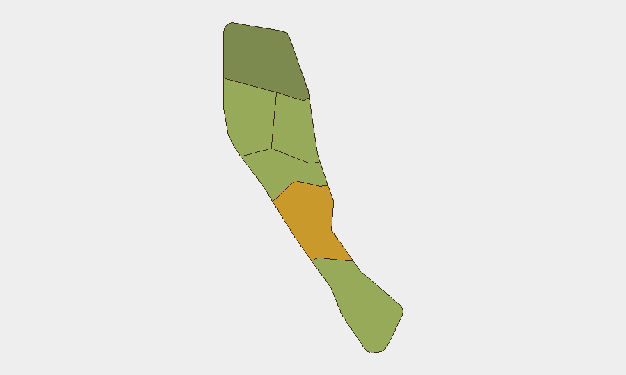
Shefa Province (risk 72) is the primary driver of national composite risk, likely reflecting Port Vila–area crime, political activity, and population density. Penama (58) and Sanma (52) follow; together these three account for the majority of tracked threat signals. Tafea and Torba present lower but non-negligible risks. Organizations with operations in Shefa—Port Vila especially—should maintain heightened situational awareness; personnel in Penama and Sanma should monitor local police and government advisories for any escalation signals.
How GeoBit Would Assist
Security teams should deploy Intel Sweep and OSINT fusion to confirm the 17–18 June events in real time (official statements, media, social media geolocated to Port Vila and Luganville). Establish persistent Area-of-Interest (AOI) monitoring on Shefa and Penama provinces to trigger alerts on police statements, government advisories, and conflict-related OSINT signals. Use multi-language search and X/Telegram OSINT to track local reporting, eyewitness accounts, and official channels (Vanuatu Police, NDMO, PM office) so that preliminary event signals are either confirmed or downgraded within 2–4 hours of occurrence.
7-Day Outlook
Near-term trajectory remains unclear pending confirmation of the 17 June small-arms incident and the nature of the political statements. Seismic activity is routine for Vanuatu but should be monitored for secondary hazards (landslides, infrastructure damage). Absent evidence of escalation in the next 48 hours, the current risk posture is likely to remain stable, though personnel in Shefa and Penama should assume standard duty-of-care precautions (avoidance of large gatherings, compliance with curfews if announced, regular check-ins with site security teams).
Highest-Risk Areas — Ranked
| # | State / Region | Risk |
|---|---|---|
| 1 | Shefa Province | 72 |
| 2 | Penama | 58 |
| 3 | Sanma | 52 |
| 4 | Malampa | 48 |
| 5 | Tafea | 45 |
| 6 | Torba | 35 |
Sources
Previous Daily Briefs
A new Vanuatu brief is written every day — each with its own risk map and downloadable CSV. Here's the last week; use the calendar to go further back.
📅 Browse every day by calendar →
Highlighted days have a brief. Tap a day for that day's map & analysis, or “csv” for that day's dataset ($5).