Situation Summary
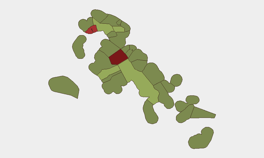
The Bahamas maintains a moderate security profile (#86 globally) with crime and gang activity as the primary driver of risk. No sustained incident cluster or acute threat escalation was detected during the reporting week, though isolated violent crime continues in high-risk urban centers. The sub-national risk landscape is sharply stratified, with New Providence (Nassau) and Freeport accounting for disproportionate risk relative to the wider archipelago.
Key Developments
- Cowpen Road West, New Providence — September 23: Police investigated a fatal shooting of an adult male. Single-source reporting limits independent corroboration but is consistent with persistent gang and interpersonal violence patterns in New Providence's highest-risk neighborhoods.
- Bahamian Government / U.S. Drug Enforcement Administration — September 24–25: The Bahamian government formally raised allegations that "rogue" DEA agents operated on Bahamian soil without proper authorization, escalating the matter to the Trump administration through official diplomatic channels. The allegation was confirmed by Reuters reporting and reflects ongoing friction over U.S. law-enforcement presence and operational boundaries in Bahamian waters and territory.
- Grand Bahama waters — September 26: Police investigated the death of a 53-year-old Filipino national aboard a vessel. Authorities preliminarily ruled out foul play pending autopsy results; the incident appears to fall outside the crime/gang driver categories but indicates continued maritime activity requiring law-enforcement response.
Highest-Risk Areas
New Providence (risk score 92) and Freeport (78) are the clear drivers of national risk, accounting for the vast majority of violent crime, gang activity, and organized-crime exposure. New Providence—home to Nassau and ~70% of the population—concentrates homicides, shootings, and trafficking in specific neighborhoods (e.g., Cowpen Road West, Over the Hill corridors); Freeport on Grand Bahama serves as a secondary organized-crime and trafficking nexus. The remaining ten tracked regions drop substantially (Central Abaco at 52, Central Andros at 48), suggesting that risk is highly localized to two urban centers rather than dispersed across the archipelago. Corporate and diplomatic personnel based outside Nassau and Freeport face materially lower risk from the crime/gang profile that defines the national threat score.
How GeoBit Would Assist
Security teams managing exposure in Bahamas should deploy AOI Monitoring & Early Warning on New Providence and Freeport neighborhoods to track incident clustering and emerging gang territorial disputes in near-real time. OSINT fusion & corroboration (X/Twitter, local news, police statements) provides rapid triage of single-source reports and validates escalation signals. Network & Actor Analysis applied to gang structure and known traffickers on the islands supports duty-of-care planning and route avoidance; Routing & Network Analysis identifies safer transit corridors in high-risk urban zones.
7-Day Outlook
No acute security shock or policy change is forecast over the coming week. The DEA diplomatic row, while notable, does not currently portend operational disruption to commercial or corporate activity. Violent crime in New Providence and Freeport will likely continue at baseline rates; personnel in either city should maintain standard urban-security protocols.
Highest-Risk Areas — Ranked
| # | State / Region | Risk |
|---|---|---|
| 1 | New Providence | 92 |
| 2 | City of Freeport | 78 |
| 3 | Central Abaco | 52 |
| 4 | Central Andros | 48 |
| 5 | Exuma | 45 |
| 6 | East Grand Bahama | 42 |
| 7 | South Andros | 38 |
| 8 | North Abaco | 35 |
| 9 | North Eleuthera | 33 |
| 10 | South Abaco | 32 |
| 11 | Cat Island | 30 |
| 12 | Mangrove Cay | 28 |
Sources
Previous Weekly Briefs
A new Bahamas brief is written every Monday, covering the week — each with its own risk map and downloadable CSV. Use the calendar to go further back.
- September 22, 2026
- September 15, 2026
- September 8, 2026
- September 2, 2026
- August 31, 2026
- August 29, 2026
- August 27, 2026
📅 Browse past briefs by calendar →
Highlighted days have a brief. Tap a day for that day's map & analysis, or “csv” for that day's dataset ($5).
Atlas — our AI intelligence desk — emails them this snapshot personally. Nothing else, no list.