Situation Summary
The Democratic Republic of Congo faces an acute security crisis driven by simultaneous armed conflicts in the east (North Kivu, Ituri, Tanganyika), organized crime and banditry in central regions (Kasai-Central, Haut-Katanga), and civil-order tensions in the capital. The last 24–48 hours have seen a sharp uptick in combat operations, civilian casualties, and displacement across multiple provinces, with no indication of de-escalation. Humanitarian access is degrading in conflict zones, and cross-border instability (particularly involving M23 and ADF groups) shows no signs of containment.
Key Developments
- North Kivu – Beni territory (26 June): Suspected ADF militants conducted night attacks on villages near Mavivi–Oïcha axis north of Beni, killing 5–10 civilians and burning homes; population displacement towards Beni town ongoing.
- North Kivu – Goma outskirts (26 June afternoon/evening): Heavy artillery and mortar fire from positions north of Goma directed at Kibumba–Kanyaruchinya area; clashes between M23 and FARDC/Wazalendo fighters disrupted Goma–Rutshuru road and risked impact on populated IDP sites.
- North Kivu – Rutshuru territory (26 June): Intense fighting along Tongo–Meso axis between M23 and pro-government forces with documented drone/photo evidence; new civilian displacement towards Mweso and Kanyabayonga; humanitarian corridor constraints along Kanyabayonga–Kiwanja noted.
- Ituri – Bunia (25–26 June): CODECO elements conducted overnight incursions on Bunia–Djugu road, killing multiple civilians and burning huts; FARDC reinforced patrols on 26 June but travel restrictions remain in effect.
- Tanganyika – Kalemie (26 June): Armed bandits attacked lake transport on Lake Tanganyika near Kalemie port, robbing passengers at gunpoint with at least one injury; local authorities suspended some crossings and issued warnings against night travel.
- Kasai-Central – Kananga (night 25–26 June): Armed robberies and shootings in Nganza and Katoka communes; multiple arrests of suspected bandits; police imposed night movement restrictions after 21:00.
- Kinshasa (26 June): Heightened Republican Guard and police presence around Palais du Peuple and central intersections in response to social-media calls for anti-government protests; brief scuffles and detentions reported near Victoire and Matonge.
- Haut-Katanga – Lubumbashi–Likasi road (26 June): At least two armed hold-ups targeting commercial and mining vehicles between Kilometer 40–60; authorities advised convoy travel during daylight only.
Highest-Risk Areas
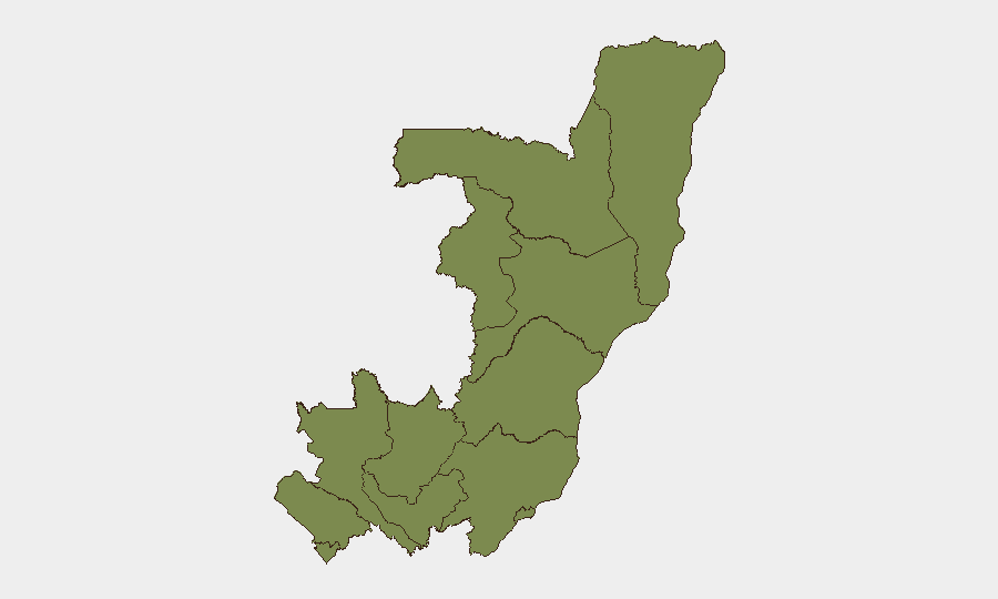
Cuvette-Ouest Department carries by far the highest composite risk score (31.4), though recent events are concentrated in the eastern provinces: North Kivu dominates with simultaneous M23 and ADF operations, Ituri is experiencing CODECO incursions, and Tanganyika faces bandit attacks on water routes. Brazzaville (the capital, risk 4.5) is showing civil-order stress related to political dissent. The remaining departments score uniformly at 1.4, reflecting lower recent event frequency but baseline vulnerability to banditry and militia activity.
How GeoBit Would Assist
Organizations operating in Congo should deploy AOI Monitoring & Early Warning on high-threat zones (North Kivu, Ituri, Kasai-Central) to detect militia movements and displacement patterns in near-real time. Intel Sweep and X/Telegram OSINT with multi-language processing will track militia communications, protest organizing, and crime networks faster than official channels. Battle Mapping and GIS & Spatial Analysis enable route risk assessment and alternative-corridor planning for supply chains and personnel movement.
7-Day Outlook
M23 and FARDC/Wazalendo clashes in Rutshuru and Goma periphery are likely to sustain high intensity through early July; civilian displacement and humanitarian bottlenecks will worsen. ADF activity in Beni territory may intensify if FARDC operations are drawn eastward. Urban crime (Kananga, Bukavu, Lubumbashi) and banditry on transport corridors are expected to remain elevated as state capacity to respond remains limited.
Highest-Risk Areas — Ranked
| # | State / Region | Risk |
|---|---|---|
| 1 | Cuvette-Ouest Department | 31.4 |
| 2 | Brazzaville (department) | 4.5 |
| 3 | Sangha | 1.4 |
| 4 | Likouala | 1.4 |
| 5 | Cuvette Department | 1.4 |
| 6 | Kouilou Department | 1.4 |
| 7 | Niari Department | 1.4 |
| 8 | Pointe-Noire (département) | 1.4 |
| 9 | Lékoumou Department | 1.4 |
| 10 | Bouenza Department | 1.4 |
| 11 | Plateaux Department | 1.4 |
| 12 | Pool Department | 1.4 |
Sources
Previous Daily Briefs
A new Congo brief is written every day — each with its own risk map and downloadable CSV. Here's the last week; use the calendar to go further back.
📅 Browse every day by calendar →
Highlighted days have a brief. Tap a day for that day's map & analysis, or “csv” for that day's dataset ($5).