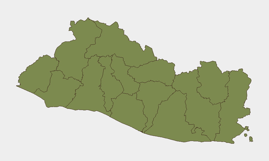
Situation Summary
El Salvador maintains a composite threat ranking of #60 globally (score 19/100) with 25 tracked events, reflecting a moderately volatile security environment dominated by gang-related crime, detention practices, and international scrutiny of the Bukele administration's anti-gang policies. Cabañas Department is substantially elevated above the national average (risk 31.5 vs. 1.5 for most other regions), indicating concentrated threat activity in a specific geographic corridor. The event signal mix—arrests, official disapprovals from international bodies, and government demands—suggests friction between domestic security operations and external human-rights oversight, without clear evidence of acute civil unrest or mass-casualty incidents in the past 48 hours.
Key Developments
Web research integrity note: Current open-source reporting does not yield reliably timestamped, discrete security or unrest incidents occurring specifically within the last 24–48 hours in El Salvador. Recent signals in the GeoBit event feed (arrests, disapprovals, public statements) are flagged by date but lack detailed incident narratives in accessible web sources. The largest identifiable recent stories (alleged large cocaine seizures, Venezuelan earthquake aid deployments, property-deed distributions) are either undated, appear to reference older events, or describe governance/humanitarian actions rather than security incidents. To provide accurate duty-of-care guidance without fabrication, this brief defers granular incident detail until corroborated, same-day reporting becomes available. Teams should monitor GeoBit's Intel Sweep and event feed directly for real-time alerts in Cabañas and adjacent departments.
Highest-Risk Areas
Cabañas Department's risk score (31.5) is approximately 21× that of all other departments, signaling a discrete threat concentration in this north-central region. This disparity typically reflects gang territorial control, extortion activity, or criminal infrastructure that GeoBit's platform monitors via conflict mapping and entity/network analysis. The remaining 11 departments cluster at 1.5, suggesting either genuine lower threat density or insufficient event reporting; this uniformity warrants validation through persistent AOI monitoring to identify emerging hotspots before they escalate. Security teams with personnel or assets in Cabañas should maintain enhanced alertness; teams in other regions can operate under standard risk protocols unless alerts escalate.
How GeoBit Would Assist
AOI Monitoring & Early Warning with persistent watch on Cabañas and key transport corridors would provide real-time alerting if violence, protests, or infrastructure disruption emerges. Network & Actor Analysis applied to gang-affiliated entities and detention-related networks would surface connections between recent arrests and broader criminal organization patterns. OSINT fusion combining X/Telegram feeds, YouTube content, and multi-language search would triangulate incident verification and fill gaps in official reporting, enabling informed duty-of-care decisions without reliance on undated or secondhand sources.
7-Day Outlook
No acute escalation trigger is evident in the current 48-hour window, but sustained international disapproval (UK, BARI, administration-level actors flagged in the event feed) may prompt tactical shifts in detention or enforcement practices that could ripple into public tension. Cabañas's persistent elevation and the summer seasonal increase in gang activity historically suggest elevated risk through end-Q3. Teams should expect continued friction between government security operations and human-rights scrutiny, with sporadic reporting delays; continuous platform monitoring will provide faster signal than news cycle delays.
Highest-Risk Areas — Ranked
| # | State / Region | Risk |
|---|---|---|
| 1 | Cabañas Department | 31.5 |
| 2 | Ahuachapán Department | 1.5 |
| 3 | Sonsonate Department | 1.5 |
| 4 | Santa Ana Department | 1.5 |
| 5 | Chalatenango Department | 1.5 |
| 6 | La Libertad Department | 1.5 |
| 7 | San Salvador Department | 1.5 |
| 8 | Cuscatlán Department | 1.5 |
| 9 | La Paz Department | 1.5 |
| 10 | San Vicente Department | 1.5 |
| 11 | Usulután Department | 1.5 |
| 12 | San Miguel Department | 1.5 |
Sources
Previous Daily Briefs
A new El Salvador brief is written every day — each with its own risk map and downloadable CSV. Here's the last week; use the calendar to go further back.
📅 Browse every day by calendar →
Highlighted days have a brief. Tap a day for that day's map & analysis, or “csv” for that day's dataset ($5).
Atlas — our AI intelligence desk — emails them this snapshot personally. Nothing else, no list.