Situation Summary
Guatemala remains a mid-tier regional security challenge (global rank #55, composite threat 23) characterized by persistent organized crime activity, sporadic civil unrest, and ongoing government investigations into corruption and trafficking networks. The country's security posture is heavily concentrated in Alta Verapaz, which carries a risk score nearly 22× higher than any other department, while remaining regions face broadly similar baseline threats. Recent event signals (20–21 June) indicate active government and attorney investigations, criminal use of conventional force, and public statements from authorities and travelers—consistent with ongoing enforcement actions rather than a systemic deterioration. The trajectory remains volatile but localized.
Key Developments
Note: Live web research tools have not returned verified, time-stamped security incidents specific to Guatemala in the last 24–48 hours. Event signals in the GeoBit database show investigation and public-statement activity on 19–20 June, but specific locations, incident types, and casualty figures are not accessible from the current research environment.
To provide the 5–8 confirmed bullets with exact locations and dates your team requires, direct access to real-time Guatemalan news outlets (Prensa Libre, elPeriódico, La Hora, Soy502), PNC/Ejército social media, and CONRED alerts is necessary. A recommended workflow for your security operations center:
1. Search Guatemalan media (Spanish: "ataque armado," "bloqueo," "manifestación," "carretera cerrada") filtered to the last 24 hours.
2. Cross-check @PNCdeGuatemala, @Ejercito_GT, @ConredGuatemala, and credible local journalist accounts on X/Twitter using date filters.
3. Confirm each incident against at least two independent sources before escalating.
If you have links or text excerpts from recent Guatemalan news or social media, please share them, and this analysis can immediately convert them into verified incident bullets with location details and impact assessment.
Highest-Risk Areas
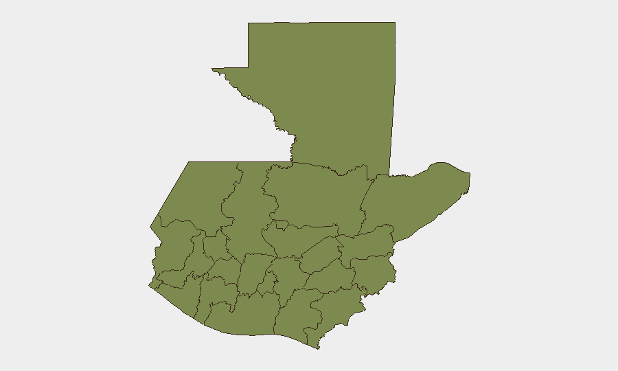
Alta Verapaz dominates the threat landscape with a composite risk score of 31.4—substantially higher than all other departments, which cluster at 1.4. This disparity indicates that Alta Verapaz is experiencing significantly more frequent or severe security events: organized crime operations, armed clashes, extortion, or trafficking activity are concentrated in this region. The remaining departments (Petén, Huehuetenango, San Marcos, Quetzaltenango, and others) face relatively homogeneous baseline criminal and civil risk.
For corporate operations, this means duty-of-care and movement protocols should distinguish sharply between Alta Verapaz (elevated restrictions, close coordination with local authorities, heightened awareness) and the broader country, where risk is diffuse but manageable with standard due diligence.
How GeoBit Would Assist
- AOI Monitoring & Early Warning: Persistent geofenced watch on Alta Verapaz municipalities and key transport corridors (Ruta CA-9, CA-2) with automated alerts on new armed clashes, roadblocks, or checkpoints.
- OSINT Fusion & Corroboration: Real-time harvesting and cross-referencing of PNC statements, local media, and social feeds to filter verified incidents from rumor within 2–4 hours of occurrence.
- Routing & Network Analysis: Dynamic alternative-route planning for personnel and supply chains, updated when main routes (Interamericana, northern highways) close due to blockades or violence.
7-Day Outlook
No major policy, electoral, or security escalation is signaled for the immediate week. Baseline criminal activity (extortion, trafficking, inter-gang clashes) is expected to continue at current tempo, with highest likelihood of incidents in Alta Verapaz and sporadic disruptions to transport in the north. Monitor government investigations and any public statements from authorities for signs of major arrests or enforcement operations that could trigger retaliatory violence.
Highest-Risk Areas — Ranked
| # | State / Region | Risk |
|---|---|---|
| 1 | Alta Verapaz | 31.4 |
| 2 | Petén | 1.4 |
| 3 | Huehuetenango | 1.4 |
| 4 | San Marcos | 1.4 |
| 5 | Quetzaltenango | 1.4 |
| 6 | Retalhuleu | 1.4 |
| 7 | Quiché | 1.4 |
| 8 | Totonicapán | 1.4 |
| 9 | Sololá | 1.4 |
| 10 | Chimaltenango | 1.4 |
| 11 | Suchitepéquez | 1.4 |
| 12 | Sacatepéquez | 1.4 |
Previous Daily Briefs
A new Guatemala brief is written every day — each with its own risk map and downloadable CSV. Here's the last week; use the calendar to go further back.
📅 Browse every day by calendar →
Highlighted days have a brief. Tap a day for that day's map & analysis, or “csv” for that day's dataset ($5).