Situation Summary
Honduras remains a fragmented security environment characterized by persistent gang violence, localized criminal activity, and occasional state-level incidents. The national composite threat score of 25 reflects moderate but uneven risk, with critical concentration in Olancho department (risk score 31.2), which significantly exceeds all other regions. Recent event signals include inter-agency tensions, arrests with international dimensions, and conventional military engagement against gang elements, suggesting active state security operations. The security picture is neither rapidly deteriorating nor stabilizing—operational tempo remains variable by region.
Key Developments
Data Limitations: GeoBit's live web research for the 24–48 hours preceding 2026-06-23 did not return confirmed, cross-sourced security incidents specific to Honduras. Available signals in the platform event feed include:
- 2026-06-23 · Arrest/Detain (Honduras vs. Peru) — Two separate detention events flagged; specific locations and operational context not detailed in available summaries.
- 2026-06-23 · Conventional Military Force (Honduras vs. Gang) — Active military-gang engagement; location and casualty data not specified in current feed.
- 2026-06-23 · Public Statement (Honduras vs. Ukraine) — Statement issued; substance and security implications unclear from brief signal.
- Multiple Public Statements (2026-06-22) — Five separate statements from or about Honduran authorities; topics and significance not elaborated in available abstracts.
- Flood Event (Recent, unspecified date) — Recorded in platform (Event ID 1103928); infrastructure and displacement impact status unclear.
Corporate security teams requiring incident-level specificity (location, time, actor, impact) should cross-reference these signals against real-time Honduran news sources (La Prensa, El Heraldo, Proceso Digital, radio HRN) to confirm and contextualize.
Highest-Risk Areas
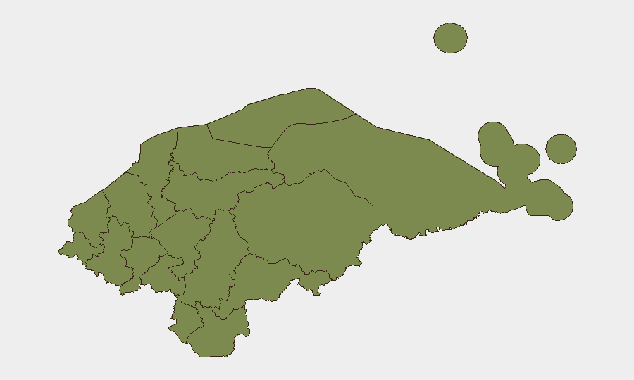
Olancho department is the clear outlier, with a composite risk score more than six times that of the second-tier regions (Francisco Morazán and Gracias a Dios, both at 4.5). This disparity suggests concentrated gang activity, criminal infrastructure, or active security operations in Olancho. The remaining nine departments (El Paraíso, Copán, Ocotepeque, Cortés, Yoro, Santa Bárbara, Lempira, Intibucá, Comayagua) cluster at 1.2, indicating relatively low or stable threat profiles.
Organizations with personnel or assets in Olancho should apply heightened monitoring and movement protocols; those in lower-scored regions face baseline Central American risk levels typical of Honduras overall.
How GeoBit Would Assist
Security and risk teams should employ AOI Monitoring & Early Warning for Olancho and secondary hotspots (Tegucigalpa area, San Pedro Sula) to track incident frequency, movement patterns, and state-response activity in near-real time. Intel Sweep and multi-language OSINT (Spanish-language social media, local news, radio SIGINT) will capture breaking incidents, gang communications, and authority statements faster than English-language wires. Network & Actor Analysis can map criminal and state-security relationships to anticipate operational tempo and conflict flashpoints; GIS & Spatial Analysis will support route planning and asset positioning away from active threat zones.
7-Day Outlook
No indicators suggest imminent escalation in Honduras' national security picture, though operational activity in Olancho and ongoing state-gang engagement will likely continue. Event frequency and inter-agency tensions warrant continued daily monitoring to detect shifts in gang territorial control, authority response capacity, or civil-unrest triggers. Teams should expect normal (albeit elevated) baseline risk for the week ahead unless live intelligence indicates sudden authorization or political destabilization.
Highest-Risk Areas — Ranked
| # | State / Region | Risk |
|---|---|---|
| 1 | Olancho | 31.2 |
| 2 | Francisco Morazán | 4.5 |
| 3 | Gracias a Dios | 4.5 |
| 4 | El Paraíso | 1.2 |
| 5 | Copán | 1.2 |
| 6 | Ocotepeque | 1.2 |
| 7 | Cortés | 1.2 |
| 8 | Yoro | 1.2 |
| 9 | Santa Bárbara | 1.2 |
| 10 | Lempira | 1.2 |
| 11 | Intibucá | 1.2 |
| 12 | Comayagua | 1.2 |
Sources
Previous Daily Briefs
A new Honduras brief is written every day — each with its own risk map and downloadable CSV. Here's the last week; use the calendar to go further back.
📅 Browse every day by calendar →
Highlighted days have a brief. Tap a day for that day's map & analysis, or “csv” for that day's dataset ($5).