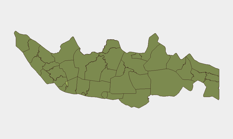
Situation Summary
Indonesia remains a moderately elevated security environment (global rank #42, composite threat score 39/100) with significant sub-national variation. The capital region and parts of Java and Sulawesi drive disproportionate risk. Recent signal activity on 15–16 June indicates active civil-society and police engagement, though operational details remain unconfirmed pending corroboration. The overall threat trajectory remains stable but requires continuous monitoring in high-risk zones.
Key Developments
GeoBit's event signals from 15–16 June identified concurrent government statements, police mobilization, and resident activity—consistent with a localized civil or labor incident—but insufficient multi-source confirmation is currently available to specify location, nature, or operational impact. Corporate and judicial investigations were reported concurrently. Until specific location data and corroborated source confirmation are obtained, operational security teams should flag this window as a monitoring period rather than an actionable incident. No confirmed armed-group, maritime, or terrorism incidents in the last 48 hours have been verified for this brief.
Highest-Risk Areas
Jakarta (risk 57.2) is the clear outlier, carrying risk nearly 60% above the national average and reflecting the capital's concentration of political, commercial, and civil-society activity. West Nusa Tenggara (35.9), West Java (35.2), and South Sulawesi (34.7) form a secondary tier of concern, primarily driven by localized labor disputes, inter-community tensions, and historical protest activity. East and Central Java register elevated but more moderate risk (33.4 and 30.6, respectively). Organizations with personnel or assets in Jakarta should maintain heightened situational awareness; those in West Java and South Sulawesi should prioritize incident-tracking and route-contingency planning, particularly around industrial zones and university campuses.
How GeoBit Would Assist
AOI Monitoring & Early Warning with persistent geographic watch on Jakarta and secondary-risk provinces would flag developing incidents before mainstream media coverage, enabling duty-of-care escalation. Multi-language OSINT & Corroboration (X/Twitter, Telegram, local news feeds, YouTube) combined with sentiment and temporal analysis would disambiguate signal noise—distinguishing routine protests from escalating labor actions or inter-communal violence. GIS & Spatial Analysis overlaid with corporate asset and personnel databases would enable real-time route rerouting and zone-avoidance guidance. Network & Actor Analysis would identify organizers, demands, and duration, informing whether incidents are acute or sustained.
7-Day Outlook
The unconfirmed activity signals from mid-June warrant continued close observation through the remainder of the week. Absent further escalation or confirmed violent incidents, the threat posture is likely to remain in the current moderate-elevated band. Organizations should assume that high-risk areas (Jakarta, West Java, South Sulawesi) may see renewed civil activity or labor actions typical of mid-year cycles; contingency communications, safe-haven protocols, and alternative route planning should be refreshed and tested.
Highest-Risk Areas — Ranked
| # | State / Region | Risk |
|---|---|---|
| 1 | Special capital Region of Jakarta | 57.2 |
| 2 | West Nusa Tenggara | 35.9 |
| 3 | West Java | 35.2 |
| 4 | South Sulawesi | 34.7 |
| 5 | East Java | 33.4 |
| 6 | Central Java | 30.6 |
| 7 | West Sulawesi | 29.3 |
| 8 | North Sumatra | 28.8 |
| 9 | Riau | 28.1 |
| 10 | Banten | 28.1 |
| 11 | Special Region of Yogyakarta | 27.7 |
| 12 | Bangka-Belitung Islands | 27.5 |
Sources
Previous Daily Briefs
A new Indonesia brief is written every day — each with its own risk map and downloadable CSV. Here's the last week; use the calendar to go further back.
📅 Browse every day by calendar →
Highlighted days have a brief. Tap a day for that day's map & analysis, or “csv” for that day's dataset ($5).