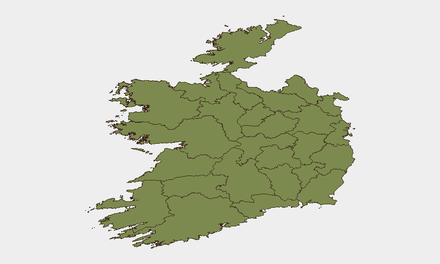
Situation Summary
Ireland's composite threat score of 39 places it in the lower-risk global tier, but sub-national volatility is pronounced: Dublin and Monaghan together account for the majority of tracked security events, driven by active counter-terrorism operations and a serious homicide investigation. A foiled car-bomb plot near the Northern Ireland border on 22 July, combined with the ongoing manhunt for a suspect in a US national's death in Kerry, has elevated operational tempo across An Garda Síochána and raised cross-border security alert levels. The threat trajectory is upward in the short term, particularly in border regions and the capital, though incidents remain episodic rather than systemic.
Key Developments
- Carrickmacross, Co Monaghan – 22 July 2026 (confirmed 24–25 July): Gardaí intercepted a vehicle near the Northern Ireland border and recovered an "extremely significant" improvised explosive device assessed as military-grade and intended for a dissident republican car-bomb attack; two suspects (woman in her 20s, man in his 40s) arrested under Offences Against the State Act and remain in custody; Army EOD unit secured the device for forensic examination.
- Dublin Garda Station – 23–24 July 2026: Second suspect in his 40s arrested on suspicion of involvement in transporting the suspected explosives; both detainees held under Section 30 of the Offences Against the State Act as forensic analysis continues.
- Co Monaghan / Northern Ireland border corridor – 24–25 July 2026: Security assessment by senior Garda officers highlighted elevated cross-border militant risk and infrastructure-attack potential, noting counter-terrorism resources already under pressure from Ireland's EU Presidency workload.
- Killarney, Co Kerry – 21 July 2026 (investigation updates 24–48h ago): Post-mortem examination of US national Jamey Carney, found dead in her home, confirmed death by suffocation; primary suspect remains at large and has fled Ireland; Gardaí liaising with foreign law-enforcement agencies.
Highest-Risk Areas
County Dublin (risk 31.3) and County Monaghan (risk 20.6) dominate the threat landscape. Dublin concentrates organized-crime, detention, and institutional investigative activity; Monaghan is the focal point for dissident republican militant operations near the border, as evidenced by the 22 July bomb interception and ongoing counter-terrorism operations. All other counties score below 5.0, indicating that threat concentration is both geographic and operational. Border-area residents and cross-border workers face elevated ambient risk from sporadic militant activity, while Dublin-based corporate and government personnel should anticipate continued law-enforcement activity and security screening.
How GeoBit Would Assist
Immediate operational support includes AOI Monitoring & Early Warning on the Monaghan border corridor and Dublin stations to track emerging militant or organized-crime signals; OSINT fusion (Telegram, social media, and radio SIGINT) to detect dissident republican communications and intent shifts; and Network & Actor Analysis to map relationships between the detained suspects and wider militant networks. Routing & Network Analysis can identify safer alternative routes for personnel traveling near the Northern Ireland border, and Intel Sweep with multi-language and temporal filtering provides real-time alerts on Gardaí operations, court developments, and cross-border security posture changes.
7-Day Outlook
Expect continued high-profile Garda operations in Monaghan and the border region as forensic examination of the seized explosives proceeds and suspects remain in custody. The outstanding murder suspect in Kerry will likely drive active international law-enforcement coordination, with potential border-checkpoint activity. Dissident republican threat posture is likely to remain elevated but sporadic; no imminent second attack is assessed, but security operatives should maintain heightened vigilance in border areas and Dublin transport hubs through early August.
Highest-Risk Areas — Ranked
| # | State / Region | Risk |
|---|---|---|
| 1 | County Dublin | 31.3 |
| 2 | County Monaghan | 20.6 |
| 3 | County Galway | 4.1 |
| 4 | County Tipperary | 1.9 |
| 5 | County Louth | 1.9 |
| 6 | County Mayo | 1.3 |
| 7 | County Sligo | 1.3 |
| 8 | County Clare | 1.3 |
| 9 | County Limerick | 1.3 |
| 10 | County Donegal | 1.3 |
| 11 | County Leitrim | 1.3 |
| 12 | County Roscommon | 1.3 |
Sources
Previous Daily Briefs
A new Ireland brief is written every day — each with its own risk map and downloadable CSV. Here's the last week; use the calendar to go further back.
📅 Browse every day by calendar →
Highlighted days have a brief. Tap a day for that day's map & analysis, or “csv” for that day's dataset ($5).
Atlas — our AI intelligence desk — emails them this snapshot personally. Nothing else, no list.