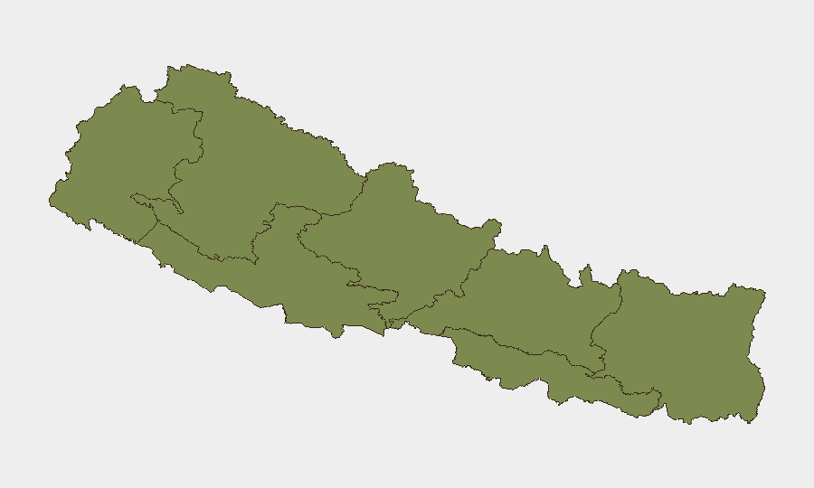
Situation Summary
Nepal is experiencing acute political instability and civil unrest following 27 hours of violent anti-government protests that resulted in at least 19 deaths and over 500 injuries. Prime Minister KP Sharma Oli resigned on 21 July following mass demonstrations; the Nepal Army assumed nationwide security control on the evening of 21 July and has deployed troops across major urban centers with curfew-like restrictions as of 22 July morning. The security environment in Kathmandu and surrounding areas has deteriorated sharply, with ongoing protest potential fueled by restoration of social-media access and underlying grievances tied to police misconduct and economic hardship.
Key Developments
- Army security takeover (21–22 July): Nepal Army announced assumption of nationwide security operations from 22:00 on 21 July, deploying troops across Kathmandu, Lalitpur, and Bhaktapur; restrictive orders and curfew-style measures remain in effect across major cities as of 22 July morning.
- Prime Minister resignation (21 July): PM KP Sharma Oli tendered resignation following two days of mass protests surrounding Parliament; President Ramchandra Paudel accepted the resignation the same day, creating a leadership vacuum during active civil unrest.
- Violent protest escalation (20–21 July): Security forces opened fire during anti-government demonstrations, killing at least 19 and injuring over 500; looting and arson occurred in multiple locations before army deployment.
- Social-media ban revocation (night of 20–21 July): Government lifted ban on major social-media platforms after 24+ hours; restoration is likely to enable rapid re-mobilization of protest movements.
- Movement restrictions in Kathmandu Valley (22 July): Kathmandu District Administration issued advisory for travelers to exercise "extra caution" entering and leaving the valley due to combined security operations and monsoon rainfall risk; checkpoints and sudden route closures anticipated.
- Localized flooding (20–21 July): Continuous heavy rainfall caused flooding and inundation in parts of Chitwan District; major rivers remain below flood-warning levels but conditions subject to change with ongoing precipitation.
Highest-Risk Areas
Bagamati Province (composite risk 31.3) dominates the threat landscape, driven by the acute political crisis and military security operations centered in Kathmandu. Gandaki Province (risk 13.3) presents secondary concern, while Lumbini, Karnali, and eastern provinces register lower but measurable risk. The concentration of unrest, arrests, police mobilization, and governmental instability in the Kathmandu Valley makes Bagamati Province the primary focus for duty-of-care assessment; secondary provincial risks merit monitoring for spillover protest activity and potential supply-chain disruption.
How GeoBit Would Assist
Security teams should deploy AOI Monitoring & Early Warning on Kathmandu Valley and key transport corridors to track checkpoint activity, military movement, and protest gathering patterns in real time. Conflict & Military mapping of army deployment sites and Network & Actor Analysis of protest organizer communications (via X/Twitter and Telegram OSINT) would provide granular visibility into command structure, messaging, and likely escalation vectors. Routing & Network Analysis capabilities enable identification of alternative travel routes and supply chains around active curfew zones and flood-prone areas.
7-Day Outlook
The political transition will likely remain volatile over the next week as parties negotiate a successor PM; army-enforced curfews are expected to persist in Kathmandu and major cities, with intermittent protest flare-ups as social-media mobilization resumes. Monsoon rainfall may worsen flooding in central districts and complicate both security operations and commercial logistics. Travel and asset risk in Bagamati Province will remain elevated through at least 28 July absent clear stabilization signals.
Highest-Risk Areas — Ranked
| # | State / Region | Risk |
|---|---|---|
| 1 | Bagamati Province | 31.3 |
| 2 | Gandaki Province | 13.3 |
| 3 | Lumbini Province | 3.4 |
| 4 | Karnali Province | 2.9 |
| 5 | Sudurpashchim Province | 1.3 |
| 6 | Koshi Province | 1.3 |
| 7 | Madhesh Province | 1.3 |
Sources
Previous Daily Briefs
A new Nepal brief is written every day — each with its own risk map and downloadable CSV. Here's the last week; use the calendar to go further back.
📅 Browse every day by calendar →
Highlighted days have a brief. Tap a day for that day's map & analysis, or “csv” for that day's dataset ($5).
Atlas — our AI intelligence desk — emails them this snapshot personally. Nothing else, no list.