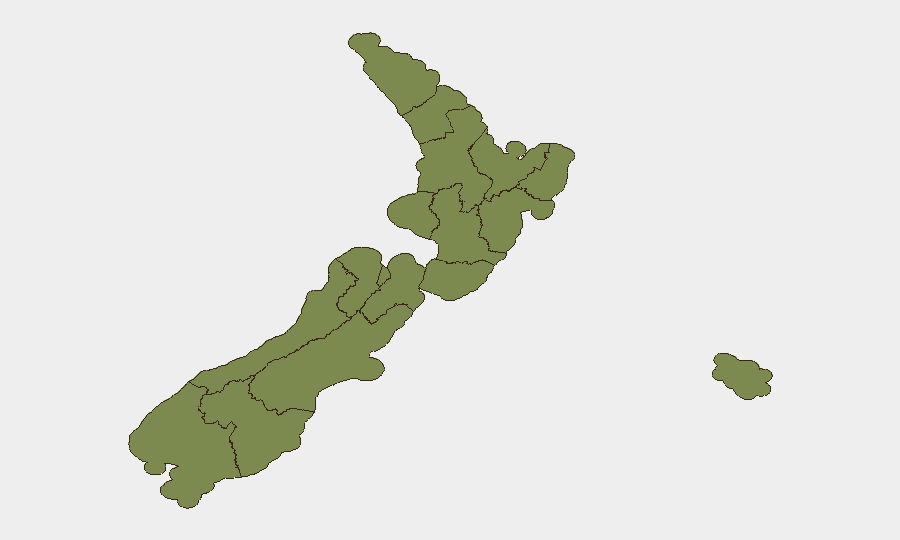
Situation Summary
New Zealand remains a low–threat jurisdiction globally (composite score 24; rank #null among 195 nations tracked). Security incidents over the past 48 hours are dominated by road-traffic collisions, firearms-related police operations, and routine ordnance disposal, with no indicators of organized violence, civil unrest, or destabilizing political action. Wellington accounts for the majority of tracked threat signals (risk score 31.3), though absolute incident volumes remain modest. The overall security trajectory is stable, with operational disruptions driven by transport accidents and routine law-enforcement activity rather than systemic threat escalation.
Key Developments
- Whanganui town centre (27 July, morning): Armed police responded to firearm sighting; one person arrested following response operation.
- Papakura, South Auckland (23 July incident; charges confirmed 27 July): Two men charged following alleged firearm discharge at Hill Crescent property; case progressed through charging stage over past 48 hours.
- Henderson Valley, West Auckland (27 July, overnight): Vehicle fire on Babich Road; police opened suspected arson investigation.
- Stillwater/Hibiscus Coast near Auckland (27 July, morning): Defence Force bomb squad neutralized second piece of military ordnance on Ara Weiti Road; public-safety warnings reiterated following prior controlled detonation at Orewa Beach.
- State Highway 59, Kāpiti Coast (27 July, ~6pm): Collision between car and cyclist resulted in serious injury; SH59 closed between Pukerua Bay and Paekākāriki; significant coastal-route disruption.
- State Highway 1, Christchurch (27 July): Southbound lane blocked near Russley–Yaldhurst Road; substantial commuter delays.
- Taranaki (weekend prior to 27 July; enforcement outcomes current): Police dangerous-driving operation yielded 50+ infringements, 4 arrests, 3 vehicles and 1 motorcycle impounded; bottle thrown through police car window during operation.
Highest-Risk Areas
Wellington dominates the sub-national ranking (31.3), driven by recent investigation, rejection, and disapproval signals tracked on 30–31 July; the specific operational context requires direct liaison with local authorities for clarity on scope and duration. Bay of Plenty and West Coast register notably above baseline (8.8 and 8.2 respectively), though current incident data reflects routine road crashes and police activity rather than escalating threat drivers. Auckland, Waikato, and Otago all register at 2.5 or below, suggesting concentrated risk rather than dispersed instability. Corporate teams with operations in Wellington should maintain heightened situational awareness; other regions present standard operational-security posture.
How GeoBit Would Assist
AOI Monitoring & Early Warning on Wellington, Bay of Plenty, and Waikato would enable persistent, real-time detection of protest activity, civil disorder, or political destabilization before operational impact. OSINT fusion & corroboration across X/Twitter, Telegram, YouTube, and local news feeds would provide continuous intelligence on emerging firearms incidents, labour-relations disputes, and protest intent signalling—critical for duty-of-care teams managing staff presence. Routing & Network Analysis can generate real-time alternative-route recommendations during transport disruptions (e.g., SH1, SH58, SH59 closures), mitigating commuter risk and operational continuity loss.
7-Day Outlook
No indicators of escalation are visible across the tracked event set. Road-safety and routine firearms policing are likely to remain the primary operational-risk drivers in the near term. Organizations should maintain standard security protocols and leverage AOI monitoring for Wellington to detect any substantive change in the political or civil-order environment.
Highest-Risk Areas — Ranked
| # | State / Region | Risk |
|---|---|---|
| 1 | Wellington | 31.3 |
| 2 | Bay of Plenty | 8.8 |
| 3 | West Coast | 8.2 |
| 4 | Auckland | 2.5 |
| 5 | Waikato | 2.5 |
| 6 | Otago | 2.5 |
| 7 | Southland | 1.9 |
| 8 | Chatham Islands | 1.3 |
| 9 | Northland | 1.3 |
| 10 | Taranaki | 1.3 |
| 11 | Manawatū-Whanganui | 1.3 |
| 12 | Hawke's Bay | 1.3 |
Sources
Previous Daily Briefs
A new New Zealand brief is written every day — each with its own risk map and downloadable CSV. Here's the last week; use the calendar to go further back.
📅 Browse every day by calendar →
Highlighted days have a brief. Tap a day for that day's map & analysis, or “csv” for that day's dataset ($5).
Atlas — our AI intelligence desk — emails them this snapshot personally. Nothing else, no list.