Situation Summary
Papua New Guinea faces acute localized security crises overlaid on chronic governance and service-delivery gaps. A major upsurge of armed violence in Porgera (Enga Province) over the past 48 hours has triggered a significant PNG Defence Force and police deployment, with 20–50 reported fatalities and widespread displacement. Secondary incidents—including a reported maritime mass-casualty event near Lihir Island, violent crime arrests in East Sepik and Morobe Provinces, and police operations in Lae—indicate fragmented but active security pressures across multiple provinces. The national threat trajectory remains volatile, with Milne Bay and Porgera/Enga zone as the highest-risk focal points.
Key Developments
- Porgera, Enga Province (31 Jul–1 Aug 2026): UN reports an upsurge of armed violence with 20–50 estimated fatalities, widespread property destruction, displacement, and service disruptions. PNG Defence Force and police Provincial Emergency Response Team units are mobilizing to the area; a joint UN needs-assessment mission is planned within 48–72 hours.
- Porgera, Enga Province (31 Jul–1 Aug 2026): Security operations intensifying with additional law-and-order deployments; heightened risk of further clashes and movement restrictions for civilian and commercial access.
- Lihir Island, New Ireland Province (1 Aug 2026): Local reports indicate a boat named "Zhephir" sank while returning from Mali Island with seven Chinese nationals on board; no survivors reported. Report status: unconfirmed via mainstream outlets; treat as potential mass-casualty maritime incident pending corroboration.
- Lae, Morobe Province (31 Jul–1 Aug 2026): Following a recent attack near UniTech girls' dormitory, police conducted a destructive operation in Poaba‑Egatang settlement targeting alleged suspects, who escaped; localized tension in university vicinity.
- Angoram, East Sepik Province (30 Jul 2026): Police arrested a suspect in custody for a prior wire-catapult attack that killed one woman and injured another; short-term security gain offset by potential for local retaliatory action.
- Kundiawa, Simbu Province (30–31 Jul 2026): Barawagi Correctional Institution reports severe El Niño-driven water-supply disruption, forcing inmates to seek alternative sources; risk of health complications and facility unrest.
- National Airports (30–31 Jul 2026): National Airports Corporation trained 21 personnel on safety-management system compliance; a mitigating action rather than a new threat.
Highest-Risk Areas
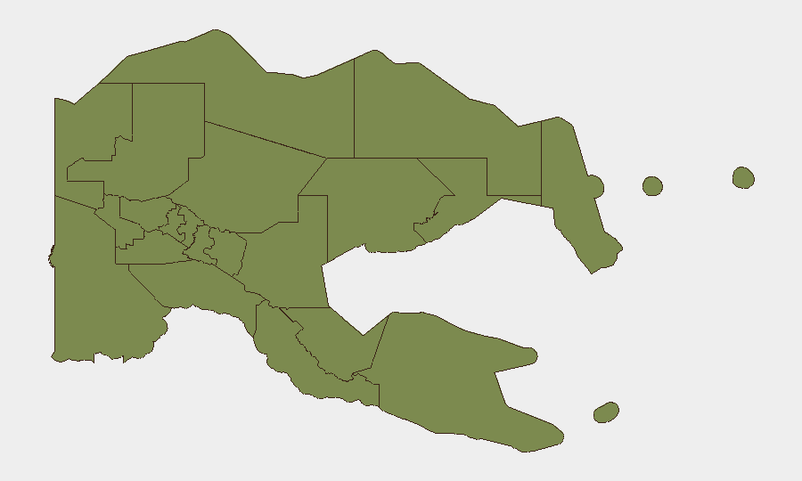
Milne Bay dominates the sub-national ranking (risk score 31.3), reflecting persistent maritime crime, trafficking, and governance challenges in that province. Porgera and Enga Province—currently experiencing a major armed-conflict upsurge—represent the most acute immediate threat, despite not appearing separately in the historical ranking; the Enga violence is a dynamic escalation warranting urgent monitoring. All other tracked provinces cluster at risk score 1.3, indicating either lower chronic threat levels or data-collection limitations. Organizations with personnel or operations in Porgera, Milne Bay, or maritime zones around New Ireland should apply heightened duty-of-care protocols.
How GeoBit Would Assist
Security teams should deploy AOI Monitoring & Early Warning for Porgera/Enga and Milne Bay to track violence patterns and displacement in near-real time. Intel Sweep and multi-language OSINT (Telegram, local web channels, UN feeds) will corroborate unconfirmed events—e.g., the Lihir boat sinking—and extract emerging actor networks in conflict zones. GIS & Spatial Analysis can map safe corridors and route alternatives around Porgera during the security operation, and Network & Actor Analysis can identify escalation triggers and key stakeholders in armed-conflict mediation.
7-Day Outlook
The Porgera violence is likely to persist or expand over the next 5–7 days as PNG Defence Force operations unfold and the UN assessment mission mobilizes. Maritime and aviation incidents may spike if weather/El Niño conditions deteriorate. Localized crime and police operations in urban centers (Lae, Angoram) are expected to remain episodic unless a broader law-and-order campaign is announced.
Highest-Risk Areas — Ranked
| # | State / Region | Risk |
|---|---|---|
| 1 | Milne Bay | 31.3 |
| 2 | Eastern Highlands | 1.3 |
| 3 | Gulf | 1.3 |
| 4 | Madang | 1.3 |
| 5 | Manus | 1.3 |
| 6 | West New Britain | 1.3 |
| 7 | New Ireland | 1.3 |
| 8 | East New Britain | 1.3 |
| 9 | Morobe | 1.3 |
| 10 | National Capital District | 1.3 |
| 11 | Central | 1.3 |
| 12 | Oro | 1.3 |
Sources
Previous Daily Briefs
A new Papua New Guinea brief is written every day — each with its own risk map and downloadable CSV. Here's the last week; use the calendar to go further back.
📅 Browse every day by calendar →
Highlighted days have a brief. Tap a day for that day's map & analysis, or “csv” for that day's dataset ($5).
Atlas — our AI intelligence desk — emails them this snapshot personally. Nothing else, no list.