Situation Summary
Togo remains a transit hub for regional military logistics and a focal point for illicit arms trafficking amid broader Sahel instability. The northern Savanes and Kara regions face acute insurgency and terrorism pressure spilling from Burkina Faso and Mali, while the capital and southern Maritime Region maintain lower acute threat profiles. No major security incidents have been recorded in the past 48 hours, but underlying conditions—porous borders, weapons proliferation, and foreign military movement—sustain moderate-to-high risk in the north.
Key Developments
- Agoè-Nyivé (Lomé suburbs), 2026-08-07: Togo's anti-arms-proliferation authority conducted a public destruction operation of approximately 1,000 illicit firearms as part of a broader anti-crime security initiative. This signals active government efforts to counter weapons trafficking but also underscores the scale of illegal armament in civilian circulation.
- Port of Lomé, 2026-08-04: French and international media reported Russian military vehicles transiting through Togo's port en route to Mali. This reflects continued use of Togo's infrastructure by external state actors and highlights the country's role in broader regional military supply chains, particularly Wagner/Russian-linked operations in the Sahel.
- No new discrete security incidents (armed clashes, bombings, or kidnappings) were reported in Togo's territory during the 24–48-hour window. Threat activity remains concentrated in Savanes and Kara regions, consistent with historical patterns.
Highest-Risk Areas
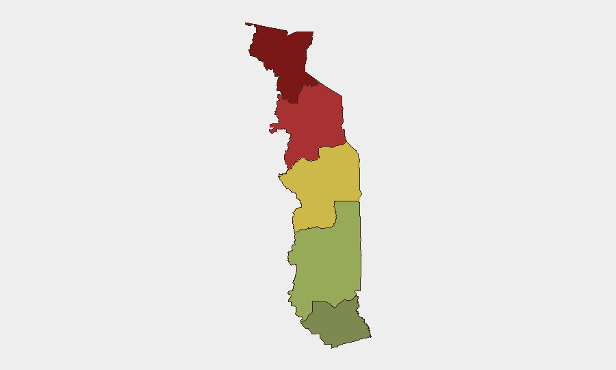
The northern Savanes Region (score 92) and Kara Region (score 78) dominate Togo's threat profile, driven by spillover from Burkina Faso's active insurgency and proximity to ungoverned spaces. Both regions face recurrent recruitment, taxation, and violence by jihadist and separatist armed groups. The Centrale Region (score 65) experiences secondary risk from similar cross-border dynamics. By contrast, the Maritime Region and greater Lomé area remain substantially lower-risk, though both serve as logistics and transshipment nodes for illicit weapons and foreign military cargo—a vulnerability that amplifies indirect exposure.
How GeoBit Would Assist
Intel Sweep and multi-language OSINT would provide continuous monitoring of port activity, military movements, and arms-trafficking networks operating through Lomé. AOI Monitoring & Early Warning with persistent geospatial watch on Savanes and Kara border crossings would detect new incursions, militant staging, or displacement patterns before they escalate. Network & Actor Analysis would map illicit weapons supply chains and foreign military actors to inform corporate movement restrictions and asset positioning in the north.
7-Day Outlook
No imminent escalation is forecast for the coming week. Seasonal August weather patterns may temporarily reduce mobility in affected northern areas. Arms destruction operations and continued French/international counter-insurgency activity in neighboring Mali may sustain low-level pressure on militant networks but are unlikely to produce major tactical shifts. Corporate teams should maintain heightened vigilance for northern travel and personnel security, particularly in Savanes and Kara, while monitoring port activity for weapons and contraband flow.
Highest-Risk Areas — Ranked
| # | State / Region | Risk |
|---|---|---|
| 1 | Savanes Region | 92 |
| 2 | Kara Region | 78 |
| 3 | Centrale Region | 65 |
| 4 | Plateaux Region | 45 |
| 5 | Maritime Region | 28 |
Sources
Previous Daily Briefs
A new Togo brief is written every day — each with its own risk map and downloadable CSV. Here's the last week; use the calendar to go further back.
📅 Browse every day by calendar →
Highlighted days have a brief. Tap a day for that day's map & analysis, or “csv” for that day's dataset ($5).
Atlas — our AI intelligence desk — emails them this snapshot personally. Nothing else, no list.