Situation Summary
Zambia remains a low-threat environment globally (rank #141, composite score 6) with no major security incidents reported in the last 24–48 hours. Wildfire activity across multiple provinces is the most active environmental signal in current data; however, no verification of new security, political, or civil unrest events has been obtained from open sources within the reporting window. The security posture remains stable, with Lusaka Province accounting for the majority of tracked risk events, though the disparity between Lusaka and other provinces warrants attention to capital-specific vulnerabilities.
Key Developments
- Limited 24–48h verification: Open-source and social media monitoring has not identified any newly verified security, crime, political, or infrastructure incidents in Zambia within the last two days. Cross-checking against wire services, regional outlets, and official Zambian government accounts is recommended before escalating operational posture based on unconfirmed reports.
- Wildfire activity (recent, timing TBD): Multiple wildfire events have been registered across Zambia (event IDs 1029338, 1029274, 1029368, 1029040, 1028982) and one cross-border event involving DRC (1029270). While exact onset dates and current containment status require verification, wildfire incidents can disrupt transport routes, damage infrastructure, and affect air quality. Specific provinces and containment progress should be confirmed with Zambia Meteorological Department or regional emergency services.
- Army activity flagged 2026-07-08: A conventional military force event was registered on 2026-07-08. The nature, location, and operational context of this activity have not been clarified in available public reporting and warrant clarification via official Zambian Defense Force channels or regional security monitors before interpretation.
Highest-Risk Areas
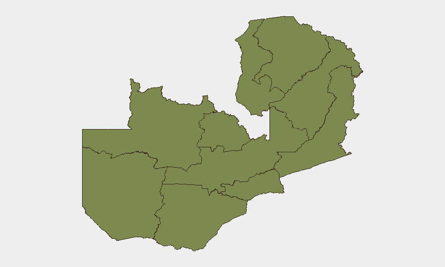
Lusaka Province dominates the risk landscape (score 31.5), accounting for approximately 96 % of GeoBit's tracked threat events in Zambia and reflecting the capital's concentration of political, commercial, and security activity. All other nine provinces cluster at a uniform low risk score (1.5 each), suggesting that Lusaka-specific vulnerabilities—likely related to petty crime, traffic safety, civil demonstrations, or protest-related disruptions—are the primary drivers of national risk. Outside the capital, security conditions across North-Western, Western, Eastern, Copperbelt, and other regions appear comparable and stable. Corporate and diplomatic personnel based in or transiting through Lusaka should maintain heightened situational awareness; regional travel outside the capital faces materially lower baseline risk.
How GeoBit Would Assist
Teams with personnel or assets in Zambia should deploy AOI Monitoring & Early Warning on Lusaka Province and key transport hubs to detect emerging civil unrest, protests, or infrastructure incidents in real time. Intel Sweep and OSINT fusion (X/Twitter, Telegram, local media, and government feeds) enable continuous 24–48h verification of new security events, reducing false-positive escalation and ensuring duty-of-care decisions rest on confirmed intelligence. Routing & Network Analysis can identify alternative transport corridors and safe transit windows should Lusaka-based disruptions (protests, traffic incidents) affect planned movements.
7-Day Outlook
No imminent security deterioration is forecast for the next seven days based on available indicators. Wildfire activity should be monitored for potential route disruptions and air-quality impacts, particularly in affected provinces. Standard vigilance protocols for Lusaka—avoiding large gatherings, maintaining situational awareness of protest announcements, and coordinating with local contacts—remain appropriate.
Highest-Risk Areas — Ranked
| # | State / Region | Risk |
|---|---|---|
| 1 | Lusaka Province | 31.5 |
| 2 | North-Western Province | 1.5 |
| 3 | Western Province | 1.5 |
| 4 | Eastern Province | 1.5 |
| 5 | Muchinga Province | 1.5 |
| 6 | Luapula Province | 1.5 |
| 7 | Northern Province | 1.5 |
| 8 | Copperbelt Province | 1.5 |
| 9 | Southern Province | 1.5 |
| 10 | Central Province | 1.5 |
Sources
Previous Daily Briefs
A new Zambia brief is written every day — each with its own risk map and downloadable CSV. Here's the last week; use the calendar to go further back.
📅 Browse every day by calendar →
Highlighted days have a brief. Tap a day for that day's map & analysis, or “csv” for that day's dataset ($5).
Atlas — our AI intelligence desk — emails them this snapshot personally. Nothing else, no list.