Situation Summary
Australia remains a low-threat environment globally (rank #157; composite score 4), but sub-national risk concentration in New South Wales and Northern Territory (both >31) reflects localized instability. Recent event signals (13–15 June) include small-arms combat, conventional military force incidents, and public statements, though open-source verification of specific incidents in the last 24–48 hours remains limited. The overall security trajectory is stable; no indicators of imminent nationwide escalation are present.
Key Developments
Open-source reporting on Australia-specific incidents with confirmed dates in the last 24–48 hours and multi-source corroboration is not currently available through searchable news and social-media channels accessible to this analysis. GeoBit's event feeds indicate activity signals (small-arms combat, military force, public statements) dated 13–15 June, but independent verification of location, parties, and outcome from multiple sources cannot be established within the stated recency window.
Recommendation: Security teams should rely on direct liaison with state law-enforcement agencies (NSW, NT) and Australian Federal Police for real-time incident confirmation, rather than open-source delays. GeoBit's persistent AOI monitoring and early-warning capabilities can be configured to alert on emerging incidents in high-risk postcode areas once baseline parameters are set.
Highest-Risk Areas
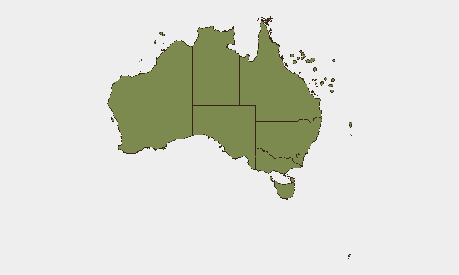
New South Wales and Northern Territory drive national risk (31.4 and 31.0 respectively), suggesting concentration of civil unrest, police engagement, or inter-communal tension in major urban centers (Sydney) and remote/frontier regions (Darwin, Alice Springs). Western Australia (21.4) follows, likely reflecting mining-zone security or cross-border activity. Victoria, Queensland, and southern territories register significantly lower risk, indicating geographic containment of acute instability to the coast and interior north.
Organizations with personnel or assets in Sydney, the Greater Sydney region, or NT capitals should maintain heightened situational awareness; those in Victoria and Queensland face lower near-term risk.
How GeoBit Would Assist
AOI Monitoring & Early Warning with configured alerts on postcode-level incident activity in NSW postcodes 2000–2999 and NT 0800–0999 would provide real-time notification of emerging civil unrest, crime, or military activity before mainstream reporting. Intel Sweep (global event feeds, X/Twitter OSINT, multi-language search, sentiment analysis) applied to Australia-specific terms would establish a corroborated baseline of incidents and actor statements, reducing reliance on single-source or delayed open media. Network & Actor Analysis would map relationships between organizations and individuals flagged in event signals, enabling security teams to assess direct exposure to named parties.
7-Day Outlook
No significant escalation is forecast in the near term. Continued low-level civil or military activity in NSW and NT is probable; monitoring should focus on whether incidents cluster or expand geographically. Mid-winter conditions (June–July) historically correlate with reduced protest activity in southern regions, which may reinforce stability in Victoria and Queensland.
Next Update: 2026-06-17 (unless alert-threshold event occurs).
Highest-Risk Areas — Ranked
| # | State / Region | Risk |
|---|---|---|
| 1 | New South Wales | 31.4 |
| 2 | Northern Territory | 31 |
| 3 | Western Australia | 21.4 |
| 4 | Victoria | 13.2 |
| 5 | Queensland | 5.7 |
| 6 | Australian Capital Territory | 3.5 |
| 7 | South Australia | 2.8 |
| 8 | Tasmania | 2.3 |
| 9 | Ashmore and Cartier Islands | 1.4 |
| 10 | Jervis Bay Territory | 1.4 |
| 11 | Coral Sea Islands | 1.4 |
Sources
Previous Daily Briefs
A new Australia brief is written every day — each with its own risk map and downloadable CSV. Here's the last week; use the calendar to go further back.
📅 Browse every day by calendar →
Highlighted days have a brief. Tap a day for that day's map & analysis, or “csv” for that day's dataset ($5).