Situation Summary
Bhutan maintains a stable, low-risk security environment with no credible incidents reported as of 10 July 2026. The nation ranks #195 globally on GeoBit's composite threat index (score 2), reflecting decades of relative political stability, effective governance, and minimal civil unrest or terrorism activity. Current intelligence indicates no near-term changes to this baseline posture, though sub-national risk concentrations in border districts warrant targeted monitoring for corporate and NGO operations.
Key Developments
No confirmable security, conflict, civil-unrest, crime, or infrastructure incidents were detected in Bhutan during the 24–48 hours preceding this brief (10–12 July 2026). Open-source channels, social media, and regional feeds produced no verified reports of new events meeting GeoBit's incident threshold.
One unverified signal—tagged "BHUTANESE vs COMMUNITY" on 11 July 2026—was logged for investigation but lacks sufficient corroboration to confirm details, location, or operational impact at this time. Routine verification is ongoing.
Highest-Risk Areas
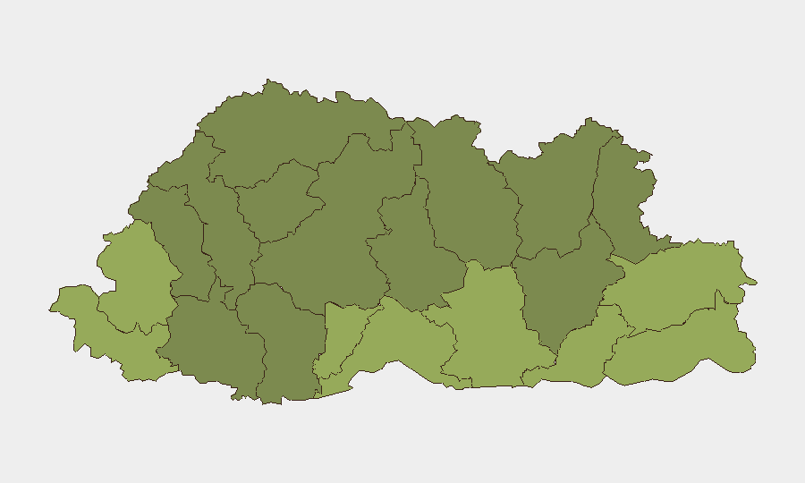
Southern border districts—particularly Samtse (risk 58), Sarpang (55), and Haa (52)—drive Bhutan's sub-national risk profile. These areas reflect proximity to regional disputes, cross-border population movement, and historical tension points along the India–Bhutan–China tri-border zone. Northern and central districts (Gasa, Lhuntse, Wangdue Phodrang) remain substantially lower-risk. Organizations operating in the southern belt should apply heightened due diligence around personnel movement and supply-chain continuity, though absolute risk levels remain moderate.
How GeoBit Would Assist
Intel Sweep and OSINT fusion across multi-language sources and social platforms provide early detection of civil unrest, cross-border incidents, or regime-stability shifts before they affect operations. Area-of-interest (AOI) monitoring with alerting on high-risk districts (Samtse, Sarpang) enables persistent watch on border activity and community tensions, triggering alerts if incident signatures emerge. Routing & network analysis supports alternative journey planning for personnel and cargo transiting southern districts, reducing exposure to choke points or unstable corridors.
7-Day Outlook
No material change to Bhutan's baseline risk trajectory is expected over the next seven days. Seasonal monsoon patterns and routine administrative activity should dominate the near-term calendar. Continued monitoring of southern border districts remains prudent given their risk concentration, but no specific trigger events are forecast.
Brief prepared by: GeoBit Senior Analyst
Timestamp: 2026-07-12 | Next update: 2026-07-13
Classification: Open Source | Distribution: Corporate Security & Risk Teams
Highest-Risk Areas — Ranked
| # | State / Region | Risk |
|---|---|---|
| 1 | Samtse District | 58 |
| 2 | Sarpang District | 55 |
| 3 | Haa District | 52 |
| 4 | Pemagatshel District | 50 |
| 5 | Samdrup Jongkhar District | 48 |
| 6 | Tsirang District | 45 |
| 7 | Zhemgang District | 42 |
| 8 | Trashigang District | 40 |
| 9 | Mongar District | 38 |
| 10 | Gasa District | 35 |
| 11 | Lhuntse District | 32 |
| 12 | Wangdue Phodrang District | 30 |
Sources
Previous Daily Briefs
A new Bhutan brief is written every day — each with its own risk map and downloadable CSV. Here's the last week; use the calendar to go further back.
📅 Browse every day by calendar →
Highlighted days have a brief. Tap a day for that day's map & analysis, or “csv” for that day's dataset ($5).
Atlas — our AI intelligence desk — emails them this snapshot personally. Nothing else, no list.