Situation Summary
Comoros remains a low-frequency threat environment (global rank #137, composite score 7/100) with no discrete security incidents reported in the last 24–48 hours. The archipelago's risk profile is geographically concentrated, with Anjouan driving substantially higher exposure than Grande Comore or Moheli. No imminent destabilization signals are evident, though the absence of recent reportage does not eliminate underlying vulnerabilities in governance, maritime security, and inter-island tensions.
Key Developments
No credible security, conflict, civil-unrest, crime, political-instability, infrastructure, or travel-risk events have been identified in Comoros during the last 24–48 hours. Web and social media monitoring returned references to development initiatives (water-access projects, resilience work) and health responses (mpox), but none timestamped within the specified window. A Comoros-flagged maritime incident was noted in the Strait of Hormuz; however, the post lacks a reliable timestamp and cannot be confidently attributed to the last 48 hours as of 2026-07-04. Ongoing monitoring of port activity, inter-island ferry operations, and political communications will resume upon detection of substantive developments.
Highest-Risk Areas
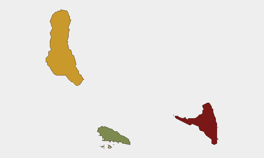
Anjouan (risk score 88) is the dominant driver of national risk and merits priority in duty-of-care planning. The island has historically experienced separatist agitation, governance disputes, and limited state capacity; these structural weaknesses persist despite periods of relative calm. Grande Comore (score 72) ranks second and includes the capital, Moroni, where political and administrative functions concentrate; its risk reflects urban density, port activity, and dependence on inter-island logistics. Moheli (score 35) presents materially lower exposure. Organizations with staff, assets, or supply chains touching Anjouan should maintain heightened situational awareness and contingency protocols; Grande Comore operations warrant standard international-business-travel risk management.
How GeoBit Would Assist
AOI Monitoring & Early Warning with persistent watch on Anjouan's political messaging, security-force activity, and port traffic would provide advance notice of instability. Intel Sweep and multi-language OSINT (social media, radio SIGINT, local news) enable real-time detection of civil unrest, inter-island disputes, or maritime incidents. Maritime & Aviation tracking and alternative route/journey planning allow security teams to monitor ferry schedules, shipping corridors, and contingency evacuation pathways should inter-island communication or transport deteriorate. Sentiment & temporal analysis of local political discourse will flag emerging tensions before they escalate to reportable incidents.
7-Day Outlook
No acute security deterioration is forecast for the coming week. Routine governance, health, and development activities are expected to continue. However, the gap between low current event-reporting and Anjouan's historical volatility suggests that detection capability—rather than absolute risk reduction—is the primary operational lever; organizations should ensure monitoring systems are active and alert thresholds are calibrated to catch early signals of political friction or maritime disruption before they propagate to operational impact.
Highest-Risk Areas — Ranked
| # | State / Region | Risk |
|---|---|---|
| 1 | Anjouan | 88 |
| 2 | Grande Comore | 72 |
| 3 | Moheli | 35 |
Sources
Previous Daily Briefs
A new Comoros brief is written every day — each with its own risk map and downloadable CSV. Here's the last week; use the calendar to go further back.
📅 Browse every day by calendar →
Highlighted days have a brief. Tap a day for that day's map & analysis, or “csv” for that day's dataset ($5).
Atlas — our AI intelligence desk — emails them this snapshot personally. Nothing else, no list.