Situation Summary
The Democratic Republic of Congo faces a compound security crisis driven by armed-group escalation in the east, epidemic-related civil unrest, and political instability in the capital. Over the past 48 hours, M23 rebel activity has intensified displacement in North Kivu, cross-border abductions have spiked at the Chad and Rwanda borders, and authorities have imposed a ban on public gatherings in Kinshasa and three provinces. The overall security environment has deteriorated noticeably, with rising risks of movement restrictions, ambush, detention, and protest-related disruption across multiple regions.
Key Developments
- North Kivu displacement crisis (2026-06-28 to 29): Tens of thousands newly displaced or re-displaced in Lubero, Rutshuru, and Nyiragongo territories due to escalating M23 activity; humanitarian access severely constrained and conditions described as critical.
- Kinshasa public-gathering ban (2026-06-29): Congolese authorities announced a ban on public gatherings in the capital and three unspecified provinces, citing security and political tension; raises likelihood of protest confrontations and arbitrary enforcement.
- Ituri Ebola-response escalation (2026-06-27 to 28): Residents in Rwampara (Ituri) attacked Ebola burial teams and breached response facilities; reflects broader mistrust of authorities and raises risk of movement controls and health-sector disruption.
- Chad–DRC border abductions (2026-06-28): Two separate kidnapping incidents reported—one attributed to bandit group, one to terrorist actor—signaling active cross-border criminal and militant operations and elevated kidnap risk for NGOs and commercial traffic.
- Rwanda–DRC border friction (2026-06-27): A "rejection incident" between Rwandan and Congolese actors at an unspecified crossing reflects diplomatic tension and potential disruption for cross-border travel.
- Ebola outbreak acceleration (update 2026-06-26, current through 29): CDC briefing confirms over 1,100 confirmed cases across DRC and Uganda with expectations of further rise; sustains health-related travel risk and possible local unrest where communities resist response measures.
- Eastern provinces security deterioration (2026-06-27 to 28): Overall security environment in Ituri, South Kivu, and border corridors has worsened in 48 hours, with spike in bandit and terrorist abductions at international frontiers.
Highest-Risk Areas
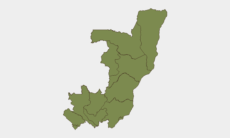
Cuvette-Ouest Department significantly outranks other regions with a composite risk score of 31.8, roughly 17 times higher than all other departments (each rated 1.8). While the sub-national rankings do not align precisely with the current event hotspots—which are concentrated in eastern DRC (North Kivu, Ituri) and the capital—the Cuvette-Ouest risk elevation warrants monitoring for unreported armed-group activity, resource-dispute violence, or criminal networks in that remote region. Kinshasa, though ranked lower, now carries acute near-term risk due to the public-gathering ban and underlying political instability. Security teams should treat eastern border zones (Rwanda, Chad, Uganda frontiers) as active kidnap and militancy corridors despite their lower formal rankings.
How GeoBit Would Assist
Security and duty-of-care teams would deploy AOI Monitoring & Early Warning on Kinshasa, North Kivu and Ituri to detect escalation in real time and trigger alerts before movement restrictions tighten. Intel Sweep, OSINT fusion, and multi-language social-media analysis (X, Telegram, local sources) would track Ebola-response unrest, M23 movements, and protest rhetoric to anticipate flash points. Routing & Network Analysis would identify alternative cross-border and inter-provincial corridors to bypass compromised checkpoints and conflict zones.
7-Day Outlook
Displacement in North Kivu is likely to accelerate if M23 pressure continues unchecked, while the Kinshasa gathering ban may trigger intermittent protest flare-ups and unpredictable policing. Ebola-related movement controls and community resistance are expected to persist. Cross-border kidnap risk will remain elevated in remote Chad and Rwanda frontier zones. Overall, expect cumulative hardening of access, travel delays, and localized security incidents rather than a single large-scale event.
Highest-Risk Areas — Ranked
| # | State / Region | Risk |
|---|---|---|
| 1 | Cuvette-Ouest Department | 31.8 |
| 2 | Sangha | 1.8 |
| 3 | Likouala | 1.8 |
| 4 | Cuvette Department | 1.8 |
| 5 | Kouilou Department | 1.8 |
| 6 | Niari Department | 1.8 |
| 7 | Pointe-Noire (département) | 1.8 |
| 8 | Lékoumou Department | 1.8 |
| 9 | Bouenza Department | 1.8 |
| 10 | Plateaux Department | 1.8 |
| 11 | Pool Department | 1.8 |
| 12 | Brazzaville (department) | 1.8 |
Sources
Previous Daily Briefs
A new Congo brief is written every day — each with its own risk map and downloadable CSV. Here's the last week; use the calendar to go further back.
📅 Browse every day by calendar →
Highlighted days have a brief. Tap a day for that day's map & analysis, or “csv” for that day's dataset ($5).