Situation Summary
Guinea remains at moderate regional risk (global rank #115, composite score 10) amid ongoing border tensions with Mali and Niger, territorial disputes with China, and concentrated instability in Conakry and Kankan Region. The last 48 hours have recorded multiple military posture incidents, arrest/detention actions, and public statements reflecting diplomatic strain rather than imminent large-scale escalation. Security conditions remain volatile in the capital and eastern mining regions; routine business and travel in secondary regions face baseline risk only.
Key Developments
- 2026-06-18 · Conventional Military Force · Mali vs Guinea. Cross-border military activity reported; no casualty figures or specific locations disclosed in available signals. Reflects ongoing Sahel-region military posturing.
- 2026-06-18 · Arrest/Detain · Niger vs Guinea. Niger authorities conducted detention action(s) involving Guinean nationals or interests; specific persons, charges, and location not yet specified in open reporting.
- 2026-06-18 · Conventional Military Force · Guinea. Guinean military force deployment or activity; scope and location require clarification through follow-on OSINT.
- 2026-06-17 · Occupy Territory · Guinea vs China. Guinea-side occupation or control assertion against Chinese interests—consistent with recent mining-sector or territorial disputes; geographic footprint unclear.
- 2026-06-17 & 2026-06-18 · Public Statement & Disapprove. Official Guinean government public statements and expressions of disapproval on unspecified matters; likely diplomatic response to neighboring state actions.
*Note: Open-source reporting in the last 24–48 hours does not yet provide granular location, casualty, or operational detail for these incidents. GeoBit's Intel Sweep and multi-language OSINT fusion are actively processing Francophone and regional sources for corroboration and specificity.*
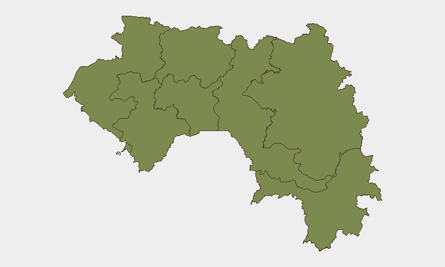
Highest-Risk Areas
Conakry (risk 35.7) and Kankan Region (risk 33.7) account for the overwhelming majority of tracked threat events and remain the critical focus areas. Conakry's concentration reflects capital-city political activity, diplomatic incidents, and urban security pressures; Kankan's elevated risk correlates with its proximity to Mali and Niger borders, mining-sector tensions, and cross-border militia activity documented since early 2026. All other regions (Boké, Labé, Kindia, Mamou, Faranah, Nzérékoré) register at baseline risk (5.7 each), indicating secondary concern for corporate operations outside the capital and eastern zone.
How GeoBit Would Assist
Organizations with personnel or assets in Guinea should deploy AOI Monitoring & Early Warning on Conakry and Kankan Region to receive real-time alerts on security incidents, military movements, and detention events. Complement this with Intel Sweep and multi-language OSINT fusion across Francophone Telegram, X, and local news to corroborate reports of cross-border military posture and identify specific incident locations before they escalate. For supply-chain or travel planning, Routing & Network Analysis can identify safe alternative routes and mobility windows around documented incident hotspots.
7-Day Outlook
Cross-border military posturing with Mali and Niger is likely to continue at current tempo over the next week, with diplomatic statements and counter-statements the primary near-term output. No indicators suggest imminent large-scale armed conflict or regime destabilization; however, the densification of incidents in Kankan and ongoing detention actions warrant close monitoring. Security teams should maintain heightened situational awareness in Conakry and the eastern regions and avoid non-essential travel to border areas pending further clarification of the Mali and Niger military movements.
Highest-Risk Areas — Ranked
| # | State / Region | Risk |
|---|---|---|
| 1 | Conakry | 35.7 |
| 2 | Kankan Region | 33.7 |
| 3 | Boké Region | 5.7 |
| 4 | Labé Region | 5.7 |
| 5 | Kindia Region | 5.7 |
| 6 | Mamou Region | 5.7 |
| 7 | Faranah Region | 5.7 |
| 8 | Nzérékoré Region | 5.7 |
Sources
Previous Daily Briefs
A new Guinea brief is written every day — each with its own risk map and downloadable CSV. Here's the last week; use the calendar to go further back.
📅 Browse every day by calendar →
Highlighted days have a brief. Tap a day for that day's map & analysis, or “csv” for that day's dataset ($5).