Situation Summary
Honduras maintains a composite threat score of 30 (rank #56 globally) with 53 tracked events, reflecting persistent but not acute security pressures. The threat landscape remains dominated by localized criminal activity and gang-related violence concentrated in specific departments, particularly Olancho and Francisco Morazán, rather than nationwide destabilization. Open-source reporting for the 24–48 hours preceding this brief contains no confirmed, cross-sourced incident-level events; the security picture reflects structural risk patterns and departmental vulnerability rather than imminent crisis indicators.
Key Developments
No reliably confirmed, incident-level security events specific to Honduras were identified in open-source reporting for the 24–48 hours preceding 2026-06-25. GeoBit's live web research indicates limited discrete incident reporting in this window. Corporate security teams are advised to rely on real-time local media outlets (La Prensa, El Heraldo, Proceso Digital, HRN radio) for same-day event verification, as English-language open-source feeds do not consistently capture sub-national incidents at reporting speed.
Background context (not current events): U.S. SOUTHCOM military engagement with Honduras was noted in a June 18 briefing; Honduras announced acquisition of Ukrainian drone systems as of June 22. These represent policy- or capability-level developments rather than security incidents.
Highest-Risk Areas
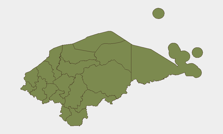
Olancho department (composite risk 31.9) significantly outpaces all other regions and remains the primary geographic driver of national risk, reflecting ongoing criminal operations and limited state security capacity in remote areas. Francisco Morazán (risk 24.4), which includes the capital Tegucigalpa, presents secondary but substantial urban risk tied to gang presence and homicide rates. All remaining departments cluster at risk 1.9, indicating either lower incident density, better reporting, or more effective local security presence. Corporate operations in Tegucigalpa and San Pedro Sula (Cortés department) warrant standard urban-crime vigilance; personnel or assets in Olancho require elevated duty-of-care protocols including movement restrictions and local security liaison.
How GeoBit Would Assist
AOI Monitoring & Early Warning would establish persistent watch on Olancho and Francisco Morazán with automated alerting on gang activity, police operations, or trafficking incidents. Network & Actor Analysis combined with OSINT fusion (X/Twitter, Telegram, local radio SIGINT, YouTube content monitoring) enables real-time tracking of criminal-group movements and territorial disputes without reliance on official statements. GIS & Spatial Analysis with satellite/imagery review can assess infrastructure vulnerability, roadblock locations, and safe routing for corporate movement in high-risk departments. These capabilities collectively enable proactive early warning and duty-of-care risk management in an environment where open-source incident reporting lags ground reality.
7-Day Outlook
No significant escalation indicators are evident in the available reporting window. Structural risk in Olancho and Francisco Morazán will likely persist without major policy or security-force changes. Corporate security teams should maintain current vigilance levels and flag any uptick in local social-media reporting of gang activity, police operations, or civilian incidents to regional risk officers for real-time assessment.
GeoBit Intelligence | Honduras Daily Security Brief | 2026-06-25
Highest-Risk Areas — Ranked
| # | State / Region | Risk |
|---|---|---|
| 1 | Olancho | 31.9 |
| 2 | Francisco Morazán | 24.4 |
| 3 | El Paraíso | 1.9 |
| 4 | Copán | 1.9 |
| 5 | Ocotepeque | 1.9 |
| 6 | Cortés | 1.9 |
| 7 | Yoro | 1.9 |
| 8 | Santa Bárbara | 1.9 |
| 9 | Lempira | 1.9 |
| 10 | Intibucá | 1.9 |
| 11 | Comayagua | 1.9 |
| 12 | La Paz | 1.9 |
Sources
Previous Daily Briefs
A new Honduras brief is written every day — each with its own risk map and downloadable CSV. Here's the last week; use the calendar to go further back.
📅 Browse every day by calendar →
Highlighted days have a brief. Tap a day for that day's map & analysis, or “csv” for that day's dataset ($5).