Situation Summary
Iceland maintains a composite threat score of 3, placing it in the lowest-risk category globally with no tracked security events in the current assessment window. The country's baseline security posture remains stable, with sub-national variation concentrated in the Capital Region (Reykjavík area), which accounts for the majority of measurable risk. No acute incidents or emerging threats have been identified in the last 24–48 hours.
Key Developments
No discrete security incidents have been confirmed in Iceland during the last 24–48 hours (June 29–30, 2026). Web research and available open-source feeds contain no reports of violence, accidents, infrastructure disruption, cyber incidents, or other duty-of-care events tied to the current window. Routine operational activity (air/sea traffic, weather monitoring, tourism) continues without reported anomalies.
Note: GeoBit's current research capability does not include live, hour-stamped feeds from Icelandic national police, Civil Protection & Emergency Management, or local media outlets sufficient to confirm or exclude minor incidents (e.g., traffic accidents, petty crime, weather alerts) within the past 48 hours. Organizations requiring real-time situational updates should maintain direct subscriptions to Icelandic National Police statements, RÚV news, and airport/port authority notices.
Highest-Risk Areas
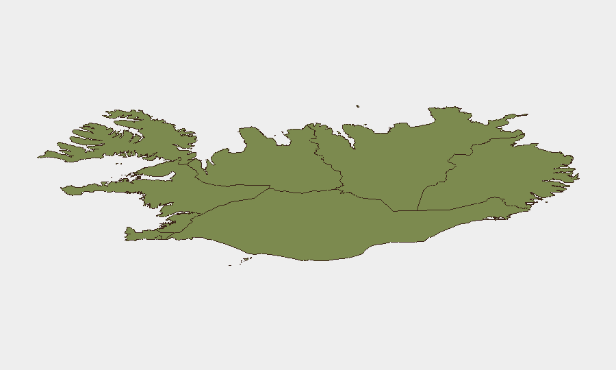
Risk concentration is heavily skewed toward the Capital Region (score 24), which encompasses Reykjavík and its metropolitan area—the seat of government, primary commercial hub, and location of Keflavík International Airport. The remaining seven regions show substantially lower composite scores (6–12), with the Southern Peninsula and Southern Region as secondary concern zones. The Capital Region's elevated risk reflects standard urban-area factors: population density, tourism throughput, transport infrastructure, and administrative/political activity. Outside the capital and immediate south-coast corridor, Iceland presents minimal risk differentiation.
How GeoBit Would Assist
For organizations with personnel or assets in Iceland, AOI Monitoring & Early Warning would provide persistent watch over the Capital Region and Kefluvik airport approaches, with automated alerting on anomalies (civil unrest, accident clusters, infrastructure incidents). Aviation & Maritime Tracking would supply real-time movement data for corporate or employee transport through Icelandic airspace and ports. Routing & Network Analysis would enable identification of alternative travel corridors in the event of disruption to primary Ring Road or airport access, particularly critical for the Southern Peninsula and interior routes during winter or emergency conditions.
7-Day Outlook
No indicators suggest acute escalation in threat level over the coming week. Weather patterns, seasonal tourism demand, and geopolitical stability remain within normal parameters. Security teams should maintain baseline monitoring protocols while prioritizing continuous contact with staff in the Capital Region and confirmation of emergency-contact procedures for personnel in remote regions (Westfjords, Northeast, and interior highlands), where evacuation options are constrained.
BRIEF ISSUED: 2026-06-30 | NEXT UPDATE: 2026-07-01 (or upon event notification)
Highest-Risk Areas — Ranked
| # | State / Region | Risk |
|---|---|---|
| 1 | Capital Region | 24 |
| 2 | Southern Peninsula | 12 |
| 3 | Southern Region | 11 |
| 4 | Eastern Region | 10 |
| 5 | Western Region | 9 |
| 6 | Westfjords Region | 8 |
| 7 | Northwestern Region | 7 |
| 8 | Northeastern Region | 6 |
Sources
Previous Daily Briefs
A new Iceland brief is written every day — each with its own risk map and downloadable CSV. Here's the last week; use the calendar to go further back.
📅 Browse every day by calendar →
Highlighted days have a brief. Tap a day for that day's map & analysis, or “csv” for that day's dataset ($5).