Situation Summary
Ireland's security posture remains broadly stable with a composite threat score of 27 globally, but localized incidents in the past 48 hours span serious violent crime, suspected terrorism activity near the border, infrastructure attacks, and multiple road fatalities. County Wexford and Dublin account for the majority of tracked risk, though the interception of military-grade explosives in County Monaghan on 31 July signals active counterterrorism operations linked to dissident republican activity. No evidence of widespread civil unrest or systemic national instability is present; incidents remain geographically dispersed and event-driven rather than part of coordinated campaigns.
Key Developments
- Carrickmacross, Co Monaghan – suspected car bomb interdiction (N2 corridor) – 31 July (Thursday–Friday). Gardaí and the Special Detective Unit intercepted a vehicle containing military-grade plastic explosives, detonator, and timer, believed destined for cross-border attack in Northern Ireland. A female driver was arrested Thursday; a man in his 40s arrested Friday under the Offences Against the State Act. Garda Commissioner described the seizure as "extremely significant," indicating active dissident republican surveillance or cell activity in the border region.
- Killarney, Co Kerry – US national murder investigation update. A 43-year-old US woman (Jamey Carney) was found dead on Muckross Road; post-mortem confirmed suffocation. The primary suspect (28-year-old male) has fled Ireland within the last 48 hours. Gardaí are coordinating with Interpol and foreign law-enforcement agencies, elevating this to a cross-border manhunt with reputational and diplomatic dimensions.
- Portlaoise, Co Laois – fatal assault (Church Street). A woman in her 50s died following an assault at a residential property on or shortly before 1 August 2026. A man in his 70s was arrested in connection. Emergency services responded after 12:30 p.m. on 1 August.
- Swords, Co Dublin – arson attack on Ryanair-linked properties. Deliberate fire attack on multiple properties associated with Ryanair in north County Dublin within the last 48 hours. Gardaí investigating as criminal damage by fire; motive unclear but suggests possible labor or activist targeting.
- An Sraith Salach (Conamara, Co Galway) – major commercial fire. A significant fire destroyed multiple businesses in this small village within the last 48 hours, described as a community lifeline. Cause under investigation; economic impact on local infrastructure is substantial.
- Cork city – assault on Garda patrol vehicles. An SUV rammed Garda patrol vehicles, injuring at least one officer, within the last 48 hours. Incident classified as dangerous driving and assault on police; heightens local law-enforcement risk profile.
- Multiple road fatalities (Kerry, Cork, Mayo). Three separate fatal road collisions reported in the last 48 hours, including a motorcyclist (Co Cork, male in his 40s), a male in his 20s (Co Kerry), and a child struck by a vehicle (Co Mayo). Incidents reflect seasonal road-safety risk rather than deliberate harm but may cause temporary local travel restrictions.
Highest-Risk Areas
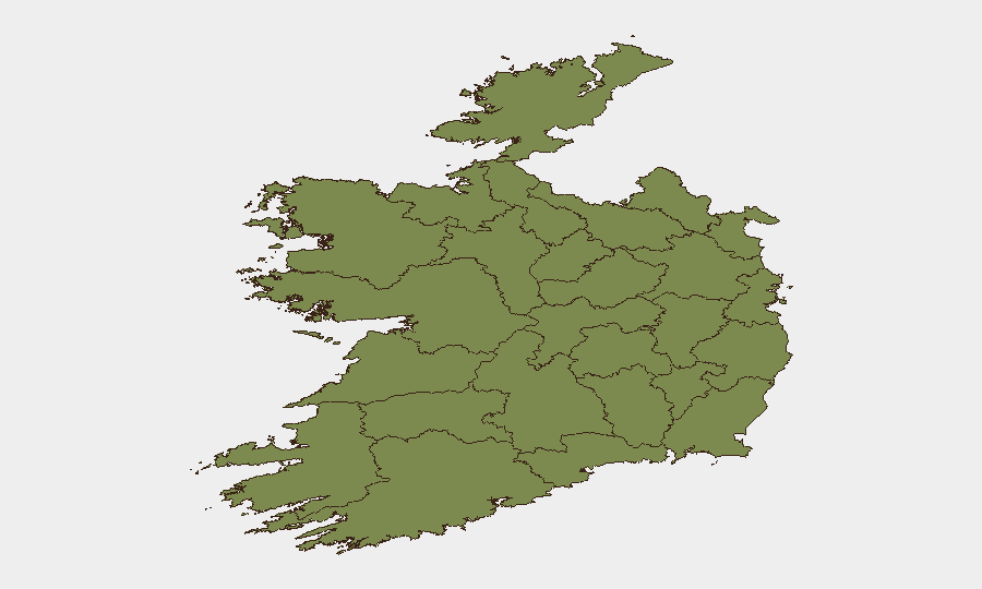
County Wexford (risk score 31.3) and County Dublin (21.7) dominate the national risk ranking, though the threat profile differs: Wexford's elevation appears driven by the July 31 event cluster (threats, arrests, investigations), while Dublin reflects ongoing urban crime and the recent Swords arson. County Donegal (3.7) trails significantly; remaining counties cluster at 1.3–2.5, indicating highly localized rather than dispersed risk. The Monaghan border region, though not listed in the top 12 sub-national ranking, has surfaced as a critical counterterrorism concern due to the explosives interception and suspected dissident republican nexus.
How GeoBit Would Assist
Security teams managing operations or personnel in Ireland should deploy Intel Sweep and X/Twitter & Telegram OSINT to monitor emerging threats in real time, particularly around border regions and Dublin/Wexford. AOI Monitoring & Early Warning on high-risk counties (Wexford, Dublin, Monaghan) with alert thresholds for weapons, explosives, or organized crime signals would provide duty-of-care coverage. Routing & Network Analysis can identify safer transit corridors in light of recent road fatalities and localized arson/assault incidents.
7-Day Outlook
Near-term trajectory favors stabilization: the explosives interception removes an immediate attack vector, and the Killarney murder suspect's flight suggests isolation of that incident rather than organized criminal escalation. Road fatalities and localized property crime are seasonal and episodic. However, sustained Garda and border-security operations around the Monaghan corridor and ongoing investigation of the Ryanair arson should be monitored for signs of coordinated activist or dissident activity; any escalation in cross-border explosives trafficking or organized arson would elevate national threat posture materially.
Highest-Risk Areas — Ranked
| # | State / Region | Risk |
|---|---|---|
| 1 | County Wexford | 31.3 |
| 2 | County Dublin | 21.7 |
| 3 | County Donegal | 3.7 |
| 4 | County Cork | 2.5 |
| 5 | County Mayo | 1.3 |
| 6 | County Sligo | 1.3 |
| 7 | County Galway | 1.3 |
| 8 | County Clare | 1.3 |
| 9 | County Limerick | 1.3 |
| 10 | County Leitrim | 1.3 |
| 11 | County Roscommon | 1.3 |
| 12 | County Cavan | 1.3 |
Sources
Previous Daily Briefs
A new Ireland brief is written every day — each with its own risk map and downloadable CSV. Here's the last week; use the calendar to go further back.
📅 Browse every day by calendar →
Highlighted days have a brief. Tap a day for that day's map & analysis, or “csv” for that day's dataset ($5).
Atlas — our AI intelligence desk — emails them this snapshot personally. Nothing else, no list.