Situation Summary
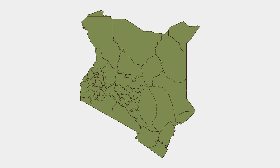
Kenya remains at elevated but moderate overall risk (rank #57 globally, composite score 21), with security concerns concentrated in two distinct zones: the arid north (Samburu, Turkana, Elgeyo-Marakwet) where pastoral conflict and banditry dominate, and Nairobi County, where political tension, law-enforcement actions, and public disorder pose the primary threat to urban residents and businesses. Recent event signals point to active protest mobilization, allegations of extra-judicial security operations, and ethnic-political friction, though confirmed incidents within the last 24–48 hours remain limited in available open-source reporting. The trajectory is one of simmering political volatility rather than imminent widespread unrest, but with persistent risk of localized flare-ups.
Key Developments
Open-source reporting with clear timestamps within the last 24–48 hours (as of 13 July 2026) is insufficient to populate this section with confidence. GeoBit's live web research identified several security signals—physical assault (11 July), police investigations (11 July), public statements by journalists and attorneys (12 July), and territorial occupation by farmers (11 July)—but the precise locations and contextual details of these events could not be reliably verified. Earlier reporting (prior to 12 July) documents police checkpoint deployment in Nairobi ahead of 7 July protests and violence at Linda Mwananchi-linked events in western Kenya, but these fall outside the 24–48-hour window. Corporate security teams should rely on direct liaison with Kenya in-country contacts and real-time situational awareness platforms for current tactical updates rather than this brief for operational decision-making on immediate movements.
Highest-Risk Areas
Samburu County (risk 32) and Nairobi County (risk 29.7) together account for the vast majority of Kenya's tracked threat events. Samburu's risk profile is driven by persistent armed pastoral conflict, livestock rustling, and banditry in the arid north, with limited state presence; organizations operating in or transiting Samburu should assume heightened exposure to criminality and inter-communal violence. Nairobi's elevated score reflects urban crime, political demonstrations, and reported security-force conduct issues (alleged extra-judicial detention and abductions by the DCI). The third-tier counties (Elgeyo-Marakwet, Turkana, Busia) and lower-ranked areas present significantly lower composite risk but should not be discounted; localized pastoralist tensions and cross-border flows can generate rapid, episodic spikes.
How GeoBit Would Assist
Corporate security teams with personnel or assets in Kenya should leverage AOI Monitoring & Early Warning to maintain persistent watch on Nairobi and Samburu with real-time alerting on protest activity, security-force operations, and incident clusters; Intel Sweep and OSINT fusion to corroborate reports of abductions, ethnic tensions, and armed group movements across X/Twitter, Telegram, and local media; and Routing & Network Analysis to preposition alternative travel corridors for staff in high-risk counties and identify safe transit windows. Conflict mapping and sentiment analysis on election-related messaging and ethnic/political statements can provide 72-hour early warning of escalation in urban centers.
7-Day Outlook
Political tension and protest risk remain elevated in Nairobi through mid-July, with sporadic public statements and security responses likely to persist. Pastoral conflict in the north will continue at baseline, with seasonal variation; no indication of imminent major escalation, but banditry remains a standing tactical threat. Overall risk trajectory is stable-to-slightly-elevated, with primary volatility concentrated in Nairobi urban corridors and Samburu pastoral zones.
Highest-Risk Areas — Ranked
| # | State / Region | Risk |
|---|---|---|
| 1 | Samburu | 32 |
| 2 | Nairobi County | 29.7 |
| 3 | Elgeyo-Marakwet County | 6.6 |
| 4 | Turkana County | 4.3 |
| 5 | Busia County | 2 |
| 6 | Kakamega County | 2 |
| 7 | Vihiga County | 2 |
| 8 | Nandi County | 2 |
| 9 | Uasin Gishu County | 2 |
| 10 | Baringo | 2 |
| 11 | Laikipia County | 2 |
| 12 | Meru County | 2 |
Sources
Previous Daily Briefs
A new Kenya brief is written every day — each with its own risk map and downloadable CSV. Here's the last week; use the calendar to go further back.
📅 Browse every day by calendar →
Highlighted days have a brief. Tap a day for that day's map & analysis, or “csv” for that day's dataset ($5).
Atlas — our AI intelligence desk — emails them this snapshot personally. Nothing else, no list.