Situation Summary
Kuwait remains at global threat rank #115 with a composite score of 7.0, reflecting a relatively stable baseline security environment for the region. However, recent event signals (primarily 2026-07-09 to 2026-07-10) indicate elevated military and cross-border activity involving Iran, Iraq, the United States, and Kuwaiti forces—marking a departure from routine operations. No confirmed security incidents (attacks, unrest, infrastructure damage, or mass arrests) have been corroborated in Kuwait's population centers or critical sites within the last 24–48 hours according to available open-source reporting.
Key Developments
Unable to confirm discrete, location-specific incidents in Kuwait within the last 24–48 hours.
Accessible open-source reporting (news wires, X/Twitter, regional outlets) does not contain time-stamped, corroborated details of security events—protests, attacks, arrests, infrastructure disruptions, or travel restrictions—specific to Kuwait governorates during 2026-07-10 to 2026-07-11 UTC. GeoBit's event signal cluster (80 tracked events) reflects broader military posturing and diplomatic activity (conventional forces, demands, public statements) involving regional and global actors, but these signals lack granular, confirmed impact assessments tied to discrete Kuwait locations or civilian/business operations during the immediate 24–48-hour window.
Recommendation: Duty-of-care teams should monitor GeoBit's AOI (area-of-interest) alerts and multi-source fusion feeds for any escalation in Jahra or cross-border activity; absence of reported incidents does not preclude rapid-onset risk.
Highest-Risk Areas
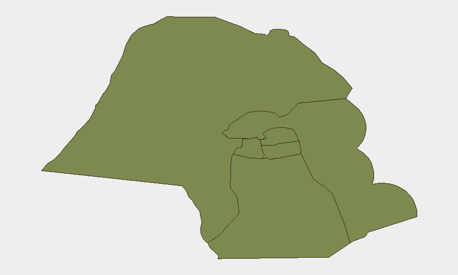
Jahra Governorate is the sole significant outlier in the sub-national ranking, with a composite risk score of 31.5—roughly 20 times higher than any other Kuwaiti governorate. Jahra borders Iraq and sits astride major transportation and logistics corridors; its elevation reflects exposure to cross-border militia activity, smuggling, and conventional military operations on the Iraqi side of the boundary. The remaining five governorates (Ahmadi, Farwaniya, Hawalli, Mubarak al-Kabir, and Capital) all score 1.5, indicating baseline, relatively homogeneous risk profiles. Organizations with personnel or critical infrastructure in Jahra should apply heightened monitoring protocols; those in central and southern governorates face lower localized threat levels, though national-level (Iran-linked, Iraq-linked, or US-led) military escalation could affect air space, ports, and electricity grids pan-Kuwait.
How GeoBit Would Assist
Intel Sweep & OSINT fusion across X/Twitter, local Arabic and English news, and cross-border Telegram channels would surface early warning of militia mobilization, weapons movements, or attack planning before incidents occur. AOI Monitoring & Early Warning with persistent watches on Jahra's border zone and critical infrastructure (Mina al-Ahmadi port, Al-Zour refinery, Kuwait International Airport) would trigger alerts on unusual military, vehicle, or crowd activity. Routing & Network Analysis capabilities would enable rapid identification of alternate routes and safe zones for personnel evacuation or asset relocation if cross-border activity spikes.
7-Day Outlook
The next 7 days will likely see continued elevated military signaling and posturing by regional actors; barring a major new escalation trigger (e.g., a major attack attributed to a state or proxy), civilian and business operations in Kuwait's major population centers and economic zones should remain largely unaffected. Jahra Governorate and border-adjacent areas warrant sustained close monitoring; any confirmed cross-border incursion, attack, or significant casualty event would immediately elevate national-level risk and warrant activation of contingency plans for expatriate staff and supply-chain resilience.
Highest-Risk Areas — Ranked
| # | State / Region | Risk |
|---|---|---|
| 1 | Jahra Governorate | 31.5 |
| 2 | Ahmadi Governorate | 1.5 |
| 3 | Farwaniya Governorate | 1.5 |
| 4 | Hawalli Governorate | 1.5 |
| 5 | Mubarak al-Kabir Governorate | 1.5 |
| 6 | Capital Governorate | 1.5 |
Sources
Previous Daily Briefs
A new Kuwait brief is written every day — each with its own risk map and downloadable CSV. Here's the last week; use the calendar to go further back.
📅 Browse every day by calendar →
Highlighted days have a brief. Tap a day for that day's map & analysis, or “csv” for that day's dataset ($5).
Atlas — our AI intelligence desk — emails them this snapshot personally. Nothing else, no list.