Situation Summary
Maldives remains a low-threat environment globally (rank #163, composite score 5) with no tracked security events in the current reporting window. The archipelago's security posture is stable, though urban concentrations—particularly the capital Malé—carry elevated operational risk relative to more remote atolls. No incidents of terrorism, civil unrest, major crime, or infrastructure failure have been verified in the last 24–48 hours.
Key Developments
No verified security, conflict, civil unrest, crime, political instability, infrastructure, or travel-risk incidents have been identified in the Maldives in the last 24–48 hours based on available open-source reporting.
Highest-Risk Areas
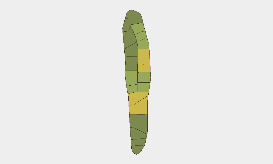
Malé (risk 85) and Malé Atoll (risk 68) significantly outpace all other sub-national zones and account for the majority of tracked composite risk. This concentration reflects the capital's role as the administrative, commercial, and transportation hub, where personnel density, maritime traffic, and interaction with informal-economy actors are highest. Hadhdhunmathi (65) and Kolhumadulu (60) represent secondary risk clusters; all other atolls register substantially lower risk (≤58), with outer northern and southern atolls carrying minimal operational threat. Risk in these urban centers is primarily associated with petty crime, traffic incidents, and occasional labor or political friction rather than organized violence or terrorism.
How GeoBit Would Assist
Security teams with personnel or assets in Maldives should employ AOI Monitoring & Early Warning to maintain persistent watch on high-risk zones (Malé, Malé Atoll, resort corridors) and receive automated alerts if civil unrest, transport disruption, or crime clusters emerge. OSINT fusion—including multi-language web search, X/Twitter monitoring, and local news feeds—would provide real-time detection of incidents, political developments, or maritime/aviation anomalies that could affect operations or movement. Routing & Network Analysis supports duty-of-care planning, allowing rapid identification of alternative travel routes and safe zones should any localized incident necessitate movement restrictions or evacuation.
7-Day Outlook
The security environment is expected to remain stable over the next seven days. Monitoring should remain routine, with emphasis on tracking weather (monsoon season) and maritime conditions rather than conflict or unrest indicators. Teams should maintain standard travel protocols and local liaison networks; no escalation in underlying threat is anticipated.
Highest-Risk Areas — Ranked
| # | State / Region | Risk |
|---|---|---|
| 1 | Malé | 85 |
| 2 | Malé Atoll | 68 |
| 3 | Hadhdhunmathi | 65 |
| 4 | Kolhumadulu | 60 |
| 5 | Felidhu Atoll | 58 |
| 6 | Mulaku Atoll | 55 |
| 7 | Faadhippolhu | 52 |
| 8 | South Miladhunmadulu | 48 |
| 9 | North Miladhunmadulu | 45 |
| 10 | South Nilandhe Atoll | 44 |
| 11 | North Nilandhe Atoll | 42 |
| 12 | South Ari Atoll | 40 |
Sources
Previous Daily Briefs
A new Maldives brief is written every day — each with its own risk map and downloadable CSV. Here's the last week; use the calendar to go further back.
📅 Browse every day by calendar →
Highlighted days have a brief. Tap a day for that day's map & analysis, or “csv” for that day's dataset ($5).
Atlas — our AI intelligence desk — emails them this snapshot personally. Nothing else, no list.