Situation Summary
Nepal is experiencing a critical political and security crisis following large-scale anti-government protests that escalated into armed clashes on 21–22 July. Prime Minister KP Sharma Oli resigned under pressure after security forces opened fire on demonstrators, killing at least 19 and injuring over 500; the Nepal Army has assumed nationwide security operations with troops deployed across Kathmandu and curfews enforced. Concurrent monsoon-driven landslides and flooding across nine major highways have compounded mobility constraints and exacerbated the security environment, while India has heightened border vigilance in response to internal unrest.
Key Developments
- Kathmandu (Parliament, PM's Office) – 21–22 July: Anti-government protests escalated into violent clashes; security forces opened fire, resulting in at least 19 deaths and over 500 injuries. PM Oli resigned on 22 July; President Ramchandra Paudel formally accepted the resignation, triggering a leadership transition.
- Kathmandu Valley – 22 July, 22:00: Nepal Army took command of nationwide security operations and deployed troops across Kathmandu, Lalitpur, and Bhaktapur; curfews and security restrictions imposed across multiple areas of the valley to contain ongoing youth-led protests.
- Kathmandu – 22 July: Following Oli's resignation, demonstrations continued demanding accountability for corruption, restrictions, and alleged police misconduct; security forces remained mobilized with enforcement orders in place.
- Nepal–India Border – 22 July: India's Sashastra Seema Bal (SSB) escalated security posture across all border posts along the 1,751-km frontier, increasing checks and vigilance that may disrupt cross-border movement and trade.
- Narayanghat–Muglin Highway & Prithvi Highway (Chitwan District) – 19–21 July: Vehicular movement suspended due to landslide risk and rain-induced hazards; complete and partial closures reported on at least nine major highways nationwide, affecting connectivity to western and southern Nepal.
- Pokhara (Kaski District) – 21–22 July: Continuous rainfall triggered a landslide that blocked the Seti River in Pokhara ward 15/17; authorities conducting technical assessment amid concern over rising upstream water levels and potential flooding.
- Kuleshwor, Kathmandu – 19 July: Police arrested two individuals, including an Indian national, following a gun discharge during an anti-narcotics operation, indicating ongoing law-enforcement activity.
Highest-Risk Areas
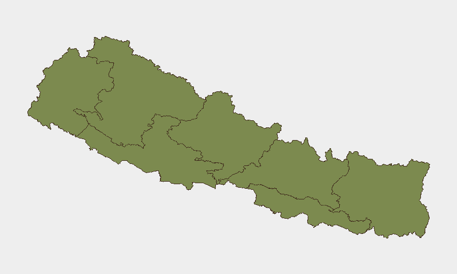
Bagamati Province—which encompasses Kathmandu and the Kathmandu Valley—poses the overwhelming risk (31.2 composite score), driven by the active leadership crisis, military deployment, curfews, and ongoing protests. Gandaki Province (7.4) and Lumbini Province (5.3) face secondary risks primarily from monsoon-related landslides and road closures affecting supply chains and mobility. Remaining provinces carry lower but non-negligible risk from weather disruption and potential spillover from the capital's unrest.
How GeoBit Would Assist
Security teams should deploy AOI Monitoring & Early Warning capabilities to track Kathmandu Valley, border crossing points, and major highway corridors for real-time incident and curfew updates; OSINT & Intel Sweep to monitor official announcements, social-media sentiment, and protest organization across X, Telegram, and local news; and Routing & Network Analysis to identify alternative supply and movement corridors around closed highways and identify safe passage windows during curfew enforcement.
7-Day Outlook
The immediate risk trajectory remains elevated: a leadership vacuum during military-led security operations and ongoing youth mobilization create conditions for further clashes and extended curfews in Kathmandu through at least 24–48 hours. Monsoon disruption to highways will persist, constraining logistics and staff mobility nationwide. Organizations should assume restricted movement in Bagamati Province and prepare contingency staffing and supply-chain arrangements for 7–10 days.
Highest-Risk Areas — Ranked
| # | State / Region | Risk |
|---|---|---|
| 1 | Bagamati Province | 31.2 |
| 2 | Gandaki Province | 7.4 |
| 3 | Lumbini Province | 5.3 |
| 4 | Koshi Province | 4.3 |
| 5 | Karnali Province | 3.3 |
| 6 | Sudurpashchim Province | 2.2 |
| 7 | Madhesh Province | 1.2 |
Sources
Previous Daily Briefs
A new Nepal brief is written every day — each with its own risk map and downloadable CSV. Here's the last week; use the calendar to go further back.
📅 Browse every day by calendar →
Highlighted days have a brief. Tap a day for that day's map & analysis, or “csv” for that day's dataset ($5).
Atlas — our AI intelligence desk — emails them this snapshot personally. Nothing else, no list.