Situation Summary
Tonga remains in a low-threat security environment with no verified incidents, civil unrest, crime spikes, or infrastructure disruptions reported in the last 24–48 hours. The country's composite threat score of 5 reflects continued stability across law enforcement, political, and public-order domains. Recent seismic activity (three earthquakes, M 4.8–4.9, in the past week) poses natural hazard risk but has not triggered secondary security events or cascading infrastructure failures to date.
Key Developments
- No verified security, civil-unrest, crime, or political-instability incidents recorded across Tonga in the last 24–48 hours; open-source reporting, government advisories, and regional security feeds contain no new alerts or corroborated reports (as of 2026-06-22).
- Seismic activity ongoing: M 4.9 earthquake recorded 260 km SSW of ʻOhonua; M 4.8 events at 172 km SW of Hihifo and 86 km ENE of Fangaleʻounga (dates within recent window). No tsunami warnings or secondary disaster-response disruptions reported.
- Regional security landscape stable: East–West Center Pacific Islands Report and multi-language OSINT monitoring show no Tonga-specific developments; civil-unrest reporting is concentrated on other Pacific jurisdictions (Samoa, Solomon Islands, Timor-Leste).
- U.S. and allied travel advisories unchanged: No new warnings, travel restrictions, or duty-of-care alerts issued for Tonga in the last 48 hours.
Highest-Risk Areas
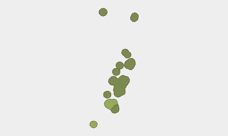
Tongatapu (risk score 45) remains the dominant risk driver, reflecting the concentration of population, government institutions, port infrastructure, and economic activity on the primary island. Vavaʻu (risk 28) and Haʻapai (risk 22) carry material but secondary risk, likely reflecting smaller populations, limited service redundancy, and exposure to natural hazards (seismic and maritime). ʻEua and ʻOngonīua present minimal risk. The sub-national gradient reflects vulnerability to natural events and localized service disruption rather than active conflict, crime, or unrest; duty-of-care teams should prioritize Tongatapu for infrastructure resilience and continuity-of-operations planning.
How GeoBit Would Assist
Security teams operating in or supporting Tonga would benefit from AOI Monitoring & Early Warning to establish persistent watch on Tongatapu and secondary islands, with automated alerting for civil unrest, infrastructure disruptions, or security incidents. Multi-language OSINT fusion (X/Twitter, Telegram, local news, radio SIGINT) combined with sentiment and temporal analysis would enable rapid detection of emerging political instability or public-order shifts. Environmental & Health intelligence, coupled with satellite and imagery analysis, would provide early warning of seismic or volcanic secondary effects (tsunami risk, infrastructure damage) before they cascade into security or logistical impacts.
7-Day Outlook
Tonga is expected to remain in a stable, low-threat posture over the next seven days absent major geopolitical shocks or a significant natural-hazard event. Continued seismic activity is probable given regional tectonic patterns but does not currently indicate elevated secondary risk. Corporate and government security teams should maintain routine monitoring posture while prioritizing continuity-of-operations planning for Tongatapu in case of infrastructure disruption.
Highest-Risk Areas — Ranked
| # | State / Region | Risk |
|---|---|---|
| 1 | Tongatapu | 45 |
| 2 | Vavaʻu | 28 |
| 3 | Haʻapai | 22 |
| 4 | ʻEua | 18 |
| 5 | Ongo Niua | 12 |
Sources
Previous Daily Briefs
A new Tonga brief is written every day — each with its own risk map and downloadable CSV. Here's the last week; use the calendar to go further back.
📅 Browse every day by calendar →
Highlighted days have a brief. Tap a day for that day's map & analysis, or “csv” for that day's dataset ($5).