Situation Summary
Zambia remains a relatively stable country with a composite threat score of 4 (globally ranked #175), though sub-national risk concentrations warrant attention. The most significant recent development is a helicopter crash involving Vice President Mutale Nalumango on 9 July in Nakonde, Muchinga Province, which all occupants survived but which has raised aviation-safety and campaign-security concerns amid the 2026 election period. Administrative sanctions activity and public statements involving Zambia, Malawi, UNICEF, and individuals including Farooq Abdullah are evident in the last 24 hours, though confirmed details remain limited in open sources. No large-scale civil unrest, riots, or terrorist incidents have been reported in the past 48 hours.
Key Developments
- Nakonde, Muchinga Province – 9 July 2026: Vice President Mutale Nalumango and seven others survived a Zambian Air Force helicopter crash shortly after takeoff; all occupants escaped unhurt. Incident raises questions about aviation safety during the election campaign period and senior-leadership travel security.
- Election campaign locations, Zambia – 9–10 July 2026: Social-media commentary notes a perceived pattern of helicopter incidents involving top officials during the 2026 election campaigns, with some local sources framing these as unusual and contributing to political-stability narratives.
- Administrative sanctions actions – 10–11 July 2026: Multiple administrative sanctions involving Zambia, Malawi, and the Chewa ethnic/linguistic group, plus public statements by UNICEF and individual Farooq Abdullah, are evident in event tracking. Confirmed details and underlying causes remain unclear from available open sources.
- National threat-monitoring initiatives – 11 July 2026: Prime Television Zambia reported on satellite-transmitter deployments for wildlife and movement monitoring, reflecting institutional efforts to improve threat-detection infrastructure.
- Rural conflict reduction – 2025–2026 season: Conservation projects in eastern and southern farming areas report only 10 elephant crop-raiding incidents during the 2025–2026 season in solar-fenced project areas, indicating reduced human–wildlife conflict in monitored zones.
- Absence of major unrest – 10–11 July 2026: National broadcast coverage for 10–11 July contains no reports of multi-location riots, large protests, terrorist attacks, or critical infrastructure sabotage in the past 24–48 hours.
Highest-Risk Areas
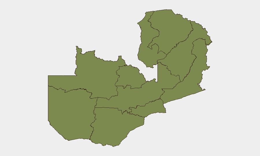
Eastern Province is substantially more exposed than others, with a composite risk score of 31.5—nearly three times that of Lusaka Province (11.5)—likely reflecting border-zone dynamics, cross-border movement, wildlife conflict, or resource-competition factors. All other provinces cluster at 1.5, suggesting that risk in Zambia is highly concentrated rather than dispersed. Security operations and duty-of-care planning should prioritize the Eastern Province, while Lusaka—the capital and administrative hub—merits standard corporate-security baseline protocols. Personnel and asset movements in border-adjacent areas merit enhanced situational awareness.
How GeoBit Would Assist
Corporate teams should deploy AOI Monitoring & Early Warning on Eastern Province and Lusaka to detect escalation patterns; Intel Sweep and OSINT Fusion to clarify the administrative sanctions, Malawi–Zambia tensions, and helicopter-incident drivers; and Election Monitoring tools to track campaign-period security incidents and political stability indicators through the 2026 cycle. Routing & Network Analysis can support alternative-route planning for personnel travel, especially in cross-border and aviation-dependent contexts.
7-Day Outlook
The near-term outlook is stable with caveats. Election-campaign activity will continue; aviation safety and senior-leadership travel merit close watch given the 9 July incident. The administrative and diplomatic activity involving Malawi and UNICEF should be clarified within 48–72 hours through diplomatic channels or media follow-up; if escalation occurs, it would likely manifest in border-area incidents or refugee/humanitarian effects rather than domestic unrest.
Highest-Risk Areas — Ranked
| # | State / Region | Risk |
|---|---|---|
| 1 | Eastern Province | 31.5 |
| 2 | Lusaka Province | 11.5 |
| 3 | North-Western Province | 1.5 |
| 4 | Western Province | 1.5 |
| 5 | Muchinga Province | 1.5 |
| 6 | Luapula Province | 1.5 |
| 7 | Northern Province | 1.5 |
| 8 | Copperbelt Province | 1.5 |
| 9 | Southern Province | 1.5 |
| 10 | Central Province | 1.5 |
Sources
Previous Daily Briefs
A new Zambia brief is written every day — each with its own risk map and downloadable CSV. Here's the last week; use the calendar to go further back.
📅 Browse every day by calendar →
Highlighted days have a brief. Tap a day for that day's map & analysis, or “csv” for that day's dataset ($5).
Atlas — our AI intelligence desk — emails them this snapshot personally. Nothing else, no list.