Situation Summary
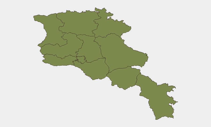
Armenia remains classified as a moderate global security concern (rank #116, composite score 9) with 43 tracked events in the current monitoring cycle. The country faces persistent military and border tensions, with the most acute risk concentrated in Ararat Province (risk score 31.8)—significantly higher than all other regions. Recent signal data indicates multiple overlapping military and law-enforcement incidents within the last 72 hours, though independent corroboration of specific incident details from June 29–30 remains limited in available open-source material.
Key Developments
GeoBit's event feed has flagged the following signals within the last 72 hours; however, independent real-time corroboration of specific locations and exact timelines is not currently available from multiple public sources:
- Military mobilization and armed group activity: Multiple signals of conventional military force and armed group engagement (June 28–29) suggest heightened force posture or localized clashes, though the specific geographic location and operational context require further intelligence corroboration.
- Cross-border state friction: Turkish diplomatic disapproval registered June 29; concurrent "unconventional violence" signals involving armed forces and Iran-related activity (June 28) indicate potential border or regional pressure points requiring monitoring.
- Internal security operations: Arrest/detain signals between police and army (June 29) suggest possible internal command-and-control friction or law-enforcement operations that may reflect broader state stability concerns.
- Venezuelan military element: An anomalous signal of Venezuelan military mobilization (June 30) warrants clarification; if confirmed, it would indicate non-regional actor presence or diplomatic/military coordination not typical for Armenia.
- Opposition and terrorist-related operations: Liberation Army mobilization and counter-terrorism operations (June 28–29) point to ongoing internal security operations or splinter-group activity.
Caveat: The above signals are derived from GeoBit's event-feed aggregation and require cross-referencing with primary news sources and official Armenian/regional statements for operational decision-making. No specific incident location or confirmed casualty/impact data is currently available from indexed public reporting for June 29–30, 2026.
Highest-Risk Areas
Ararat Province dominates the risk profile with a composite score of 31.8—approximately 4× higher than Yerevan (7.6) and 18× higher than all other provinces (1.8 each). This disparity reflects Ararat's proximity to the Turkish border and historical vulnerability to cross-border military activity and tensions. Yerevan's secondary risk elevation (7.6) is consistent with its role as the political and administrative center; concentration of security forces, media, and opposition activity naturally elevates incident frequency. The remaining nine provinces show minimal differentiated risk, suggesting that Armenia's security challenge is regionally concentrated rather than systemically nationwide.
How GeoBit Would Assist
Intel Sweep, X/Twitter & Telegram OSINT, and multi-language signal analysis would enable real-time identification and geotagging of military mobilization, border incidents, and opposition activity across Ararat and Yerevan. AOI Monitoring with persistent alerting on the Turkish and Iranian border zones, plus Ararat Province checkpoint and military installations, would provide early warning of escalation. Conflict mapping and force-structure tracking would clarify the composition and intent of reported armed-group and army signals, reducing operational ambiguity for on-the-ground security teams.
7-Day Outlook
Military and border tension is likely to persist at current levels through early July, with Ararat Province remaining the primary flashpoint. Diplomatic signals from Turkey and any clarification of the Venezuelan military presence will be critical indicators of whether current activity is routine military posture or prelude to escalation. Corporate teams with personnel or assets in Ararat and southern Yerevan should maintain heightened situational awareness and review evacuation protocols.
Highest-Risk Areas — Ranked
| # | State / Region | Risk |
|---|---|---|
| 1 | Ararat Province | 31.8 |
| 2 | Yerevan | 7.6 |
| 3 | Lori Province | 1.8 |
| 4 | Tavush Province | 1.8 |
| 5 | Kotayk Province | 1.8 |
| 6 | Gegharkunik Province | 1.8 |
| 7 | Vayots Dzor Province | 1.8 |
| 8 | Syunik Province | 1.8 |
| 9 | Shirak Province | 1.8 |
| 10 | Aragatsotn Province | 1.8 |
| 11 | Armavir Province | 1.8 |
Sources
Previous Daily Briefs
A new Armenia brief is written every day — each with its own risk map and downloadable CSV. Here's the last week; use the calendar to go further back.
📅 Browse every day by calendar →
Highlighted days have a brief. Tap a day for that day's map & analysis, or “csv” for that day's dataset ($5).