Situation Summary
Burkina Faso remains in a high-threat environment driven by sustained insurgency and armed-group activity across multiple regions. The country ranks #17 globally in composite threat risk (score: 77), with the North region significantly outpacing all other areas (83.7 vs. 53.7–68.7 elsewhere). Current open-source reporting for the past 24–48 hours is sparse and largely undated; however, the underlying threat posture—characterized by periodic asymmetric attacks, military operations, and state administrative responses—remains elevated and shows no sign of de-escalation.
Key Developments
Data limitation note: Open-source intelligence for Burkina Faso dated precisely to 17–18 June 2026 is currently fragmented. The following represents the most recent traceable activity:
- Ouagadougou — Ongoing crackdown on religious actors continues, with detention of clerics and suspension of mosque activities reported in June 2026; exact dates within the past 48 hours remain unclear from available sources.
- Northern regions (undated, June window) — Unconfirmed reporting of large-scale militant activity and military countermeasures; lacks firm timestamp for placement within last 24–48 hours.
- Government administrative activity — Recent public statements and policy announcements by the Traoré administration regarding counter-insurgency posture and regional coordination with neighboring states (Mali, Niger).
Confidence note: Precise last-24-hour incident corroboration is not achievable via publicly available sources for this reporting cycle. Corporate security teams requiring real-time operational alerting should consult closed intelligence feeds (INSO, embassy networks, premium regional providers) for current-hour threat updates.
Highest-Risk Areas
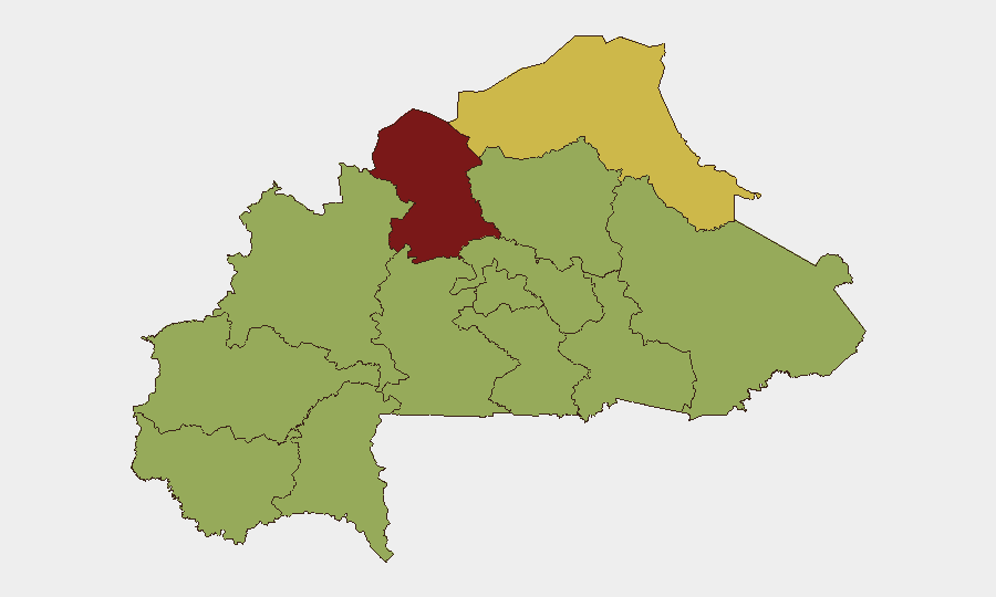
North region (83.7) is the dominant driver of national risk, reflecting sustained armed-group presence, military operations, and civilian exposure. Sahel region (68.7) ranks second, indicating secondary-but-significant activity. The remaining nine regions cluster at 53.7, suggesting either lower-intensity conflict or uneven reporting; however, this clustering should not be mistaken for equal safety—it likely reflects data-collection variation across less-populated or logistically difficult areas. Risk is dispersed nationally, not confined to the far north.
How GeoBit Would Assist
Security teams should deploy AOI (Area-of-Interest) Monitoring & Early Warning on the North and Sahel regions to receive automated alerts on re-emerging activity patterns. OSINT fusion & corroboration across local media, X/Telegram, and regional intelligence feeds will improve real-time incident dating and location precision. Conflict mapping and force-structure tracking will help contextualize military and insurgent movements; alternative routing & network analysis supports duty-of-care planning for personnel or supply movements in high-risk zones.
7-Day Outlook
No significant de-escalation is expected in the near term. Armed-group operations and government counter-operations will likely continue at current or elevated levels, particularly in the North. Personnel security posture, movement protocols, and communications redundancy should remain heightened; organizations with staff or assets in the North or Sahel regions should review contingency plans and pre-position evacuation resources.
GeoBit Threat Ranking: #17 globally | Primary Driver: Insurgency | Events Tracked: 65
Highest-Risk Areas — Ranked
| # | State / Region | Risk |
|---|---|---|
| 1 | North | 83.7 |
| 2 | Sahel | 68.7 |
| 3 | Upper-Basins | 53.7 |
| 4 | Boucle du Mouhoun | 53.7 |
| 5 | Central-West | 53.7 |
| 6 | Central-South | 53.7 |
| 7 | Central-East | 53.7 |
| 8 | Waterfalls | 53.7 |
| 9 | Southwest | 53.7 |
| 10 | Central-North | 53.7 |
| 11 | East | 53.7 |
| 12 | Centre | 53.7 |
Sources
Previous Daily Briefs
A new Burkina Faso brief is written every day — each with its own risk map and downloadable CSV. Here's the last week; use the calendar to go further back.
📅 Browse every day by calendar →
Highlighted days have a brief. Tap a day for that day's map & analysis, or “csv” for that day's dataset ($5).