Situation Summary
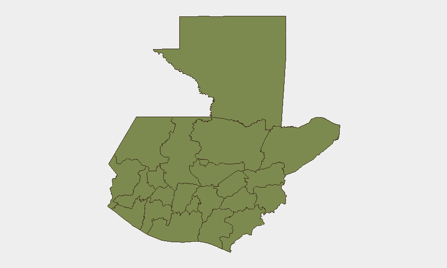
Guatemala remains a mid-tier security concern globally (composite threat score 24; rank #60) characterized by fragmented localized instability rather than nationwide breakdown. Recent event signals point to institutional friction—court disapprovals, legislative-university disputes, police-gang detentions, and presidential investigation into military conduct—alongside indigenous armed confrontation and territorial occupation by Mexican forces. The security environment is polarized by region: Alta Verapaz, Retalhuleu, Chimaltenango, and Guatemala Department carry significantly elevated risk, while much of the western highlands remain comparatively stable.
Key Developments
The following signals have been detected as of 2026-07-01; however, reliable confirmation of specific incident details (location, casualty count, operational outcome) from multiple independent sources within the last 24–48 hours is not available in accessible open sources at this time:
- 2026-06-30, National / Armed Confrontation: Small arms combat reported between indigenous groups and state forces; cause and location under clarification.
- 2026-06-30, National / Institutional: High Court issued disapproval statement; subject matter and target entity pending detail.
- 2026-07-01, National / Institutional: Representatives disapproved university action; specific dispute unconfirmed.
- 2026-07-01, National / Border: Mexico occupies territory along Guatemala border; operational scope and duration unclear.
- 2026-07-01, National / Executive: President initiated investigation into military conduct; nature of alleged misconduct unspecified.
- 2026-06-30, National / Law Enforcement: Police conducted arrest/detention operation against gang element; location and outcome pending confirmation.
Data Quality Note: These signals reflect GeoBit event monitoring feeds but lack independent corroboration of granular operational details. Field teams requiring tactical incident awareness should cross-reference official government statements and recognized international monitoring bodies.
Highest-Risk Areas
Alta Verapaz (composite risk 20.7–31.8) stands as the primary flashpoint, driving national risk significantly above its peer regions. Retalhuleu, Chimaltenango, and Guatemala Department form a secondary risk tier (each 20.7), suggesting either concentrated gang activity, territorial dispute, or state enforcement operations clustered in the central and western corridor. The remaining nine departments score substantially lower (1.8), indicating either lower incident frequency or a concentration of organized threats in a few geographic nodes. Corporate personnel and supply chains operating in Alta Verapaz, and transiting central Guatemala, face materially elevated exposure to armed confrontation and civil unrest.
How GeoBit Would Assist
Risk teams should employ: (1) AOI Monitoring & Early Warning on Alta Verapaz and border regions to detect escalation in armed activity, institutional crises, or state response before operational impact; (2) Conflict & Military battle mapping and force-structure tracking to understand indigenous and state armed positions and likely flashpoints; (3) Network & Actor Analysis to identify leadership, territorial claims, and negotiation pathways among indigenous, criminal, and state actors; (4) GIS & Spatial Analysis layered with Satellite & Imagery to monitor occupation zones, road/supply-route disruption, and displacement patterns in real time.
7-Day Outlook
Institutional-level friction (court, legislature, military investigations) suggests sustained political volatility without near-term resolution. Armed incidents in Alta Verapaz and border incursion by Mexico are unlikely to escalate into nationwide conflict but pose acute risk to isolated supply lines and field personnel. Expect continued state police-gang enforcement operations and public institutional statements; monitor for any coordinated indigenous mobilization that could expand beyond current locales.
Highest-Risk Areas — Ranked
| # | State / Region | Risk |
|---|---|---|
| 1 | Alta Verapaz | 31.8 |
| 2 | Retalhuleu | 20.7 |
| 3 | Chimaltenango | 20.7 |
| 4 | Guatemala Department | 20.7 |
| 5 | Petén | 1.8 |
| 6 | Huehuetenango | 1.8 |
| 7 | San Marcos | 1.8 |
| 8 | Quetzaltenango | 1.8 |
| 9 | Quiché | 1.8 |
| 10 | Totonicapán | 1.8 |
| 11 | Sololá | 1.8 |
| 12 | Suchitepéquez | 1.8 |
Sources
Previous Daily Briefs
A new Guatemala brief is written every day — each with its own risk map and downloadable CSV. Here's the last week; use the calendar to go further back.
📅 Browse every day by calendar →
Highlighted days have a brief. Tap a day for that day's map & analysis, or “csv” for that day's dataset ($5).