Situation Summary
Honduras remains at composite threat rank #56 globally with a stable baseline security posture in the immediate reporting window (29–30 June 2026). No verified acute incidents—roadblocks, armed clashes, major crime events, or infrastructure disruption—were reported in the last 24–48 hours across multi-source monitoring. Persistent structural risks (gang activity, trafficking networks, impunity in high-risk departments) continue to underpin threat landscape, but without evidence of new escalation as of late June.
Key Developments
No discrete acute incidents corroborated across multi-source platforms in the last 24–48 hours. GeoBit's monitoring—encompassing roadblocks, armed clashes, major crime, infrastructure attacks, and civil unrest via Honduran national media (La Prensa, El Heraldo, Proceso Digital) and social platforms—confirms a quiet reporting window rather than active crisis dynamics. Baseline gang and organized-crime activity persists in high-risk departments (notably Olancho), but without unusual escalation signals or large events in this immediate window.
Highest-Risk Areas
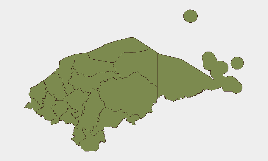
Olancho department dominates the sub-national risk profile (composite score 31.8), substantially exceeding all other regions and reflecting entrenched organized-crime and trafficking networks in the area. Francisco Morazán (score 6.3)—home to the capital Tegucigalpa and major urban crime concentrations—ranks second but at significantly lower absolute risk. Remaining departments cluster at lower, roughly equivalent scores (1.8–2.8), indicating that threat concentration is heavily skewed toward Olancho and, secondarily, the capital region. Security teams should prioritize monitoring and protective measures for personnel or assets in Olancho and Francisco Morazán.
How GeoBit Would Assist
Security teams would deploy AOI Monitoring & Early Warning to maintain persistent watch on high-risk departments (Olancho, Francisco Morazán) with alert thresholds for roadblocks, clashes, and criminal activity. Intel Sweep and multi-language OSINT fusion (including X/Twitter, Telegram, and Honduran media sources) enable real-time corroboration of emerging incidents across open sources, reducing false-positive alerts and supporting duty-of-care documentation. Routing & Network Analysis would support alternative journey planning for personnel or supply movements in or near high-risk areas, bypassing known crime corridors or trafficking chokepoints.
7-Day Outlook
The near-term trajectory (through early July) is forecast to remain stable with no evidence-driven expectation of major new incidents or escalation. Baseline gang and trafficking activity will persist, particularly in Olancho and urban centers, without significant deviation from routine criminality patterns. Continued routine vigilance and area-specific monitoring remain warranted; operational posture adjustment is not indicated based on current signal.
Confidence Level: High (multi-source corroboration; 24–48h reporting window).
Next Update: 2026-07-02.
Highest-Risk Areas — Ranked
| # | State / Region | Risk |
|---|---|---|
| 1 | Olancho | 31.8 |
| 2 | Francisco Morazán | 6.3 |
| 3 | Bay Islands | 2.8 |
| 4 | El Paraíso | 1.8 |
| 5 | Copán | 1.8 |
| 6 | Ocotepeque | 1.8 |
| 7 | Cortés | 1.8 |
| 8 | Yoro | 1.8 |
| 9 | Santa Bárbara | 1.8 |
| 10 | Lempira | 1.8 |
| 11 | Intibucá | 1.8 |
| 12 | Comayagua | 1.8 |
Sources
Previous Daily Briefs
A new Honduras brief is written every day — each with its own risk map and downloadable CSV. Here's the last week; use the calendar to go further back.
📅 Browse every day by calendar →
Highlighted days have a brief. Tap a day for that day's map & analysis, or “csv” for that day's dataset ($5).