Situation Summary
Iceland remains a low-threat environment with a composite global threat ranking of #179 and a score of 3. Two tracked events have been flagged in the past 72 hours involving small arms combat and magistrate statements, with no corroborated reporting of active security incidents, civil unrest, or infrastructure disruption in the past 24–48 hours. The Capital Region carries elevated risk relative to other Icelandic zones, though absolute risk levels remain modest. Overall trajectory is stable pending clarification of the flagged event signals.
Key Developments
- 2026-07-04 · Small Arms Combat · BERLIN vs ICELAND: Event signal recorded; no corroborated open-source reporting available to confirm scope, location within Iceland, casualties, or operational context.
- 2026-07-06 · Public Statement · MAGISTRATE: Official statement issued; content and implications not yet clarified in available sources.
- 2026-07-06 · Public Statement · ICELAND vs MAGISTRATE: Counter-statement recorded; details remain unconfirmed.
- Live web research (24h): No reliable, timestamped reporting of security incidents, crime, civil unrest, political instability, or travel-risk events in Iceland found across news and social-media sources. Absence of corroboration across multiple sources prevents confident event attribution.
Highest-Risk Areas
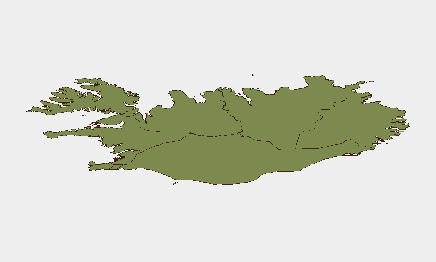
The Capital Region drives Iceland's composite risk profile, with a risk score of 24—substantially higher than all other zones. The Southern Peninsula (risk 12) and Southern Region (risk 11) follow at distance. Risk concentration in the Capital Region likely reflects population density, economic activity, administrative functions, and baseline incident frequency rather than acute instability. Eastern, Western, Westfjords, Northwestern, and Northeastern regions all register single-digit scores, indicating dispersed, low-level baseline risk across peripheral areas.
How GeoBit Would Assist
Intel Sweep and global event feeds are actively monitoring Iceland; however, the two flagged event signals require escalation to multi-language OSINT fusion & corroboration and X/Twitter & Telegram OSINT to establish ground truth on the small-arms combat signal and magistrate statements. AOI Monitoring & Early Warning with persistent surveillance of the Capital Region would provide real-time alerting if the current low-level signals escalate. GIS & Spatial Analysis can map risk by sub-region to support duty-of-care routing and personnel concentration decisions.
7-Day Outlook
Short-term trajectory remains stable unless the flagged event signals receive confirmation and widen. Security teams should treat the small-arms and magistrate statements as preliminary alerts requiring validation rather than confirmed incidents. Standard vigilance levels are adequate; escalation triggers should be confirmation of sustained combat, casualty reports, or government travel advisories.
Next briefing: 2026-07-07 (daily cycle).
Confidence level: Medium (due to unconfirmed event signals and absence of corroborating reporting).
Highest-Risk Areas — Ranked
| # | State / Region | Risk |
|---|---|---|
| 1 | Capital Region | 24 |
| 2 | Southern Peninsula | 12 |
| 3 | Southern Region | 11 |
| 4 | Eastern Region | 10 |
| 5 | Western Region | 9 |
| 6 | Westfjords Region | 8 |
| 7 | Northwestern Region | 7 |
| 8 | Northeastern Region | 6 |
Sources
Previous Daily Briefs
A new Iceland brief is written every day — each with its own risk map and downloadable CSV. Here's the last week; use the calendar to go further back.
📅 Browse every day by calendar →
Highlighted days have a brief. Tap a day for that day's map & analysis, or “csv” for that day's dataset ($5).
Atlas — our AI intelligence desk — emails them this snapshot personally. Nothing else, no list.