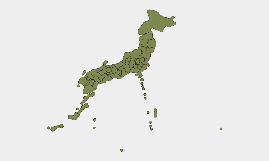
Situation Summary
Japan remains a low-threat environment globally (rank #166) with a composite threat score of 4, though sub-national variation is material. A magnitude 5.5 earthquake struck the Kantō region on 18 June, disrupting rail infrastructure around Tokyo and triggering safety inspections that continue to affect domestic travel. Recent event signals include investigations into hospital and corporate matters, international disapproval statements, and territorial occupation claims involving Brazil—none currently corroborated as active security incidents. The overall security posture remains stable, with near-term risk driven by earthquake response and infrastructure recovery rather than civil unrest or political instability.
Key Developments
- Kantō Region (Tokyo, Gunma) – 18 June 2026: Magnitude 5.5 earthquake struck the region, injuring at least two people in Gunma Prefecture and triggering immediate suspension of Shinkansen (bullet train) and local rail services pending safety inspections.
- Tokyo & Kantō Rail Corridors – 18 June 2026 (ongoing): JR and Shinkansen operators maintaining temporary halts on key routes in and out of Tokyo for structural and safety assessment; widespread delays and station crowding expected to persist 12–24 hours.
- Hospital Investigation – 16 June 2026: Event signal recorded; open-source corroboration and specific details not yet identified in live web research.
- Japan–United States Disapproval Statement – 18 June 2026: Diplomatic signal logged; context and scope remain unconfirmed in current reporting.
- Brazil vs. Japan Territorial Occupation Claim – 17 June 2026: Event signal recorded; no independent corroboration in open sources; assess as low credibility without further intelligence.
- Corporate Investigation – 17 June 2026: Event signal noted; specifics and geographic scope not yet established.
Highest-Risk Areas
Nagano Prefecture (score 33) and Tokyo (19.3) are the primary drivers of sub-national risk concentration, together accounting for the bulk of tracked threat events. Nagano's elevated score likely reflects seismic activity and geological hazard rather than civil or political instability; the 18 June earthquake and aftershock potential reinforce this pattern. Tokyo's risk reflects its role as the national capital and a hub for diplomatic, corporate, and infrastructure exposure; the current rail disruption amplifies short-term vulnerability for travelers and supply-chain operations. Aichi Prefecture (12.8) follows, primarily as a manufacturing and transport nexus. Okinawa (6.5) carries distinct geopolitical exposure due to U.S. military presence and maritime claims. All other prefectures score below 4 and pose minimal incremental risk to corporate operations.
How GeoBit Would Assist
Security teams operating in or transiting Japan should deploy AOI Monitoring & Early Warning on Tokyo, Kantō, and Nagano to track earthquake aftershocks, rail-service updates, and crowd-movement signals in real time. Routing & Network Analysis capabilities enable rapid rerouting of personnel and shipments around the affected rail corridors and identification of alternative transport or logistics pathways. OSINT fusion across Japanese and international sources, combined with multi-language sentiment & temporal analysis, provides continuous visibility into evolving diplomatic incidents (e.g., Brazil claim, U.S. statements) and corporate/hospital investigations before they escalate.
7-Day Outlook
Rail services are expected to resume incrementally over the next 24–48 hours as safety inspections conclude; residual delays and capacity constraints should ease by 20–21 June. No secondary earthquakes or civil unrest are currently signaled. Diplomatic and investigation developments remain opaque; continued low-level monitoring is prudent, but no escalation to security incidents is anticipated in the near term.
Highest-Risk Areas — Ranked
| # | State / Region | Risk |
|---|---|---|
| 1 | Nagano Prefecture | 33 |
| 2 | Tokyo | 19.3 |
| 3 | Aichi Prefecture | 12.8 |
| 4 | Okinawa Prefecture | 6.5 |
| 5 | Kagoshima Prefecture | 4 |
| 6 | Wakayama Prefecture | 4 |
| 7 | Gunma Prefecture | 4 |
| 8 | Miyazaki Prefecture | 3.3 |
| 9 | Hokkaido Prefecture | 3.3 |
| 10 | Kyoto Prefecture | 3.3 |
| 11 | Osaka Prefecture | 3.3 |
| 12 | Kanagawa Prefecture | 3.3 |
Sources
Previous Daily Briefs
A new Japan brief is written every day — each with its own risk map and downloadable CSV. Here's the last week; use the calendar to go further back.
📅 Browse every day by calendar →
Highlighted days have a brief. Tap a day for that day's map & analysis, or “csv” for that day's dataset ($5).