Situation Summary
Kuwait faces a sharp escalation in regional military tensions following reported Iranian missile and drone strikes on July 11–13, 2026, targeting U.S. military facilities and associated infrastructure across the Gulf. Three northern border posts and at least one offshore oil platform sustained confirmed material damage and casualties on July 12. The convergence of military incidents, border attacks, and energy-sector strikes has elevated Kuwait's composite threat score and created immediate risks to personnel, critical infrastructure, and supply chains across multiple governorates.
Key Developments
- Northern border posts (July 12): Kuwait's army confirmed attacks on three border locations in northern Kuwait, resulting in material damage. Multiple regional outlets corroborated the incident on the same day.
- Offshore oil platform (July 12): One worker was injured in an attack on a Kuwaiti offshore oil platform; U.S. sources separately reported damage linked to the incident, signaling targeting of energy infrastructure.
- U.S. military installations (July 12): Iranian state-linked media claimed missile strikes targeted U.S. Air Force facilities and joint military installations in Kuwait as part of a wider Gulf retaliation campaign.
- Regional escalation context (July 11–13): GeoBit event signals document multiple instances of conventional military force exchanges between Iran and Kuwait, as well as military force rejections and disapproval statements on July 13, indicating an active, multi-day military cycle.
- Maritime and infrastructure vulnerability (July 12–13): The scale of reported Iranian operations across the Gulf has raised travel, port operations, and civilian infrastructure risk throughout Kuwait's maritime zones and energy sector.
- Detention activity (July 12): Kuwait City detention/arrest activity was recorded, potentially related to security precautions or investigation into cross-border activity.
Highest-Risk Areas
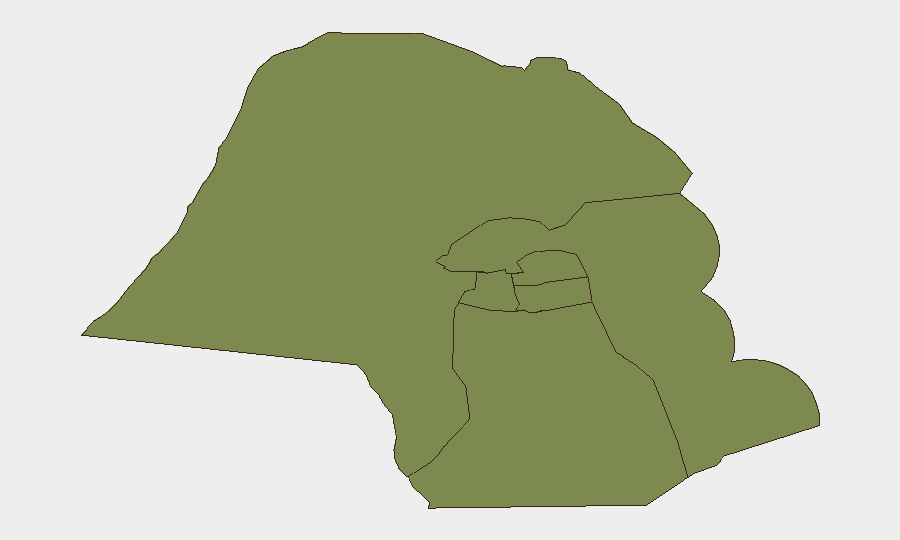
Jahra Governorate (northern region, risk 4.5 × baseline) is the primary flashpoint, directly exposed to cross-border military activity and the reported July 12 border post attacks. Farwaniya Governorate carries moderate elevated risk (4.0), likely reflecting proximity to military installations and energy infrastructure. Ahmadi, Hawalli, Mubarak al-Kabir, and Capital Governorates remain at baseline to low-moderate risk but are not isolated; offshore platforms and port facilities serving these zones remain within the reported targeting footprint. Personnel in or transiting Jahra and near oil and gas installations should apply heightened situational awareness.
How GeoBit Would Assist
Security teams should activate Area-of-Interest (AOI) Monitoring & Early Warning on Jahra Governorate, northern border crossings, and major energy installations to detect further military activity, drone signatures, or cross-border incursions in real time. Conflict & Military tracking (force structure, weapons-capability, and battle mapping) will enable continuous assessment of Iranian and Kuwaiti military posture and payload capabilities. Maritime & Aviation tracking combined with Satellite & Imagery analysis will provide independent damage assessment and infrastructure-status confirmation to support duty-of-care and business continuity decisions.
7-Day Outlook
Immediate risk remains elevated through mid-July as regional military posture remains tense and retaliation cycles are incomplete. A 24–72 hour window of heightened alert is prudent; further border incidents or energy-sector strikes are plausible if escalation continues. Normalcy in border and offshore operations will be the primary leading indicator of de-escalation; absence of such signals warrants maintaining heightened travel and facility security protocols.
Highest-Risk Areas — Ranked
| # | State / Region | Risk |
|---|---|---|
| 1 | Jahra Governorate | 31.5 |
| 2 | Farwaniya Governorate | 4 |
| 3 | Ahmadi Governorate | 1.5 |
| 4 | Hawalli Governorate | 1.5 |
| 5 | Mubarak al-Kabir Governorate | 1.5 |
| 6 | Capital Governorate | 1.5 |
Sources
Previous Daily Briefs
A new Kuwait brief is written every day — each with its own risk map and downloadable CSV. Here's the last week; use the calendar to go further back.
📅 Browse every day by calendar →
Highlighted days have a brief. Tap a day for that day's map & analysis, or “csv” for that day's dataset ($5).
Atlas — our AI intelligence desk — emails them this snapshot personally. Nothing else, no list.