Situation Summary
Maldives remains a low-threat environment globally (composite score 4; rank #173), with no confirmed security incidents in the current reporting window. The threat profile is concentrated in urban areas, particularly Malé, driven by baseline risks of petty crime, civil unrest potential, and counterterrorism concerns rather than active conflict or instability. The overall trajectory remains stable with no indicators of imminent escalation.
Key Developments
No discrete security, conflict, civil-unrest, crime, or infrastructure events were verified in Maldives during the last 24–48 hours. Baseline threat advisories from regional governments (Australia, Germany) describe standing risks including petty theft, terrorism, and occasional civil protest, but these represent persistent conditions rather than new incidents. The Maldives Police Service and local media monitoring revealed no breaking developments in the current window. Confirmation of any emerging incidents would require real-time OSINT feeds (X/Twitter, Telegram, local news aggregators) and manual corroboration with Reuters/AFP and in-country sources.
Highest-Risk Areas
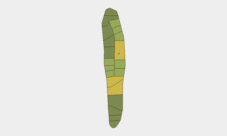
Urban Malé (risk 85) and Malé Atoll (risk 68) dominate the sub-national risk profile, reflecting population density, tourist concentration, and historical civil-unrest clustering. Hadhdhunmathi (65) and Kolhumadulu (60) follow, suggesting secondary concern in populated northern and central atolls. Risk in these areas stems from petty crime against tourists, periodic political protest, and counterterrorism monitoring rather than armed conflict. Southern and outer atolls register materially lower scores, indicating that dispersed, tourism-dependent islands present reduced security friction.
How GeoBit Would Assist
Teams with personnel or assets in Maldives should deploy AOI Monitoring & Early Warning on Malé and secondary urban centers to detect civil unrest, protest activity, or crime-pattern shifts in real time. Multi-language OSINT (X/Twitter, Telegram, local media feeds) and sentiment analysis enable rapid detection of emerging political or social tensions before they translate into incident. GIS & Spatial Analysis and entity/network mapping support identification of protest organizers, crime hotspots, and at-risk business districts, improving duty-of-care routing and protective positioning. Risk & Threat Assessment tied to election cycles or political announcements will flag windows of elevated unrest probability.
7-Day Outlook
No acute triggers are visible in the current environment. Routine monitoring of Malé political discourse, police incident reporting, and tourist-area security advisories will remain the primary sentinel for change. Any upward movement in civil unrest, protest intensity, or security-force activity should prompt rapid escalation to OSINT collection and stakeholder notification.
Highest-Risk Areas — Ranked
| # | State / Region | Risk |
|---|---|---|
| 1 | Malé | 85 |
| 2 | Malé Atoll | 68 |
| 3 | Hadhdhunmathi | 65 |
| 4 | Kolhumadulu | 60 |
| 5 | Felidhu Atoll | 58 |
| 6 | Mulaku Atoll | 55 |
| 7 | Faadhippolhu | 52 |
| 8 | South Miladhunmadulu | 48 |
| 9 | North Miladhunmadulu | 45 |
| 10 | South Nilandhe Atoll | 44 |
| 11 | North Nilandhe Atoll | 42 |
| 12 | South Ari Atoll | 40 |
Sources
Previous Daily Briefs
A new Maldives brief is written every day — each with its own risk map and downloadable CSV. Here's the last week; use the calendar to go further back.
📅 Browse every day by calendar →
Highlighted days have a brief. Tap a day for that day's map & analysis, or “csv” for that day's dataset ($5).
Atlas — our AI intelligence desk — emails them this snapshot personally. Nothing else, no list.