Situation Summary
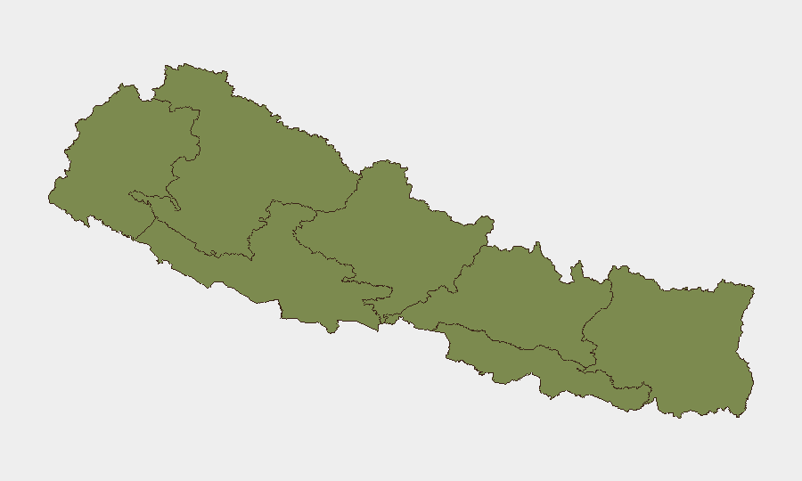
Nepal remains a low-to-moderate security environment (composite threat score 16) with no imminent large-scale conflict or mass-casualty incidents reported. The security picture is dominated by monsoon-season hazards (flooding, road accidents), routine law-enforcement operations (fugitive arrests, traffic enforcement, narcotics seizures), and localized administrative tensions. Central Bagamati Province (risk 31.3) is substantially more volatile than other regions; all other provinces register single-digit risk scores, indicating dispersed rather than concentrated instability.
Key Developments
- Kathmandu Valley security sweep (25 July, Sawan 8 / ~07-24–25): Police detained 115 people in 24 hours for suspicious activities (108 in Kathmandu, 7 in Lalitpur) and arrested 28 court-wanted fugitives, signaling heightened security screening in the capital region and potential delays at checkpoints.
- Kathmandu Valley traffic enforcement surge (same 24-hour window): Traffic police acted against 1,083 drivers for violations including speeding, red-light running, and drunk driving (49 cases), with 234 drivers required to attend compulsory awareness classes—indicating frequent roadside stops.
- National road fatalities (latest 24-hour cycle): At least 7 people killed and 105 injured across Nepal in road accidents; no specific locations given, but risk is elevated on highways and rural roads during monsoon conditions.
- Dhankuta, Koshi Province narcotics seizure (recent days, monsoon period): Police seized 775 kg of marijuana on the Koshi Highway at Sangurigadhi Rural Municipality, Dhankuta, arresting the driver; reflects heightened cargo screening on eastern corridors.
- Rautahat District, Madhesh Province enforcement drive (current 24–48h cycle): Police arrested 21 convicted fugitives in Gaur in a single day and have deployed drone surveillance over Gaur and surrounding areas, indicating localized security tightening that may restrict movement and privacy.
- Dolpa, Karnali Province flood response (ongoing): One person dead, six injured; 176 security personnel, divers, drones, and a military helicopter deployed in monsoon-swollen rivers for ongoing rescue operations, indicating infrastructure disruption and travel hazards.
- Bajura, Sudurpashchim Province bridge reopening (very recent): Bailey bridge over the Dansanghu River in Budhinanda Municipality brought into operation, temporarily restoring road connectivity disrupted by flood and landslide risk.
Highest-Risk Areas
Bagamati Province (which includes Kathmandu Valley and surrounding districts) accounts for the overwhelming majority of tracked risk (score 31.3 versus 4.1 for the second-ranked Lumbini), driven by political volatility, administrative disputes, and the density of law-enforcement operations. Lumbini Province (4.1) and Koshi Province (3.0)—which includes Dhankuta and areas along major eastern highways—show secondary risk elevation, likely linked to narcotics trafficking, road accidents, and cross-border vulnerabilities. The remaining four provinces all score below 2.5, indicating localized rather than systemic instability.
How GeoBit Would Assist
Security teams monitoring Nepal should use AOI Monitoring & Early Warning to track Bagamati Province and key highway corridors (Koshi, Lumbini) for police operations, protest signals, and accident clusters; Routing & Network Analysis to identify monsoon-affected roads and recommend bypasses around flood zones and intensive checkpoints; and Intel Sweep and OSINT Fusion to correlate official police announcements, local Telegram/X traffic, and regional news to anticipate security sweeps and travel delays in real time.
7-Day Outlook
Monsoon-season hazards (flooding, landslides, road accidents) will likely persist and drive operational disruptions, particularly in Karnali, Sudurpashchim, and eastern highway zones. Law-enforcement tempo is elevated but routine; no imminent escalation in political or armed conflict is evident. Travel and logistics planning should assume frequent checkpoints in Kathmandu Valley and eastern corridors, and continued infrastructure vulnerabilities in mountainous and flood-prone districts through early August.
Highest-Risk Areas — Ranked
| # | State / Region | Risk |
|---|---|---|
| 1 | Bagamati Province | 31.3 |
| 2 | Lumbini Province | 4.1 |
| 3 | Koshi Province | 3 |
| 4 | Karnali Province | 2.4 |
| 5 | Sudurpashchim Province | 1.9 |
| 6 | Gandaki Province | 1.3 |
| 7 | Madhesh Province | 1.3 |
Sources
Previous Daily Briefs
A new Nepal brief is written every day — each with its own risk map and downloadable CSV. Here's the last week; use the calendar to go further back.
📅 Browse every day by calendar →
Highlighted days have a brief. Tap a day for that day's map & analysis, or “csv” for that day's dataset ($5).
Atlas — our AI intelligence desk — emails them this snapshot personally. Nothing else, no list.