Situation Summary
Taiwan faces elevated near-term security pressure amid intensifying cross-strait military posturing and accelerated civil-defence mobilization. A large-scale resilience exercise in Nantou County this week tested government response to compound crises—blockade, sabotage, civil unrest, and invasion—while maritime confrontation has sharpened following Chinese Coast Guard patrols off Taiwan's east coast. President Lai's repeated emphasis on asymmetric drone capability as a "race against time" signals official perception of narrowing strategic windows; overall threat ranking remains moderate (global rank #111, composite score 10), but sub-national risk concentration in Nantou and Taipei warrants targeted asset and personnel monitoring.
Key Developments
- Nantou County, 3 July 2026 – Taiwan conducted a closed-door resilience exercise for 370+ central and local officials simulating maritime blockade, major earthquake, broadcast hijacking, infrastructure sabotage, bank runs, civil unrest, and invasion; field drills included drone interception near a power plant and food-ration logistics, marking the first major test of compound-crisis response across local and central agencies.
- Taichung City, 3 July 2026 – Raymond Greene, head of the American Institute in Taiwan, urged rapid militarization of drone capacity (surveillance, coastal attack, unmanned surface vessels) as a "hornet's nest" deterrent; government drone procurement programme targets approximately T$210 billion through 2031, supported by President Lai's 2 July statement framing asymmetric capability expansion as urgent, time-constrained national defence.
- Taiwan east-coast waters, early July 2026 – Coast Guard Administration issued directive instructing Taiwanese and foreign-flagged vessels to refuse Chinese Coast Guard boarding or inspection attempts, immediately notify Taiwan authorities, and rely on Taiwan Coast Guard interposition; order follows Chinese "special maritime traffic law enforcement" patrols in the zone and heightens maritime confrontation risk for commercial shipping.
- Taipei, 2 July 2026 – President Lai reiterated accelerated asymmetric defence build-up at Democratic Progressive Party meeting, emphasizing urgent expansion of drones and asymmetric combat capabilities in response to evolving geopolitics and modern warfare doctrine.
- Nationwide, early July 2026 – Authorities are broadening civilian–military "resilience" exercises beyond traditional drills to include cyber-sabotage, media hijacking, financial panic, and civil unrest scenarios under conditions of Chinese pressure, with Nantou cited as the first large-scale implementation test.
Highest-Risk Areas
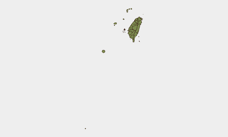
Nantou County (composite risk 31.8) and Taipei (23.4) account for the majority of tracked threat signals and represent the geographic focus of Taiwan's current resilience planning and political-military decision-making. Nantou's elevation reflects its role as the testbed for compound-crisis response; Taipei remains the seat of government and primary target for political/military messaging. Maritime risk is concentrated off Taiwan's east coast (affecting Taitung, Penghu, and adjacent waters), where Chinese Coast Guard presence and new boarding-refusal protocols have raised confrontation probability. Kinmen and other outlying islands remain lower-risk in current tracking, though their proximity to mainland maritime enforcement zones warrants separate monitoring.
How GeoBit Would Assist
Security teams should deploy AOI Monitoring & Early Warning on Nantou, Taipei, and east-coast waters to detect follow-on exercises, vessel incidents, or official directive changes in real time. Maritime & Aviation Tracking combined with Network & Actor Analysis (monitoring Chinese and Taiwanese Coast Guard communications and vessel patterns) will provide tactical warning of boarding attempts or escalatory maneuvers. Conflict & Military mapping and force-structure tracking enable continuous assessment of asymmetric drone-capability deployment timelines and doctrinal shifts signalled by official statements.
7-Day Outlook
Taiwan's near-term trajectory reflects deliberate escalation of defence posture and civil preparedness rather than imminent kinetic conflict. Maritime confrontations are likely to persist and may spike around routine Chinese patrols; commercial operators should expect operational friction. Expect continued official emphasis on asymmetric capability as a strategic messaging tool and possible follow-on resilience exercises in other regions.
Highest-Risk Areas — Ranked
| # | State / Region | Risk |
|---|---|---|
| 1 | Nantou County | 31.8 |
| 2 | Taipei | 23.4 |
| 3 | Penghu | 18.4 |
| 4 | Kinmen | 2.6 |
| 5 | Taoyuan City | 2.6 |
| 6 | Kaohsiung | 1.8 |
| 7 | Pingtung County | 1.8 |
| 8 | Taitung County | 1.8 |
| 9 | Lienchiang County | 1.8 |
| 10 | Changhua County | 1.8 |
| 11 | Miaoli County | 1.8 |
| 12 | Taichung | 1.8 |
Previous Daily Briefs
A new Taiwan brief is written every day — each with its own risk map and downloadable CSV. Here's the last week; use the calendar to go further back.
📅 Browse every day by calendar →
Highlighted days have a brief. Tap a day for that day's map & analysis, or “csv” for that day's dataset ($5).