Situation Summary
Uruguay remains a low-threat environment (composite score 5, rank 174 globally) with no verified acute security incidents, civil unrest, infrastructure disruption, or terrorism-related activity in the past 24–48 hours. Security risk is driven by structural organized-crime presence and routine law-enforcement operations rather than recent escalation. The country's security trajectory is stable, with no indicators of near-term destabilization.
Key Developments
No discrete acute security events corroborated in the past 24–48 hours. Open-source monitoring, mainstream media, and current security briefs report no verified incidents (terrorism, civil unrest, major crime spikes, infrastructure disruption) meeting operational alert criteria in the requested time window. Risk assessment reflects routine law-enforcement activity and ongoing organized-crime presence as structural issues, not new incidents. Any armed confrontations, police operations, or deployments referenced in local media lack clear timestamping within the last 48 hours or cannot be independently corroborated as current developments.
Highest-Risk Areas
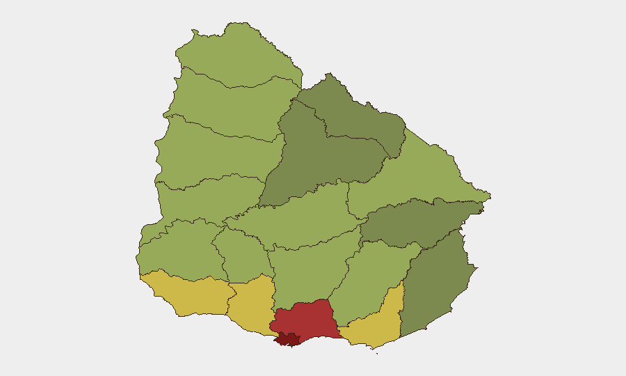
Montevideo (risk 92) and Canelones (risk 78) dominate the sub-national risk profile, reflecting high concentration of organized-crime activity, street-level gang violence, and narcotics distribution in and around the capital. Maldonado (risk 68) and San José (risk 64) follow, with elevated risk tied to trafficking corridors and secondary urban crime centers. Risk in these departments is structural—driven by gang presence, poverty, and police-resource constraints—rather than acute incident spikes in the current reporting window. Remaining departments show moderate to lower risk (Colonia, Soriano, Río Negro at 62–56), with risk tapering in northern and western regions.
How GeoBit Would Assist
Security teams with personnel or assets in high-risk departments (Montevideo, Canelones, Maldonado) would benefit from AOI (Area-of-Interest) Monitoring & Early Warning on known gang strongholds and trafficking zones, paired with OSINT Fusion & Corroboration (X, Telegram, local Spanish-language news) to detect emerging violence spikes, police operations, or supply-chain disruptions in real time. GIS & Spatial Analysis and Routing & Network Analysis enable identification of safer movement corridors and dynamic rerouting during localized incidents. Intel Sweep and multi-language search provide 24/7 monitoring of Uruguayan security developments to avoid reliance on delayed mainstream reporting.
7-Day Outlook
No acute incident indicators suggest imminent escalation over the next seven days. Organized-crime activity and police enforcement operations will continue as baseline risk drivers, particularly in Montevideo and Canelones. Security posture should remain alert to routine crime (robbery, carjacking, package theft in urban areas) and gang-related violence in known hotspots, but no systemic instability or travel restrictions are anticipated.
Highest-Risk Areas — Ranked
| # | State / Region | Risk |
|---|---|---|
| 1 | Montevideo | 92 |
| 2 | Canelones | 78 |
| 3 | Maldonado | 68 |
| 4 | San José | 64 |
| 5 | Colonia | 62 |
| 6 | Soriano | 58 |
| 7 | Río Negro | 56 |
| 8 | Salto | 54 |
| 9 | Artigas | 52 |
| 10 | Paysandú | 50 |
| 11 | Florida | 48 |
| 12 | Flores | 46 |
Sources
Previous Daily Briefs
A new Uruguay brief is written every day — each with its own risk map and downloadable CSV. Here's the last week; use the calendar to go further back.
📅 Browse every day by calendar →
Highlighted days have a brief. Tap a day for that day's map & analysis, or “csv” for that day's dataset ($5).
Atlas — our AI intelligence desk — emails them this snapshot personally. Nothing else, no list.