Situation Summary
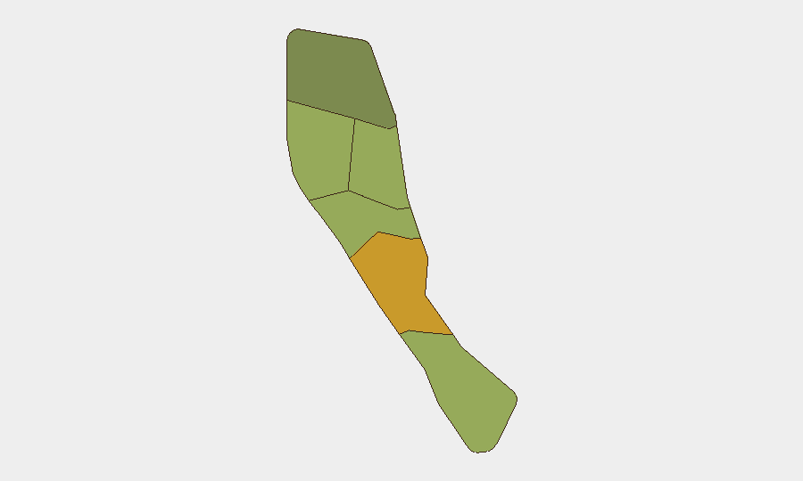
Vanuatu remains a low-threat environment globally (rank #180, composite score 4) with no confirmed security incidents, civil unrest, or infrastructure disruptions reported in the last 24–48 hours. The country has experienced a cluster of moderate seismic activity in recent days (four magnitude 4.5–4.6 earthquakes), predominantly in offshore and southern regions, with no reported casualties or damage. Risk is concentrated in Shefa Province (score 72), driven by underlying structural vulnerabilities rather than acute active incidents.
Key Developments
- No confirmed security, conflict, crime, or civil-unrest incidents in Vanuatu have been reported or reliably time-stamped within the last 24–48 hours across available news, social, and official sources.
- Seismic activity (recent, specific dates pending): Four magnitude 4.5–4.6 earthquakes recorded southwest of Isangel (Tafea), southwest of Lakatoro (Penama), east of Port-Olry (Torba), and a second event near Isangel. All are submarine or peripheral; no surface impact or emergency alerts have been surfaced.
- Regional diplomatic context (2026-07-11): An Australian Defence Minister statement addressed security partnerships with Vanuatu in general terms; no new incident or policy shift affecting corporate operations was disclosed.
- Live web research confirms no travel warnings, port/airport closures, power disruptions, or protest activity in the last 24–48 hours.
Highest-Risk Areas
Shefa Province dominates the sub-national ranking (72) and likely reflects Port Vila's density, transient populations, petty crime exposure, and maritime/port activity rather than organized violence or terrorism. Penama (58) and Sanma (52) follow, with Penama's risk plausibly linked to inter-island maritime vulnerability and limited law-enforcement reach; Sanma similarly reflects geographic isolation and service gaps. The remaining provinces (Tafea, Torba, Malampa) score 35–48, indicating baseline governance and infrastructure constraints rather than acute flashpoints. None of these rankings currently correspond to active armed conflict, insurgency, or political breakdown.
How GeoBit Would Assist
Corporate teams with personnel or assets in Vanuatu should employ AOI Monitoring & Early Warning on Shefa Province (Port Vila), Penama, and key ports to detect unplanned disruptions, labor unrest, or maritime incidents in real time. Multi-language web and social OSINT (X/Twitter, Telegram, local news) combined with sentiment & temporal analysis will surface emerging civil unrest, crime spikes, or political instability before mainstream reporting. Satellite & imagery analysis can monitor port and critical-infrastructure activity, and conflict & event-feed integration will flag any sudden escalation requiring duty-of-care response or evacuation planning.
7-Day Outlook
Vanuatu's security posture is expected to remain stable. The recent seismic cluster poses no immediate tsunami or large-scale disaster risk based on magnitude and depth; standard earthquake-preparedness protocols should remain active. Structural risks—limited law enforcement, maritime hazards, geographic fragmentation—persist but are not trending toward acute crisis; however, cyclone season (November–April) and fiscal/governance constraints on infrastructure resilience warrant routine monitoring of regional early-warning systems and port-operational stability into the second half of 2026.
Highest-Risk Areas — Ranked
| # | State / Region | Risk |
|---|---|---|
| 1 | Shefa Province | 72 |
| 2 | Penama | 58 |
| 3 | Sanma | 52 |
| 4 | Malampa | 48 |
| 5 | Tafea | 45 |
| 6 | Torba | 35 |
Sources
Previous Daily Briefs
A new Vanuatu brief is written every day — each with its own risk map and downloadable CSV. Here's the last week; use the calendar to go further back.
📅 Browse every day by calendar →
Highlighted days have a brief. Tap a day for that day's map & analysis, or “csv” for that day's dataset ($5).
Atlas — our AI intelligence desk — emails them this snapshot personally. Nothing else, no list.