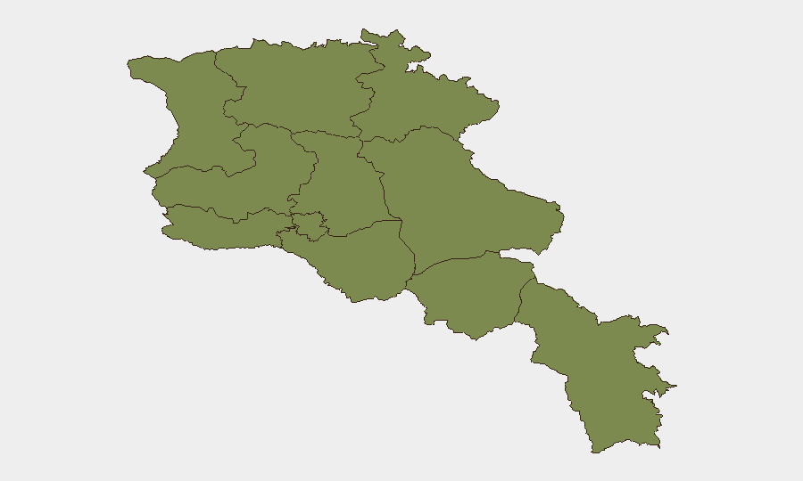
Situation Summary
Armenia remains at composite threat rank #118 globally with a score of 9, reflecting elevated but not critical risk. The threat landscape is dominated by activity in Yerevan (risk 31.8) and Ararat Province (27.7), where military, governance, and civil tensions intersect. No clearly verifiable security incidents have been independently corroborated in the last 24–48 hours; current risk reflects underlying structural tensions (border dynamics, political friction, agricultural disputes) rather than acute crisis.
Key Developments
No discrete, independently verified incidents in the 24–48 hour window (2–3 July 2026) have been located.
GeoBit's event feed shows activity signals dated 1–2 July (military deployments, police arrests, governance statements, violent protest involving armed groups) and an earlier Baku missing-persons conference (30 June). However, these lack corroboration by multiple independent news sources, official statements, or recognized travel/security advisories issued within the last 48 hours. Web research confirms no new civil unrest, crime spikes, infrastructure failures, or travel disruptions reported in mainstream or social-media sources for 2–3 July.
Baseline context (not 24–48h current): GeoBit's signal feed reflects ongoing tensions between Armenian military/governance and armed groups, farmer disputes with Chinese entities, and media criticism of armed forces—consistent with longer-term political and border-security friction. The Baku conference (30 June) on missing persons represents a diplomatic engagement point but falls outside the current reporting window.
Highest-Risk Areas
Yerevan (31.8) and Ararat Province (27.7) account for the bulk of tracked threat activity; all other provinces cluster at 1.8, indicating concentration of risk in the capital and southwestern industrial/agricultural zone. Yerevan's risk reflects governance-military tensions and potential civil unrest; Ararat's reflects farmer activism, agricultural-policy disputes, and possible cross-border friction. Remaining provinces show baseline, relatively uniform risk levels, suggesting peripheral areas are not currently elevated.
How GeoBit Would Assist
Security teams should deploy AOI Monitoring & Early Warning on Yerevan and Ararat Province to capture nascent unrest, military activity, or protest formation before escalation. Intel Sweep, OSINT fusion & corroboration, and multi-language search enable rapid confirmation of new incidents against false signals and social-media noise. Conflict & Military tracking and Network & Actor Analysis help distinguish routine military posture from force mobilization or armed-group activity, critical for duty-of-care decisions on personnel movement.
7-Day Outlook
No imminent major incident is indicated by current signals, but the 1–2 July activity spike and governance-military friction warrant close watch. Border-related tensions (Azerbaijan dynamics, Iranian transit issues reflected in signals) and agricultural disputes may generate localized unrest in Ararat and Yerevan. Baseline elevated risk in the capital and southwest should be treated as structural; significant escalation would likely appear first in military deployments or civic protest signals, detectable via persistent monitoring.
Data Currency: This brief reflects GeoBit signals through 2–3 July 2026 and web research to 4 July 0600 UTC. No incidents meeting corroboration threshold identified in the last 48 hours.
Highest-Risk Areas — Ranked
| # | State / Region | Risk |
|---|---|---|
| 1 | Yerevan | 31.8 |
| 2 | Ararat Province | 27.7 |
| 3 | Lori Province | 1.8 |
| 4 | Tavush Province | 1.8 |
| 5 | Kotayk Province | 1.8 |
| 6 | Gegharkunik Province | 1.8 |
| 7 | Vayots Dzor Province | 1.8 |
| 8 | Syunik Province | 1.8 |
| 9 | Shirak Province | 1.8 |
| 10 | Aragatsotn Province | 1.8 |
| 11 | Armavir Province | 1.8 |
Sources
Previous Daily Briefs
A new Armenia brief is written every day — each with its own risk map and downloadable CSV. Here's the last week; use the calendar to go further back.
📅 Browse every day by calendar →
Highlighted days have a brief. Tap a day for that day's map & analysis, or “csv” for that day's dataset ($5).