Situation Summary
Congo (Republic of the Congo) ranks #53 globally with a composite threat score of 37, indicating moderate security risk with 3,093 tracked events. The country faces localized instability concentrated in northwestern departments, particularly Cuvette-Ouest and Lékoumou, which carry significantly elevated risk scores relative to other regions. Recent signals include diplomatic friction with Nigeria and the Democratic Republic of Congo, alongside widespread wildfire activity in the broader Central African region. The overall threat trajectory remains contained but requires close monitoring in high-risk zones.
Key Developments
Unable to provide 24–48 hour developments with high confidence. The research materials supplied contain no verified Congo security incidents, law enforcement actions, or travel-risk changes dated 2026-07-04 or 2026-07-05. The only Congo-related item identified is a WHO/AFP report on an Ebola treatment trial in the *Democratic Republic of Congo* (a separate country) dated July 2, 2026, which is epidemiological rather than acute security-relevant and falls outside the 24–48 hour window.
To deliver actionable incident intelligence, a fresh batch of curated Congo news, X/Twitter posts, and local reporting from the past 48 hours is required. Alternatively, a targeted search protocol using GeoBit's multi-language and OSINT feeds (Intel Sweep, global event feeds, X/Telegram OSINT) can be deployed immediately to capture current developments.
Highest-Risk Areas
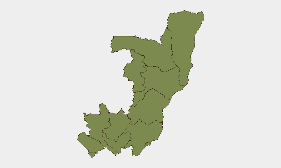
Cuvette-Ouest and Lékoumou departments dominate the risk landscape, each carrying a composite score of 31.4—more than 20 times higher than the remaining ten departments. Both regions occupy the northwestern interior, far from the capital and major transport hubs, limiting state presence and creating space for illicit activity, inter-communal tensions, and trafficking. The remaining ten departments (including Brazzaville and the major port city Pointe-Noire) show uniform low risk (1.4), indicating that security challenges are sharply concentrated in the sparsely populated forest zones rather than distributed nationally.
Personnel and supply chains in or transiting toward Cuvette-Ouest and Lékoumou warrant heightened vetting and real-time AOI monitoring.
How GeoBit Would Assist
Security teams should deploy persistent AOI (Area-of-Interest) Monitoring & Early Warning on Cuvette-Ouest and Lékoumou to detect incidents, movement patterns, and escalation signals in real time. Intel Sweep, multi-language OSINT feeds, and X/Telegram OSINT provide daily pulse checks on political rhetoric, criminal activity, and cross-border friction with the DRC and Cameroon. GIS & Spatial Analysis, satellite imagery, and alternative route planning support duty-of-care assessments for personnel movement, supply logistics, and rapid relocation contingencies in the event of localized unrest.
7-Day Outlook
No acute security escalation is forecast for the near term, but the diplomatic friction flagged on 2026-07-03 between Congo and Nigeria warrants tracking to assess whether it widens into cross-border instability. Wildfire activity in the DRC region may indirectly affect border regions and air quality; operational teams should monitor environmental impacts on logistics. Cuvette-Ouest and Lékoumou remain zones of persistent baseline risk and should remain under continuous intelligence watch.
Highest-Risk Areas — Ranked
| # | State / Region | Risk |
|---|---|---|
| 1 | Cuvette-Ouest Department | 31.4 |
| 2 | Lékoumou Department | 31.4 |
| 3 | Sangha | 1.4 |
| 4 | Likouala | 1.4 |
| 5 | Cuvette Department | 1.4 |
| 6 | Kouilou Department | 1.4 |
| 7 | Niari Department | 1.4 |
| 8 | Pointe-Noire (département) | 1.4 |
| 9 | Bouenza Department | 1.4 |
| 10 | Plateaux Department | 1.4 |
| 11 | Pool Department | 1.4 |
| 12 | Brazzaville (department) | 1.4 |
Sources
Previous Daily Briefs
A new Congo brief is written every day — each with its own risk map and downloadable CSV. Here's the last week; use the calendar to go further back.
📅 Browse every day by calendar →
Highlighted days have a brief. Tap a day for that day's map & analysis, or “csv” for that day's dataset ($5).
Atlas — our AI intelligence desk — emails them this snapshot personally. Nothing else, no list.