Situation Summary
Guatemala remains a persistently fragmented security environment with a composite threat ranking of #59 globally and a baseline characterized by organized crime, border tensions, and institutional instability rather than acute armed conflict. The 61 tracked events in GeoBit's system reflect ongoing governance, anti-corruption, and judicial pressures, but open-source monitoring has detected no confirmed, location-specific security incidents or civil unrest within the last 24–48 hours that would signal an acute spike above the country's chronic baseline. Risk remains regionally concentrated, with Alta Verapaz driving disproportionate threat scores. The near-term trajectory appears stable relative to recent weeks, though underlying structural vulnerabilities persist.
Key Developments
- No acute incidents detected (last 24–48 hours): Open-source web, news, and social-media monitoring (X/Twitter, mainstream outlets) has not corroborated specific armed clashes, major protests, significant crime events, or infrastructure disruptions in Guatemala within the strict last 24–48-hour window.
- Border-zone frictions ongoing but undated: Belizean and Guatemalan media references to "recent incidents in the Belize–Guatemala Adjacency Zone and the Sarstoon River" suggest low-level bilateral border friction; however, these sources do not timestamp incidents to the current reporting period and cannot be classified as new developments without corroboration.
- Longer-running institutional pressures: GeoBit's event signal stream shows multiple public statements, investigations, and inter-agency tensions (government vs. military, government vs. banking sector, representatives vs. university) as of 1–3 July, reflecting ongoing political and judicial disputes rather than acute security events.
- Governance and anti-corruption processes: Documented disapprovals and investigations suggest continued institutional friction around transparency, anti-corruption efforts, and executive accountability, consistent with Guatemala's structural risk profile but not indicative of imminent operational instability.
Highest-Risk Areas
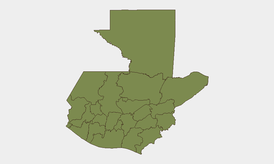
Alta Verapaz (risk score 31.8) is by far the dominant threat concentration, accounting for the majority of tracked risk and likely reflecting endemic organized-crime activity, resource trafficking, and gang presence in the region. Guatemala Department (15.4), which includes the capital and surrounding metropolitan zone, represents the second-tier risk driver, combining urban crime, commercial targeting, and proximity to government institutions. All other departments score below 3.0, indicating that country-level risk is highly concentrated in the north-central (Alta Verapaz) and central (Guatemala City) corridors. Organizations with personnel or assets in these regions should maintain elevated awareness protocols; those in peripheral departments (Petén, Quetzaltenango, Huehuetenango, and others) operate under lower ambient threat but should still apply baseline due-diligence standards.
How GeoBit Would Assist
Security teams should employ AOI Monitoring & Early Warning on Alta Verapaz and Guatemala City to detect emerging incidents, crime patterns, or unrest with automated alerting. Conflict & Military tracking combined with Network & Actor Analysis would map ongoing organized-crime operations and gang dynamics in high-risk departments. Intel Sweep and multi-language OSINT (including Telegram and social-media monitoring) would provide real-time corroboration of rumors or unverified reports, reducing false-positive risk and informing duty-of-care decisions for personnel movement and asset protection.
7-Day Outlook
No indicators suggest an imminent security escalation in the next seven days. Institutional and political tensions will likely persist, but absent new triggering events, the security posture should remain consistent with the chronic baseline. Teams should maintain standard monitoring cadence while remaining alert to border-zone developments and any acceleration in anti-corruption or judicial proceedings that could trigger secondary unrest.
Highest-Risk Areas — Ranked
| # | State / Region | Risk |
|---|---|---|
| 1 | Alta Verapaz | 31.8 |
| 2 | Guatemala Department | 15.4 |
| 3 | San Marcos | 2.8 |
| 4 | Petén | 1.8 |
| 5 | Huehuetenango | 1.8 |
| 6 | Quetzaltenango | 1.8 |
| 7 | Retalhuleu | 1.8 |
| 8 | Quiché | 1.8 |
| 9 | Totonicapán | 1.8 |
| 10 | Sololá | 1.8 |
| 11 | Chimaltenango | 1.8 |
| 12 | Suchitepéquez | 1.8 |
Sources
Previous Daily Briefs
A new Guatemala brief is written every day — each with its own risk map and downloadable CSV. Here's the last week; use the calendar to go further back.
📅 Browse every day by calendar →
Highlighted days have a brief. Tap a day for that day's map & analysis, or “csv” for that day's dataset ($5).