Situation Summary
Honduras remains a moderately elevated risk environment (rank #59 globally, composite threat score 25) with structural vulnerabilities concentrated in the capital region and specific high-crime corridors. Over the past 24–48 hours, no confirmed acute security incidents—armed clashes, roadblocks, civil unrest, or infrastructure disruptions—were detected across the country. The security posture is stable within baseline parameters, though political tensions and institutional friction at the executive and security-force levels continue to generate noise in event feeds without translating into ground-level operational risk.
Key Developments
- No confirmed acute incidents in the last 24–48 hours. Multi-source monitoring found no corroborated armed clashes, roadblocks, civil-unrest events, or infrastructure disruptions across Honduras during the reporting window (2–4 Jul 2026).
- Political and institutional friction (2–3 Jul). Event signals indicate internal tension involving presidential statements, rejection of Venezuelan overtures, and internal security-force messaging. These are rhetorical/diplomatic in nature and do not indicate imminent operational threat escalation.
- Baseline risk concentration in Francisco Morazán / Tegucigalpa (ongoing). The capital metropolitan area and surrounding state remain the dominant locus of Honduras's composite risk (score 31.9), driven by homicide, trafficking, and organized-crime presence. No new acute incident was confirmed in the last 48 hours, but persistent baseline conditions warrant continued monitoring.
- Secondary risk corridor in Olancho (ongoing). This state shows elevated baseline risk (13.5) relative to the national average, consistent with trafficking and gang activity. No current-window incident confirmed.
- No recent corroborated travel disruptions or crime escalations. The 30 Jun–2 Jul reporting window recorded no new major criminal events, extortion campaigns, or travel-route blockages.
Highest-Risk Areas
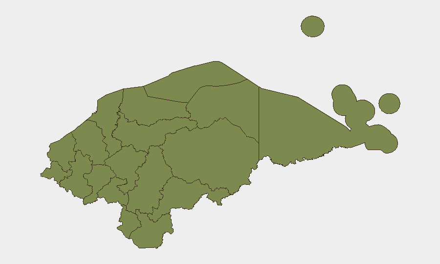
Francisco Morazán dominates the national risk profile with a composite score nearly 2.5× the country average, reflecting Tegucigalpa's persistent homicide, drug-trafficking, and gang presence. Olancho presents the second-order concern at 13.5, driven by trafficking corridors and remote-area instability. All remaining departments cluster at 1.9, indicating either lower baseline activity or insufficient reporting density; this does not imply safety, but rather suggests that risk in those areas—where it exists—is either dispersed, underreported, or less tied to organized armed actors. Organizations with personnel or assets in Tegucigalpa and the Francisco Morazán corridor should maintain heightened awareness; those elsewhere face baseline Central American risk without localized acute drivers at present.
How GeoBit Would Assist
Teams managing duty-of-care or asset-protection responsibilities in Honduras should employ AOI Monitoring & Early Warning on Francisco Morazán, Olancho, and transit corridors to detect roadblocks, clashes, or criminal activity in real time. Parallel use of Intel Sweep and OSINT fusion (X/Twitter, Telegram, local news, radio SIGINT) will capture emerging political or security-force signals before they manifest operationally. Routing & Network Analysis can identify safe and alternative routes for personnel movement, particularly in or around the capital.
7-Day Outlook
No acute escalation is anticipated in the near term. Political friction and institutional messaging are likely to continue, but current evidence suggests these remain at the rhetorical level. Organizations should maintain baseline vigilance in Francisco Morazán and monitor for any security-force deployments or policy shifts that might affect movement and operations; the outlook is stable absent new geopolitical or criminal-market shocks.
Highest-Risk Areas — Ranked
| # | State / Region | Risk |
|---|---|---|
| 1 | Francisco Morazán | 31.9 |
| 2 | Olancho | 13.5 |
| 3 | El Paraíso | 1.9 |
| 4 | Copán | 1.9 |
| 5 | Ocotepeque | 1.9 |
| 6 | Cortés | 1.9 |
| 7 | Yoro | 1.9 |
| 8 | Santa Bárbara | 1.9 |
| 9 | Lempira | 1.9 |
| 10 | Intibucá | 1.9 |
| 11 | Comayagua | 1.9 |
| 12 | La Paz | 1.9 |
Sources
Previous Daily Briefs
A new Honduras brief is written every day — each with its own risk map and downloadable CSV. Here's the last week; use the calendar to go further back.
📅 Browse every day by calendar →
Highlighted days have a brief. Tap a day for that day's map & analysis, or “csv” for that day's dataset ($5).
Atlas — our AI intelligence desk — emails them this snapshot personally. Nothing else, no list.