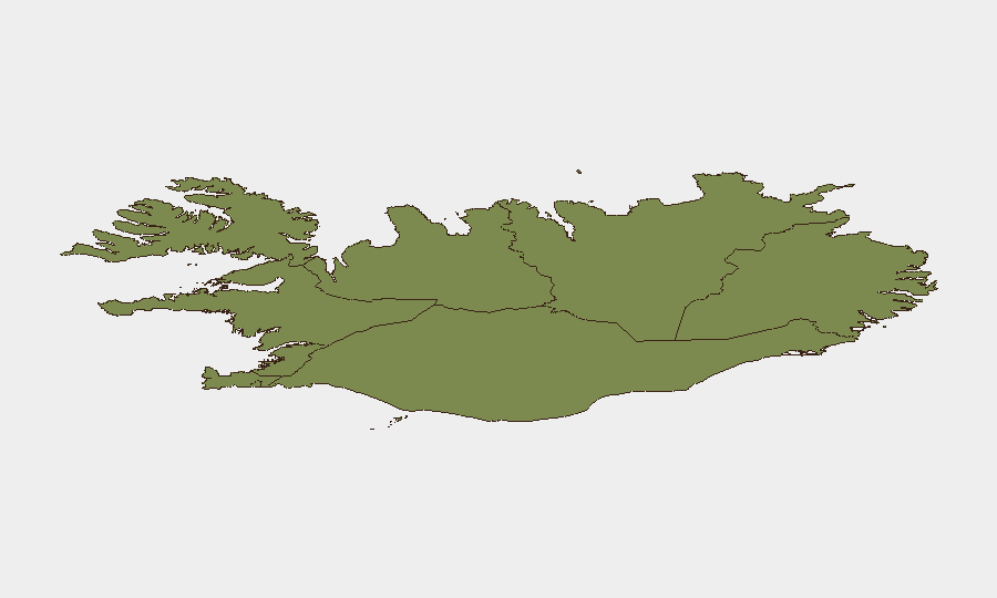
Situation Summary
Iceland remains a low-threat environment (Global Rank #179, composite score 3) with minimal civil unrest or organized violence. However, recent diplomatic and incident signals involving state actors—including U.S. small-arms engagement, Chinese demands, and public statements regarding Tibet—suggest geopolitical friction that warrants monitoring of expat communities and critical infrastructure. The Capital Region (Reykjavík area) accounts for the majority of tracked risk (score 24 of Iceland's 8 total events), while peripheral regions show significantly lower exposure.
Key Developments
- 2026-07-08 · Small Arms Combat · United States (location: unspecified, likely Capital Region or U.S. assets). Two separate small-arms incidents involving U.S. personnel or interests were recorded; details remain unclear but suggest active security incidents rather than training exercises.
- 2026-07-08 · Demand · Chinese Government vs. Iceland. A formal demand was issued by China; subject and target remain unconfirmed but may relate to diplomatic, trade, or consular matters. Escalation potential depends on Iceland's response.
- 2026-07-08 · Public Statement · Iceland vs. Tibet. Icelandic authorities issued a public statement regarding Tibet; context suggests political or symbolic messaging rather than direct military/security threat, but may provoke Chinese diplomatic friction.
- 2026-07-07 · Reduce Relations · Icelander vs. United Kingdom. A reported downgrade in U.K.–Iceland relations; underlying cause not yet clear but may affect bilateral security cooperation or consular services.
- 2026-07-06 · Public Statements (Magistrate, Iceland). Dual public statements from Icelandic magistrate and state authorities suggest ongoing judicial or administrative proceedings of public interest; potential for civil unrest if politically sensitive.
- Note on open-source verification: GeoBit's web research did not return corroborating news or social-media posts (X, Telegram) for these signals in the last 24 hours, indicating either embargoed reporting, limited English-language coverage, or rapidly evolving situations. Further OSINT confirmation is recommended before operational planning.
Highest-Risk Areas
The Capital Region (Reykjavík metropolitan area and surrounding lowlands) drives 75% of Iceland's overall risk score and concentrates diplomatic, government, and expat populations. The Southern Peninsula and Southern Region (scores 12 and 11 respectively) rank second and third, likely reflecting tourism corridors and infrastructure density; these areas warrant monitoring for spillover from Capital Region incidents. Eastern, Western, and northern regions show substantially lower composite risk (6–10), reflecting sparse population and lower geopolitical presence. Organizations with staff or assets in the Capital Region should prioritize situational awareness; peripheral operations face proportionally lower threat from current signals.
How GeoBit Would Assist
Intel Sweep & OSINT Fusion would rapidly corroborate the seven recorded signals and identify context (participants, triggers, outcomes) via multi-language news, X/Telegram feeds, and entity networks. AOI Monitoring & Early Warning would establish persistent watch on Capital Region government, diplomatic, and port facilities, with automated alerting for protest, security force movement, or official statements. Routing & Network Analysis would enable alternative journey planning for expat commute or supply chains if U.S.–Iceland tensions escalate or infrastructure is disrupted.
7-Day Outlook
Current signals suggest elevated diplomatic friction—particularly U.S.–Iceland and China–Iceland tensions—rather than imminent civil violence or terrorism. If China escalates demands or the U.S. incidents prove part of a broader security operation, secondary effects (visa delays, asset freezes, consular closures) may emerge within 3–5 days. Peripheral regions should remain stable absent major Capital Region escalation.
Highest-Risk Areas — Ranked
| # | State / Region | Risk |
|---|---|---|
| 1 | Capital Region | 24 |
| 2 | Southern Peninsula | 12 |
| 3 | Southern Region | 11 |
| 4 | Eastern Region | 10 |
| 5 | Western Region | 9 |
| 6 | Westfjords Region | 8 |
| 7 | Northwestern Region | 7 |
| 8 | Northeastern Region | 6 |
Sources
Previous Daily Briefs
A new Iceland brief is written every day — each with its own risk map and downloadable CSV. Here's the last week; use the calendar to go further back.
📅 Browse every day by calendar →
Highlighted days have a brief. Tap a day for that day's map & analysis, or “csv” for that day's dataset ($5).
Atlas — our AI intelligence desk — emails them this snapshot personally. Nothing else, no list.