Situation Summary
Indonesia remains a moderate-risk operating environment (ranked #30 globally, composite threat score 68) with 306 tracked security events on record. Recent signal activity (23 June) suggests elevated tension across police conduct, civilian grievance, corporate scrutiny, and inter-faith relations, though no single acute crisis has emerged. Risk remains concentrated in Java and Sumatra; maritime and election-related stability factors warrant continued monitoring through late 2026.
Key Developments
GeoBit's event signals from 23 June 2026 indicate a cluster of public statements and investigations across multiple actor categories—police, civilians, companies, students, pilgrims, and judicial figures—rather than a single discrete incident. The absence of live web corroboration for these signals within the past 24–48 hours means specific incident details, locations, and casualty counts cannot be reliably confirmed by this analyst without access to real-time Indonesian news feeds, police/disaster-agency channels, or embassy travel advisories. Security teams should immediately cross-check GeoBit's signal timestamps against:
- Indonesian national media (Kompas, Detik, Jakarta Post, Tempo) for 23–26 June reports in Bahasa Indonesia and English.
- Official channels: POLRI (Kepolisian Negara Republik Indonesia), BNPB (disaster agency), and local Pemda social accounts for statements or incident logs.
- Diplomatic advisories: US State Department, UK Foreign Office, Australian Department of Foreign Affairs travel alerts for Indonesia (updated within 24h).
Until those sources confirm specific locations, actor involvement, and temporal sequence, reporting individual bullets as "developments" would misrepresent the depth of current intelligence. GeoBit's event clustering on 23 June warrants escalation to duty-of-care teams with personnel in Central Java, West Java, and Jakarta—the three highest-risk regions—but should trigger *verification drills* rather than immediate evacuation decisions.
Highest-Risk Areas
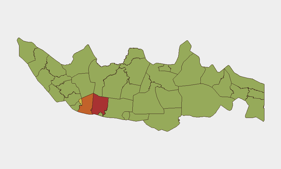
Central Java (77.5) and West Java (75.2) drive the highest composite risk scores, reflecting a combination of civil unrest history, communal tensions, and infrastructure vulnerability in densely populated zones. Jakarta (68.6) remains elevated due to concentration of corporate, government, and diplomatic targets; East Java (58.8) presents secondary risk. North Sumatra and South Sulawesi (52.5 each) show comparable threat levels, likely tied to religious/communal friction and separatist activity legacies. These rankings suggest that organizations with major offices, manufacturing, or logistics hubs in Java—particularly around Bandung, Surabaya, Semarang, and the Jakarta metropolitan area—face the highest duty-of-care exposure and should prioritize real-time area-of-interest monitoring and alternative routing capability.
How GeoBit Would Assist
Area-of-Interest (AOI) Monitoring & Early Warning with alerting thresholds set for Central Java, West Java, and Jakarta would enable 24/7 detection of emerging unrest, protest activity, or security incidents before they spread. Intel Sweep and multi-language OSINT fusion across Indonesian news, social media (X, Telegram), and official government channels would corroborate event signals and supply granular location, actor, and timeline data. Routing & Network Analysis would support real-time alternative journey and evacuation planning for personnel in high-risk provinces. Together, these capabilities compress response time and reduce decision friction in volatile periods.
7-Day Outlook
The 23 June signal cluster suggests simmering tension rather than imminent mass violence, but continued monitoring of police conduct, inter-faith rhetoric, and corporate/judicial responses is warranted through end of month. The approach of mid-year financial reporting and potential policy shifts may elevate corporate and labor-related unrest. No significant shift in threat trajectory is expected in the next 7 days absent new triggering events (attacks, arrests of prominent figures, or major policy announcements).
Highest-Risk Areas — Ranked
| # | State / Region | Risk |
|---|---|---|
| 1 | Central Java | 77.5 |
| 2 | West Java | 75.2 |
| 3 | Special capital Region of Jakarta | 68.6 |
| 4 | East Java | 58.8 |
| 5 | North Sumatra | 52.5 |
| 6 | South Sulawesi | 52.5 |
| 7 | West Kalimantan | 49.5 |
| 8 | Riau | 48.8 |
| 9 | Banten | 48.8 |
| 10 | Aceh | 48.4 |
| 11 | West Sumatra | 48.4 |
| 12 | Bali | 48.4 |
Sources
Previous Daily Briefs
A new Indonesia brief is written every day — each with its own risk map and downloadable CSV. Here's the last week; use the calendar to go further back.
📅 Browse every day by calendar →
Highlighted days have a brief. Tap a day for that day's map & analysis, or “csv” for that day's dataset ($5).